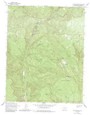
Devil Mountain Topo Map Colorado
To zoom in, hover over the map of Devil Mountain
USGS Topo Quad 37107c3 - 1:24,000 scale
| Topo Map Name: | Devil Mountain |
| USGS Topo Quad ID: | 37107c3 |
| Print Size: | ca. 21 1/4" wide x 27" high |
| Southeast Coordinates: | 37.25° N latitude / 107.25° W longitude |
| Map Center Coordinates: | 37.3125° N latitude / 107.3125° W longitude |
| U.S. State: | CO |
| Filename: | o37107c3.jpg |
| Download Map JPG Image: | Devil Mountain topo map 1:24,000 scale |
| Map Type: | Topographic |
| Topo Series: | 7.5´ |
| Map Scale: | 1:24,000 |
| Source of Map Images: | United States Geological Survey (USGS) |
| Alternate Map Versions: |
Devil Mountain CO 1964, updated 1967 Download PDF Buy paper map Devil Mountain CO 1964, updated 1967 Download PDF Buy paper map Devil Mountain CO 1964, updated 1983 Download PDF Buy paper map Devil Mountain CO 1964, updated 1987 Download PDF Buy paper map Devil Mountain CO 2011 Download PDF Buy paper map Devil Mountain CO 2013 Download PDF Buy paper map Devil Mountain CO 2016 Download PDF Buy paper map |
| FStopo: | US Forest Service topo Devil Mountain is available: Download FStopo PDF Download FStopo TIF |
1:24,000 Topo Quads surrounding Devil Mountain
> Back to 37107a1 at 1:100,000 scale
> Back to 37106a1 at 1:250,000 scale
> Back to U.S. Topo Maps home
Devil Mountain topo map: Gazetteer
Devil Mountain: Flats
Monument Park elevation 2782m 9127′Devil Mountain: Springs
Farrow Spring elevation 2817m 9242′Ford Spring elevation 2708m 8884′
Horse Mountain Springs elevation 2939m 9642′
Mesa Spring Number 1 elevation 2738m 8982′
Mesa Spring Number 2 elevation 2954m 9691′
Piedra River Hot Springs elevation 2377m 7798′
Devil Mountain: Streams
Coffee Creek elevation 2091m 6860′Coldwater Creek elevation 2230m 7316′
Davis Creek elevation 2200m 7217′
Death Valley Creek elevation 2279m 7477′
Dudley Creek elevation 2106m 6909′
Elk Creek elevation 2043m 6702′
First Fork Piedra River elevation 2159m 7083′
Horse Creek elevation 2081m 6827′
Indian Creek elevation 2069m 6788′
Sheep Creek elevation 2083m 6833′
Devil Mountain: Summits
Devil Mountain elevation 3030m 9940′Horse Mountain elevation 3030m 9940′
Mule Mountain elevation 2717m 8914′
Devil Mountain: Trails
Devil Mountain Trail elevation 2967m 9734′Devil Mountain: Valleys
Cooper Canyon elevation 2023m 6637′First Box Canyon elevation 2117m 6945′
Johnny Canyon elevation 2246m 7368′
Second Box Canyon elevation 2190m 7185′
Devil Mountain digital topo map on disk
Buy this Devil Mountain topo map showing relief, roads, GPS coordinates and other geographical features, as a high-resolution digital map file on DVD:


