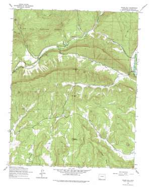
Rules Hill Topo Map Colorado
To zoom in, hover over the map of Rules Hill
USGS Topo Quad 37107c6 - 1:24,000 scale
| Topo Map Name: | Rules Hill |
| USGS Topo Quad ID: | 37107c6 |
| Print Size: | ca. 21 1/4" wide x 27" high |
| Southeast Coordinates: | 37.25° N latitude / 107.625° W longitude |
| Map Center Coordinates: | 37.3125° N latitude / 107.6875° W longitude |
| U.S. State: | CO |
| Filename: | o37107c6.jpg |
| Download Map JPG Image: | Rules Hill topo map 1:24,000 scale |
| Map Type: | Topographic |
| Topo Series: | 7.5´ |
| Map Scale: | 1:24,000 |
| Source of Map Images: | United States Geological Survey (USGS) |
| Alternate Map Versions: |
Rules Hill CO 1964, updated 1967 Download PDF Buy paper map Rules Hill CO 1964, updated 1967 Download PDF Buy paper map Rules Hill CO 1964, updated 1975 Download PDF Buy paper map Rules Hill CO 2011 Download PDF Buy paper map Rules Hill CO 2013 Download PDF Buy paper map Rules Hill CO 2016 Download PDF Buy paper map |
| FStopo: | US Forest Service topo Rules Hill is available: Download FStopo PDF Download FStopo TIF |
1:24,000 Topo Quads surrounding Rules Hill
> Back to 37107a1 at 1:100,000 scale
> Back to 37106a1 at 1:250,000 scale
> Back to U.S. Topo Maps home
Rules Hill topo map: Gazetteer
Rules Hill: Populated Places
Columbus elevation 2220m 7283′Rules Hill: Streams
Cabin Fork Red Creek elevation 2523m 8277′First Fork Red Creek elevation 2441m 8008′
North Fork Texas Creek elevation 2233m 7326′
Red Creek elevation 2268m 7440′
Shearer Creek elevation 2314m 7591′
South Fork Texas Creek elevation 2233m 7326′
Texas Creek elevation 2225m 7299′
True Creek elevation 2356m 7729′
West Fork Shearer Creek elevation 2515m 8251′
Rules Hill: Summits
Rabbit Mountain elevation 2340m 7677′Rules Hill elevation 2507m 8225′
Vosburg Pike elevation 2687m 8815′
Rules Hill: Valleys
Homer Canyon elevation 2256m 7401′Spring Gulch elevation 2230m 7316′
Rules Hill digital topo map on disk
Buy this Rules Hill topo map showing relief, roads, GPS coordinates and other geographical features, as a high-resolution digital map file on DVD:


