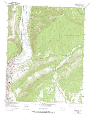
Durango East Topo Map Colorado
To zoom in, hover over the map of Durango East
USGS Topo Quad 37107c7 - 1:24,000 scale
| Topo Map Name: | Durango East |
| USGS Topo Quad ID: | 37107c7 |
| Print Size: | ca. 21 1/4" wide x 27" high |
| Southeast Coordinates: | 37.25° N latitude / 107.75° W longitude |
| Map Center Coordinates: | 37.3125° N latitude / 107.8125° W longitude |
| U.S. State: | CO |
| Filename: | o37107c7.jpg |
| Download Map JPG Image: | Durango East topo map 1:24,000 scale |
| Map Type: | Topographic |
| Topo Series: | 7.5´ |
| Map Scale: | 1:24,000 |
| Source of Map Images: | United States Geological Survey (USGS) |
| Alternate Map Versions: |
Durango East CO 1963, updated 1965 Download PDF Buy paper map Durango East CO 1963, updated 1971 Download PDF Buy paper map Durango East CO 2011 Download PDF Buy paper map Durango East CO 2013 Download PDF Buy paper map Durango East CO 2016 Download PDF Buy paper map |
| FStopo: | US Forest Service topo Durango East is available: Download FStopo PDF Download FStopo TIF |
1:24,000 Topo Quads surrounding Durango East
> Back to 37107a1 at 1:100,000 scale
> Back to 37106a1 at 1:250,000 scale
> Back to U.S. Topo Maps home
Durango East topo map: Gazetteer
Durango East: Airports
Mercy Medical Center Heliport elevation 1991m 6532′Missionary Ridge Heliport elevation 2754m 9035′
Val Air Airport elevation 2000m 6561′
Durango East: Bridges
Emerson-Parks Bridge elevation 1999m 6558′Durango East: Canals
Florida Canal elevation 2174m 7132′Durango East: Dams
Durango Regulatory Dam elevation 2100m 6889′Turner Dam elevation 2256m 7401′
Durango East: Lakes
Huck Finn Pond elevation 1987m 6519′Durango East: Mines
City Mine elevation 2130m 6988′Fireglow Mine elevation 2242m 7355′
Schroeder Tunnel Mine elevation 2164m 7099′
Durango East: Parks
Chapman Hill Municipal Ski Area elevation 1998m 6555′Fanto Park elevation 1998m 6555′
Folsom Park elevation 2009m 6591′
Janson Memorial Playground elevation 2014m 6607′
Memorial Park Phase II elevation 1987m 6519′
Memorial Park Phase One elevation 2000m 6561′
Municipal Swimming Pool elevation 2001m 6564′
Durango East: Reservoirs
Durango Regulatory Reservoir elevation 2100m 6889′Turner Reservoir elevation 2256m 7401′
Durango East: Streams
Falls Creek elevation 1993m 6538′Junction Creek elevation 1988m 6522′
Mud Spring Creek elevation 2196m 7204′
Spring Creek elevation 1994m 6541′
Durango East: Summits
Animas City Mountain elevation 2490m 8169′Baldy Mountain elevation 3005m 9858′
Florida Mesa elevation 2196m 7204′
Little Baldy elevation 2218m 7276′
Durango East: Valleys
Haflin Canyon elevation 2017m 6617′Woodard Canyon elevation 2018m 6620′
Durango East digital topo map on disk
Buy this Durango East topo map showing relief, roads, GPS coordinates and other geographical features, as a high-resolution digital map file on DVD:


