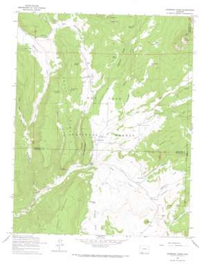
Oakbrush Ridge Topo Map Colorado
To zoom in, hover over the map of Oakbrush Ridge
USGS Topo Quad 37107d2 - 1:24,000 scale
| Topo Map Name: | Oakbrush Ridge |
| USGS Topo Quad ID: | 37107d2 |
| Print Size: | ca. 21 1/4" wide x 27" high |
| Southeast Coordinates: | 37.375° N latitude / 107.125° W longitude |
| Map Center Coordinates: | 37.4375° N latitude / 107.1875° W longitude |
| U.S. State: | CO |
| Filename: | o37107d2.jpg |
| Download Map JPG Image: | Oakbrush Ridge topo map 1:24,000 scale |
| Map Type: | Topographic |
| Topo Series: | 7.5´ |
| Map Scale: | 1:24,000 |
| Source of Map Images: | United States Geological Survey (USGS) |
| Alternate Map Versions: |
Oakbrush Ridge CO 1964, updated 1967 Download PDF Buy paper map Oakbrush Ridge CO 2011 Download PDF Buy paper map Oakbrush Ridge CO 2013 Download PDF Buy paper map Oakbrush Ridge CO 2016 Download PDF Buy paper map |
| FStopo: | US Forest Service topo Oakbrush Ridge is available: Download FStopo PDF Download FStopo TIF |
1:24,000 Topo Quads surrounding Oakbrush Ridge
> Back to 37107a1 at 1:100,000 scale
> Back to 37106a1 at 1:250,000 scale
> Back to U.S. Topo Maps home
Oakbrush Ridge topo map: Gazetteer
Oakbrush Ridge: Canals
Piedra Falls Ditch elevation 2489m 8166′Toner-Taylor Ditch elevation 2441m 8008′
Oakbrush Ridge: Cliffs
Sally Overlook elevation 2582m 8471′Oakbrush Ridge: Dams
Spring Creek Reservoir Dam elevation 2564m 8412′Oakbrush Ridge: Flats
Boulder Park elevation 2526m 8287′Carter Park elevation 2640m 8661′
Oakbrush Ridge: Gaps
The Notch elevation 2675m 8776′Oakbrush Ridge: Lakes
Martin Lake elevation 2436m 7992′O'Connell Lake elevation 2421m 7942′
Oakbrush Ridge: Pillars
Castle Rock elevation 2801m 9189′Rooster Rock elevation 2839m 9314′
Oakbrush Ridge: Reservoirs
Spring Creek Reservoir elevation 2564m 8412′Trail Ridge Reservoir elevation 2597m 8520′
Oakbrush Ridge: Ridges
Ice Cave Ridge elevation 2478m 8129′Oakbrush Ridge elevation 2590m 8497′
Trail Ridge elevation 2592m 8503′
Oakbrush Ridge: Springs
Chub Spring elevation 2546m 8353′Divide Park Springs elevation 2666m 8746′
Notch Spring elevation 2506m 8221′
Pole Park Spring elevation 2544m 8346′
Turkey Park Spring elevation 2548m 8359′
Wainwright Spring elevation 2541m 8336′
Oakbrush Ridge: Streams
Cottonwood Creek elevation 2401m 7877′East Fork Piedra River elevation 2352m 7716′
Gordon Creek elevation 2337m 7667′
Little Pagosa Creek elevation 2484m 8149′
Little Sand Creek elevation 2354m 7723′
Middle Fork Piedra River elevation 2352m 7716′
North Fork Little Pagosa Creek elevation 2543m 8343′
O'Neal Creek elevation 2300m 7545′
Pagosa Creek elevation 2404m 7887′
Plumtaw Creek elevation 2396m 7860′
Spring Creek elevation 2401m 7877′
Trail Creek elevation 2275m 7463′
Weminuche Creek elevation 2260m 7414′
Williams Creek elevation 2290m 7513′
Oakbrush Ridge: Summits
Corral Mountain elevation 2703m 8868′O'Neal Hill elevation 2747m 9012′
Rock Mountain elevation 3101m 10173′
Oakbrush Ridge: Valleys
Chub Draw elevation 2376m 7795′Wainwright Draw elevation 2366m 7762′
Weminuche Valley elevation 2355m 7726′
Oakbrush Ridge digital topo map on disk
Buy this Oakbrush Ridge topo map showing relief, roads, GPS coordinates and other geographical features, as a high-resolution digital map file on DVD:


