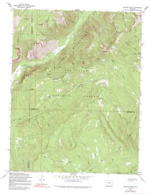
Granite Peak Topo Map Colorado
To zoom in, hover over the map of Granite Peak
USGS Topo Quad 37107d4 - 1:24,000 scale
| Topo Map Name: | Granite Peak |
| USGS Topo Quad ID: | 37107d4 |
| Print Size: | ca. 21 1/4" wide x 27" high |
| Southeast Coordinates: | 37.375° N latitude / 107.375° W longitude |
| Map Center Coordinates: | 37.4375° N latitude / 107.4375° W longitude |
| U.S. State: | CO |
| Filename: | o37107d4.jpg |
| Download Map JPG Image: | Granite Peak topo map 1:24,000 scale |
| Map Type: | Topographic |
| Topo Series: | 7.5´ |
| Map Scale: | 1:24,000 |
| Source of Map Images: | United States Geological Survey (USGS) |
| Alternate Map Versions: |
Granite Peak CO 1964, updated 1968 Download PDF Buy paper map Granite Peak CO 1964, updated 1968 Download PDF Buy paper map Granite Peak CO 1964, updated 1975 Download PDF Buy paper map Granite Peak CO 1964, updated 1991 Download PDF Buy paper map Granite Peak CO 1964, updated 1991 Download PDF Buy paper map Granite Peak CO 2011 Download PDF Buy paper map Granite Peak CO 2013 Download PDF Buy paper map Granite Peak CO 2016 Download PDF Buy paper map |
| FStopo: | US Forest Service topo Granite Peak is available: Download FStopo PDF Download FStopo TIF |
1:24,000 Topo Quads surrounding Granite Peak
> Back to 37107a1 at 1:100,000 scale
> Back to 37106a1 at 1:250,000 scale
> Back to U.S. Topo Maps home
Granite Peak topo map: Gazetteer
Granite Peak: Gaps
The Notch elevation 3095m 10154′Granite Peak: Lakes
Moon Lake elevation 2904m 9527′Rocky Basin elevation 2815m 9235′
Granite Peak: Mines
Holbrook Mine elevation 3296m 10813′Granite Peak: Populated Places
Tuckerville (historical) elevation 3247m 10652′Granite Peak: Springs
Coyote Basin Spring elevation 2956m 9698′Granite Peak: Streams
Clear Creek elevation 2545m 8349′Indian Creek elevation 2455m 8054′
Lake Creek elevation 2484m 8149′
Little Mosca Creek elevation 2500m 8202′
Pole Creek elevation 2532m 8307′
Red Creek elevation 2659m 8723′
Sin Creek elevation 2390m 7841′
West Prong Red Creek elevation 2725m 8940′
Granite Peak: Summits
Graham Peak elevation 3823m 12542′Granite Peak elevation 3693m 12116′
Grassy Point elevation 3137m 10291′
Runlett Peak elevation 3432m 11259′
Slide Mountain elevation 3382m 11095′
Three Sisters Peaks elevation 3552m 11653′
Granite Peak: Valleys
Bear Trap Canyon elevation 2590m 8497′Lost Canyon elevation 2451m 8041′
Poison Canyon elevation 2611m 8566′
Granite Peak digital topo map on disk
Buy this Granite Peak topo map showing relief, roads, GPS coordinates and other geographical features, as a high-resolution digital map file on DVD:


