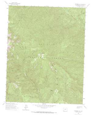
Monument Hill Topo Map Colorado
To zoom in, hover over the map of Monument Hill
USGS Topo Quad 37107d8 - 1:24,000 scale
| Topo Map Name: | Monument Hill |
| USGS Topo Quad ID: | 37107d8 |
| Print Size: | ca. 21 1/4" wide x 27" high |
| Southeast Coordinates: | 37.375° N latitude / 107.875° W longitude |
| Map Center Coordinates: | 37.4375° N latitude / 107.9375° W longitude |
| U.S. State: | CO |
| Filename: | o37107d8.jpg |
| Download Map JPG Image: | Monument Hill topo map 1:24,000 scale |
| Map Type: | Topographic |
| Topo Series: | 7.5´ |
| Map Scale: | 1:24,000 |
| Source of Map Images: | United States Geological Survey (USGS) |
| Alternate Map Versions: |
Monument Hill CO 1963, updated 1965 Download PDF Buy paper map Monument Hill CO 1963, updated 1965 Download PDF Buy paper map Monument Hill CO 1963, updated 1972 Download PDF Buy paper map Monument Hill CO 1963, updated 1972 Download PDF Buy paper map Monument Hill CO 2011 Download PDF Buy paper map Monument Hill CO 2013 Download PDF Buy paper map Monument Hill CO 2016 Download PDF Buy paper map |
| FStopo: | US Forest Service topo Monument Hill is available: Download FStopo PDF Download FStopo TIF |
1:24,000 Topo Quads surrounding Monument Hill
> Back to 37107a1 at 1:100,000 scale
> Back to 37106a1 at 1:250,000 scale
> Back to U.S. Topo Maps home
Monument Hill topo map: Gazetteer
Monument Hill: Basins
Sheephead Basin elevation 3083m 10114′Monument Hill: Cliffs
Rands Point elevation 3025m 9924′Monument Hill: Flats
Cemetery Flats elevation 3083m 10114′Monument Hill: Mines
Checkmaker Mine elevation 3117m 10226′Durango Girl Mine elevation 2820m 9251′
George A Greenwood Group Mine elevation 2734m 8969′
Gold King Mine elevation 3190m 10465′
Gold Nugget Group Mine elevation 2734m 8969′
Junction Creek Claims elevation 3040m 9973′
Kennebec Mine elevation 3445m 11302′
Last Chance Mine elevation 2716m 8910′
Mary S Mine elevation 3050m 10006′
Mineral Wonder Mine elevation 3064m 10052′
Monument Hill Mine elevation 2975m 9760′
Neglected Mine elevation 3059m 10036′
Oro Fino Mine elevation 3170m 10400′
Ruby King Mine elevation 3114m 10216′
Wheel of Fortune Mine elevation 3090m 10137′
Monument Hill: Streams
Bear Creek elevation 2532m 8307′Bondurant Creek elevation 2354m 7723′
Castle Creek elevation 2453m 8047′
Clear Creek elevation 2256m 7401′
Dutch Creek elevation 2293m 7522′
Elk Creek elevation 2690m 8825′
Flagler Fork elevation 2632m 8635′
Smith Creek elevation 2691m 8828′
Monument Hill: Summits
Barnes Mountain elevation 2944m 9658′Cape Horn elevation 3161m 10370′
Monument Hill elevation 3305m 10843′
Olga Little Mountain elevation 3480m 11417′
Red Hill elevation 3235m 10613′
Wild Oat Mesa elevation 2920m 9580′
Monument Hill: Valleys
Chicago Gulch elevation 2590m 8497′Fassbinder Gulch elevation 2816m 9238′
First Trail Canyon elevation 2451m 8041′
Foin Gulch elevation 2864m 9396′
Gaines Gulch elevation 2737m 8979′
Heffernan Gulch elevation 3029m 9937′
Leavenworth Gulch elevation 2952m 9685′
Little Ruby Gulch elevation 2673m 8769′
Mineral Wonder Gulch elevation 2813m 9229′
Red Rim Canyon elevation 2303m 7555′
Road End Canyon elevation 2399m 7870′
Ruby Gulch elevation 2976m 9763′
Sliderock Canyon elevation 2515m 8251′
Stamboul Gulch elevation 2913m 9557′
Stony Gulch elevation 2217m 7273′
Walls Gulch elevation 2599m 8526′
Monument Hill digital topo map on disk
Buy this Monument Hill topo map showing relief, roads, GPS coordinates and other geographical features, as a high-resolution digital map file on DVD:


