Granite Lake Topo Map Colorado
To zoom in, hover over the map of Granite Lake
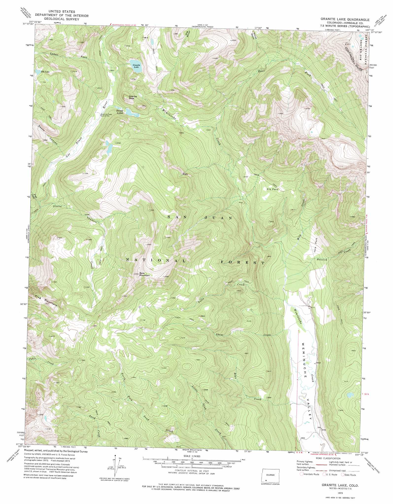
USGS Topo Quad 37107e3 - 1:24,000 scale
| Topo Map Name: | Granite Lake |
| USGS Topo Quad ID: | 37107e3 |
| Print Size: | ca. 21 1/4" wide x 27" high |
| Southeast Coordinates: | 37.5° N latitude / 107.25° W longitude |
| Map Center Coordinates: | 37.5625° N latitude / 107.3125° W longitude |
| U.S. State: | CO |
| Filename: | o37107e3.jpg |
| Download Map JPG Image: | Granite Lake topo map 1:24,000 scale |
| Map Type: | Topographic |
| Topo Series: | 7.5´ |
| Map Scale: | 1:24,000 |
| Source of Map Images: | United States Geological Survey (USGS) |
| Alternate Map Versions: |
Granite Lake CO 1973, updated 1975 Download PDF Buy paper map Granite Lake CO 1973, updated 1975 Download PDF Buy paper map Granite Lake CO 2011 Download PDF Buy paper map Granite Lake CO 2013 Download PDF Buy paper map Granite Lake CO 2016 Download PDF Buy paper map |
| FStopo: | US Forest Service topo Granite Lake is available: Download FStopo PDF Download FStopo TIF |
1:24,000 Topo Quads surrounding Granite Lake
Howardsville |
Pole Creek Mountain |
Finger Mesa |
Hermit Lakes |
Bristol Head |
Storm King Peak |
Rio Grande Pyramid |
Weminuche Pass |
Little Squaw Creek |
Workman Creek |
Columbine Pass |
Emerald Lake |
Granite Lake |
Cimarrona Peak |
Palomino Mountain |
Vallecito Reservoir |
Granite Peak |
Bear Mountain |
Oakbrush Ridge |
Pagosa Peak |
Ludwig Mountain |
Baldy Mountain |
Devil Mountain |
Chris Mountain |
Pagosa Springs |
> Back to 37107e1 at 1:100,000 scale
> Back to 37106a1 at 1:250,000 scale
> Back to U.S. Topo Maps home
Granite Lake topo map: Gazetteer
Granite Lake: Canals
Sullivan Ditch elevation 3249m 10659′Granite Lake: Flats
Elk Park elevation 2855m 9366′Miner Park elevation 2627m 8618′
Granite Lake: Lakes
Elk Lake elevation 3520m 11548′Granite Lake elevation 3140m 10301′
Granite Lake: Reservoirs
Divide Lakes elevation 3026m 9927′Granite Lake: Streams
Bear Creek elevation 2452m 8044′East Fork Weminuche Creek elevation 2852m 9356′
Falls Creek elevation 2493m 8179′
Hossick Creek elevation 2510m 8234′
Milk Creek elevation 2532m 8307′
Pope Creek elevation 2932m 9619′
Shaw Creek elevation 2453m 8047′
Sierra Vandera Creek elevation 2929m 9609′
Granite Lake: Summits
Bald Mountain elevation 3733m 12247′Flag Mountain elevation 3752m 12309′
Granite Peak elevation 3254m 10675′
Granite Lake: Valleys
Cañon Paso elevation 3043m 9983′Dog Rincon elevation 3022m 9914′
Grouse Rincon elevation 3158m 10360′
South Canyon elevation 3046m 9993′
Granite Lake digital topo map on disk
Buy this Granite Lake topo map showing relief, roads, GPS coordinates and other geographical features, as a high-resolution digital map file on DVD: