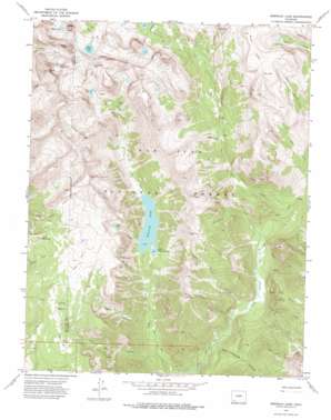
Emerald Lake Topo Map Colorado
To zoom in, hover over the map of Emerald Lake
USGS Topo Quad 37107e4 - 1:24,000 scale
| Topo Map Name: | Emerald Lake |
| USGS Topo Quad ID: | 37107e4 |
| Print Size: | ca. 21 1/4" wide x 27" high |
| Southeast Coordinates: | 37.5° N latitude / 107.375° W longitude |
| Map Center Coordinates: | 37.5625° N latitude / 107.4375° W longitude |
| U.S. State: | CO |
| Filename: | o37107e4.jpg |
| Download Map JPG Image: | Emerald Lake topo map 1:24,000 scale |
| Map Type: | Topographic |
| Topo Series: | 7.5´ |
| Map Scale: | 1:24,000 |
| Source of Map Images: | United States Geological Survey (USGS) |
| Alternate Map Versions: |
Emerald Lake CO 1973, updated 1976 Download PDF Buy paper map Emerald Lake CO 1973, updated 1976 Download PDF Buy paper map Emerald Lake CO 2011 Download PDF Buy paper map Emerald Lake CO 2013 Download PDF Buy paper map Emerald Lake CO 2016 Download PDF Buy paper map |
| FStopo: | US Forest Service topo Emerald Lake is available: Download FStopo PDF Download FStopo TIF |
1:24,000 Topo Quads surrounding Emerald Lake
> Back to 37107e1 at 1:100,000 scale
> Back to 37106a1 at 1:250,000 scale
> Back to U.S. Topo Maps home
Emerald Lake topo map: Gazetteer
Emerald Lake: Basins
Cave Basin elevation 3465m 11368′Emerald Lake: Flats
Barebottom Park elevation 3066m 10059′Emerald Lake: Lakes
Annie Lakes elevation 3731m 12240′Betty Lake elevation 3700m 12139′
Blue Lake elevation 3739m 12267′
Dollar Lake elevation 3530m 11581′
Emerald Lake elevation 3060m 10039′
Flint Lakes elevation 3529m 11578′
Half Moon Lake elevation 3714m 12185′
Lake Mary Alice elevation 3810m 12500′
Little Emerald Lake elevation 3053m 10016′
Rock Lake elevation 3611m 11847′
Emerald Lake: Streams
Cave Basin Creek elevation 2633m 8638′Falls Creek elevation 2658m 8720′
Flint Creek elevation 2818m 9245′
Porcupine Creek elevation 2686m 8812′
Willow Creek elevation 2658m 8720′
Emerald Lake: Summits
Buffalo Peak elevation 3861m 12667′Mesa Lato elevation 3860m 12664′
Mount Oso elevation 4158m 13641′
Peters Peak elevation 3994m 13103′
Popes Nose elevation 3183m 10442′
Table Mountain elevation 3565m 11696′
Emerald Lake: Valleys
Blue Spruce Canyon elevation 2609m 8559′Hell Canyon elevation 2771m 9091′
Emerald Lake digital topo map on disk
Buy this Emerald Lake topo map showing relief, roads, GPS coordinates and other geographical features, as a high-resolution digital map file on DVD:


