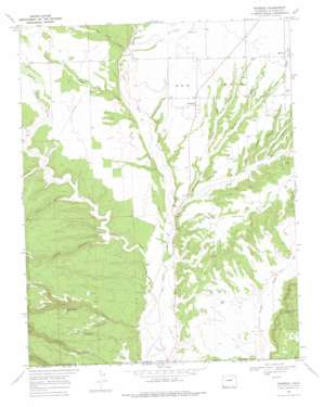
Redmesa Topo Map Colorado
To zoom in, hover over the map of Redmesa
USGS Topo Quad 37108a2 - 1:24,000 scale
| Topo Map Name: | Redmesa |
| USGS Topo Quad ID: | 37108a2 |
| Print Size: | ca. 21 1/4" wide x 27" high |
| Southeast Coordinates: | 37° N latitude / 108.125° W longitude |
| Map Center Coordinates: | 37.0625° N latitude / 108.1875° W longitude |
| U.S. State: | CO |
| Filename: | o37108a2.jpg |
| Download Map JPG Image: | Redmesa topo map 1:24,000 scale |
| Map Type: | Topographic |
| Topo Series: | 7.5´ |
| Map Scale: | 1:24,000 |
| Source of Map Images: | United States Geological Survey (USGS) |
| Alternate Map Versions: |
Redmesa CO 1968, updated 1972 Download PDF Buy paper map Redmesa CO 1968, updated 1972 Download PDF Buy paper map Redmesa CO 1968, updated 1975 Download PDF Buy paper map Redmesa CO 2010 Download PDF Buy paper map Redmesa CO 2013 Download PDF Buy paper map Redmesa CO 2016 Download PDF Buy paper map |
1:24,000 Topo Quads surrounding Redmesa
> Back to 37108a1 at 1:100,000 scale
> Back to 37108a1 at 1:250,000 scale
> Back to U.S. Topo Maps home
Redmesa topo map: Gazetteer
Redmesa: Canals
Enterprise Ditch elevation 1835m 6020′Redmesa: Cliffs
Cinder Bluffs elevation 1899m 6230′Redmesa: Populated Places
Marvel elevation 2053m 6735′Redmesa elevation 1996m 6548′
Redmesa: Streams
Cherry Creek elevation 1964m 6443′Johnny Pond Arroyo elevation 1829m 6000′
San Juan Arroyo elevation 1963m 6440′
Wheeler Arroyo elevation 1988m 6522′
Redmesa: Summits
South Cinder Butte elevation 1916m 6286′Redmesa: Valleys
Bragg Draw elevation 1881m 6171′Butch Henry Draw elevation 1982m 6502′
Cannibal Canyon elevation 1939m 6361′
Church Hollow elevation 1929m 6328′
First Canyon elevation 1936m 6351′
Government Draw elevation 1898m 6227′
Johnson Canyon elevation 1921m 6302′
Long Hollow elevation 1883m 6177′
Maverick Gulch elevation 1973m 6473′
Mooney Draw elevation 1927m 6322′
Morgan Canyon elevation 1842m 6043′
Post Canyon elevation 1955m 6414′
Red Horse Gulch elevation 1985m 6512′
Silva Draw elevation 1939m 6361′
Third Canyon elevation 1942m 6371′
Wheeler Draw elevation 1988m 6522′
Redmesa digital topo map on disk
Buy this Redmesa topo map showing relief, roads, GPS coordinates and other geographical features, as a high-resolution digital map file on DVD:


