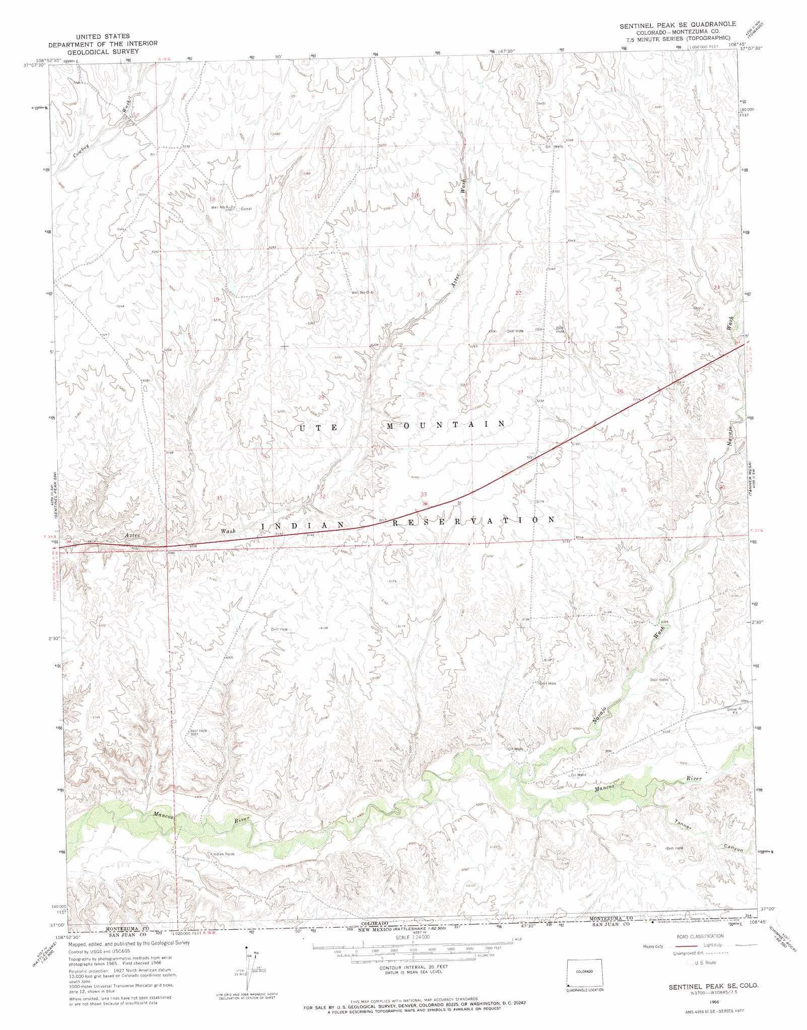
Sentinel Peak Se Topo Map Colorado
To zoom in, hover over the map of Sentinel Peak Se
USGS Topo Quad 37108a7 - 1:24,000 scale
| Topo Map Name: | Sentinel Peak Se |
| USGS Topo Quad ID: | 37108a7 |
| Print Size: | ca. 21 1/4" wide x 27" high |
| Southeast Coordinates: | 37° N latitude / 108.75° W longitude |
| Map Center Coordinates: | 37.0625° N latitude / 108.8125° W longitude |
| U.S. State: | CO |
| Filename: | o37108a7.jpg |
| Download Map JPG Image: | Sentinel Peak Se topo map 1:24,000 scale |
| Map Type: | Topographic |
| Topo Series: | 7.5´ |
| Map Scale: | 1:24,000 |
| Source of Map Images: | United States Geological Survey (USGS) |
| Alternate Map Versions: |
Sentinel Peak SE CO 1966, updated 1969 Download PDF Buy paper map Sentinel Peak SE CO 2010 Download PDF Buy paper map Sentinel Peak SE CO 2013 Download PDF Buy paper map Sentinel Peak SE CO 2016 Download PDF Buy paper map |
1:24,000 Topo Quads surrounding Sentinel Peak Se
Wickiup Canyon |
Bowdish Canyon |
Battle Rock |
Mud Creek |
Cortez |
Peters Nipple |
Mariano Wash West |
Mariano Wash East |
Towaoc |
Wetherill Mesa |
Aneth Se |
Sentinel Peak Sw |
Sentinel Peak Se |
Tanner Mesa |
Moqui Canyon |
Teec Nos Pos |
Sallies Spring |
Canal Creek |
Skinney Rock |
Palmer Mesa |
Beclabito |
Rocky Point |
Rattlesnake |
Shiprock |
Chimney Rock |
> Back to 37108a1 at 1:100,000 scale
> Back to 37108a1 at 1:250,000 scale
> Back to U.S. Topo Maps home
Sentinel Peak Se topo map: Gazetteer
Sentinel Peak Se: Streams
Navajo Wash elevation 1509m 4950′Sentinel Peak Se: Valleys
Chimney Rock Draw elevation 1556m 5104′Tanner Canyon elevation 1522m 4993′
Sentinel Peak Se digital topo map on disk
Buy this Sentinel Peak Se topo map showing relief, roads, GPS coordinates and other geographical features, as a high-resolution digital map file on DVD: