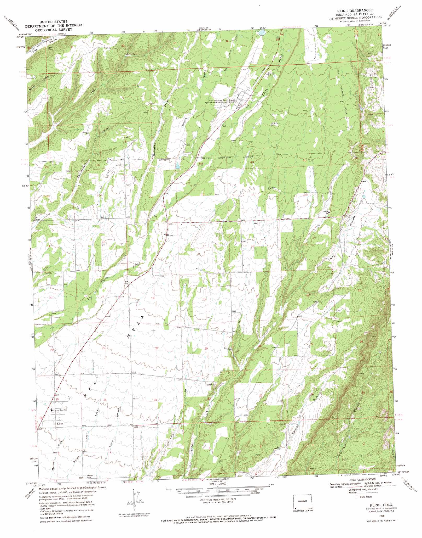
Kline Topo Map Colorado
To zoom in, hover over the map of Kline
USGS Topo Quad 37108b1 - 1:24,000 scale
| Topo Map Name: | Kline |
| USGS Topo Quad ID: | 37108b1 |
| Print Size: | ca. 21 1/4" wide x 27" high |
| Southeast Coordinates: | 37.125° N latitude / 108° W longitude |
| Map Center Coordinates: | 37.1875° N latitude / 108.0625° W longitude |
| U.S. State: | CO |
| Filename: | o37108b1.jpg |
| Download Map JPG Image: | Kline topo map 1:24,000 scale |
| Map Type: | Topographic |
| Topo Series: | 7.5´ |
| Map Scale: | 1:24,000 |
| Source of Map Images: | United States Geological Survey (USGS) |
| Alternate Map Versions: |
Kline CO 1968, updated 1971 Download PDF Buy paper map Kline CO 1968, updated 1971 Download PDF Buy paper map Kline CO 1968, updated 1972 Download PDF Buy paper map Kline CO 2010 Download PDF Buy paper map Kline CO 2013 Download PDF Buy paper map Kline CO 2016 Download PDF Buy paper map |
1:24,000 Topo Quads surrounding Kline
Millwood |
Rampart Hills |
La Plata |
Monument Hill |
Hermosa |
Mancos |
Thompson Park |
Hesperus |
Durango West |
Durango East |
Trail Canyon |
Mormon Reservoir |
Kline |
Basin Mountain |
Loma Linda |
Red Horse Gulch |
Redmesa |
Pinkerton Mesa |
Long Mountain |
Bondad Hill |
Purgatory Canyon |
La Plata |
Abode Downs Ranch |
Cedar Hill |
Tank Mountain |
> Back to 37108a1 at 1:100,000 scale
> Back to 37108a1 at 1:250,000 scale
> Back to U.S. Topo Maps home
Kline topo map: Gazetteer
Kline: Canals
Big Stick Ditch elevation 2291m 7516′Kline: Mines
Dunn Mine elevation 2229m 7312′Wheeler Mine elevation 2335m 7660′
Kline: Populated Places
Breen elevation 2239m 7345′Kline elevation 2116m 6942′
Kline: Summits
Red Mesa elevation 2303m 7555′Kline: Valleys
Soldiers Draw elevation 2219m 7280′Spring Gulch elevation 2256m 7401′
Kline digital topo map on disk
Buy this Kline topo map showing relief, roads, GPS coordinates and other geographical features, as a high-resolution digital map file on DVD: