Yellow Jacket Topo Map Colorado
To zoom in, hover over the map of Yellow Jacket
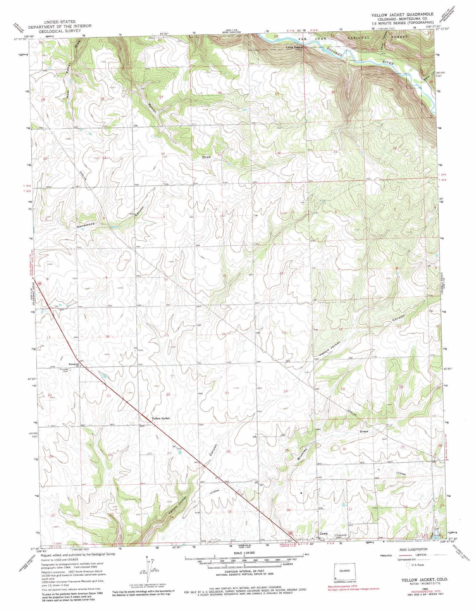
USGS Topo Quad 37108e6 - 1:24,000 scale
| Topo Map Name: | Yellow Jacket |
| USGS Topo Quad ID: | 37108e6 |
| Print Size: | ca. 21 1/4" wide x 27" high |
| Southeast Coordinates: | 37.5° N latitude / 108.625° W longitude |
| Map Center Coordinates: | 37.5625° N latitude / 108.6875° W longitude |
| U.S. State: | CO |
| Filename: | o37108e6.jpg |
| Download Map JPG Image: | Yellow Jacket topo map 1:24,000 scale |
| Map Type: | Topographic |
| Topo Series: | 7.5´ |
| Map Scale: | 1:24,000 |
| Source of Map Images: | United States Geological Survey (USGS) |
| Alternate Map Versions: |
Yellow Jacket CO 1965, updated 1968 Download PDF Buy paper map Yellow Jacket CO 1965, updated 1968 Download PDF Buy paper map Yellow Jacket CO 1965, updated 1981 Download PDF Buy paper map Yellow Jacket CO 1965, updated 1984 Download PDF Buy paper map Yellow Jacket CO 2011 Download PDF Buy paper map Yellow Jacket CO 2013 Download PDF Buy paper map Yellow Jacket CO 2016 Download PDF Buy paper map |
| FStopo: | US Forest Service topo Yellow Jacket is available: Download FStopo PDF Download FStopo TIF |
1:24,000 Topo Quads surrounding Yellow Jacket
Dove Creek |
Secret Canyon |
The Glade |
Glade Mountain |
South Mountain |
Champagne Spring |
Cahone |
Doe Canyon |
Narraguinnep Mountain |
Willow Spring |
Ruin Canyon |
Pleasant View |
Yellow Jacket |
Trimble Point |
Boggy Draw |
Negro Canyon |
Woods Canyon |
Arriola |
Dolores West |
Dolores East |
Bowdish Canyon |
Battle Rock |
Mud Creek |
Cortez |
Point Lookout |
> Back to 37108e1 at 1:100,000 scale
> Back to 37108a1 at 1:250,000 scale
> Back to U.S. Topo Maps home
Yellow Jacket topo map: Gazetteer
Yellow Jacket: Airports
Pleasant View Heliport elevation 2323m 7621′Yellow Jacket: Canals
U Lateral elevation 2090m 6856′Yellow Jacket: Cliffs
Lone Dome elevation 2113m 6932′Yellow Jacket: Parks
Dolores River State Wildlife Area elevation 2123m 6965′Lone Dome Recreation Area elevation 2001m 6564′
Yellow Jacket: Populated Places
Yellow Jacket elevation 2103m 6899′Yellow Jacket: Valleys
Ferris Canyon elevation 2013m 6604′Salter Canyon elevation 2013m 6604′
Yellow Jacket digital topo map on disk
Buy this Yellow Jacket topo map showing relief, roads, GPS coordinates and other geographical features, as a high-resolution digital map file on DVD: