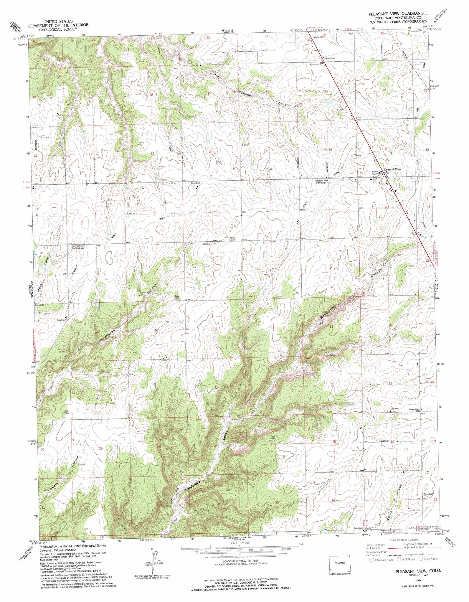
Pleasant View Topo Map Colorado
To zoom in, hover over the map of Pleasant View
USGS Topo Quad 37108e7 - 1:24,000 scale
| Topo Map Name: | Pleasant View |
| USGS Topo Quad ID: | 37108e7 |
| Print Size: | ca. 21 1/4" wide x 27" high |
| Southeast Coordinates: | 37.5° N latitude / 108.75° W longitude |
| Map Center Coordinates: | 37.5625° N latitude / 108.8125° W longitude |
| U.S. State: | CO |
| Filename: | o37108e7.jpg |
| Download Map JPG Image: | Pleasant View topo map 1:24,000 scale |
| Map Type: | Topographic |
| Topo Series: | 7.5´ |
| Map Scale: | 1:24,000 |
| Source of Map Images: | United States Geological Survey (USGS) |
| Alternate Map Versions: |
Pleasant View CO 1965, updated 1968 Download PDF Buy paper map Pleasant View CO 1965, updated 1968 Download PDF Buy paper map Pleasant View CO 1994, updated 1994 Download PDF Buy paper map Pleasant View CO 2010 Download PDF Buy paper map Pleasant View CO 2013 Download PDF Buy paper map Pleasant View CO 2016 Download PDF Buy paper map |
1:24,000 Topo Quads surrounding Pleasant View
Northdale |
Dove Creek |
Secret Canyon |
The Glade |
Glade Mountain |
Burnt Cabin Creek |
Champagne Spring |
Cahone |
Doe Canyon |
Narraguinnep Mountain |
Papoose Canyon |
Ruin Canyon |
Pleasant View |
Yellow Jacket |
Trimble Point |
Ruin Point |
Negro Canyon |
Woods Canyon |
Arriola |
Dolores West |
Wickiup Canyon |
Bowdish Canyon |
Battle Rock |
Mud Creek |
Cortez |
> Back to 37108e1 at 1:100,000 scale
> Back to 37108a1 at 1:250,000 scale
> Back to U.S. Topo Maps home
Pleasant View topo map: Gazetteer
Pleasant View: Canals
Dove Creek Canal elevation 2112m 6929′South Canal elevation 2094m 6870′
Pleasant View: Mines
Cliff House Group Mine elevation 1985m 6512′Pleasant View: Populated Places
Pleasant View elevation 2107m 6912′Pleasant View digital topo map on disk
Buy this Pleasant View topo map showing relief, roads, GPS coordinates and other geographical features, as a high-resolution digital map file on DVD: