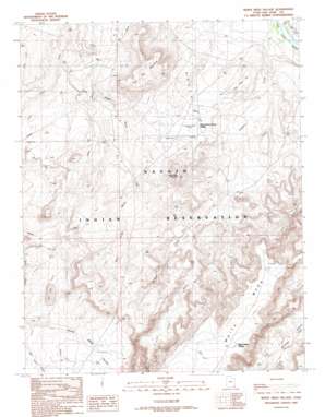
White Mesa Village Topo Map Utah
To zoom in, hover over the map of White Mesa Village
USGS Topo Quad 37109b3 - 1:24,000 scale
| Topo Map Name: | White Mesa Village |
| USGS Topo Quad ID: | 37109b3 |
| Print Size: | ca. 21 1/4" wide x 27" high |
| Southeast Coordinates: | 37.125° N latitude / 109.25° W longitude |
| Map Center Coordinates: | 37.1875° N latitude / 109.3125° W longitude |
| U.S. State: | UT |
| Filename: | o37109b3.jpg |
| Download Map JPG Image: | White Mesa Village topo map 1:24,000 scale |
| Map Type: | Topographic |
| Topo Series: | 7.5´ |
| Map Scale: | 1:24,000 |
| Source of Map Images: | United States Geological Survey (USGS) |
| Alternate Map Versions: |
White Mesa Village UT 1989, updated 1989 Download PDF Buy paper map White Mesa Village UT 2010 Download PDF Buy paper map White Mesa Village UT 2014 Download PDF Buy paper map |
1:24,000 Topo Quads surrounding White Mesa Village
> Back to 37109a1 at 1:100,000 scale
> Back to 37108a1 at 1:250,000 scale
> Back to U.S. Topo Maps home
White Mesa Village topo map: Gazetteer
White Mesa Village: Populated Places
Red Lake Village elevation 1453m 4767′White Mesa Village elevation 1699m 5574′
White Rock Curve Village elevation 1448m 4750′
White Mesa Village: Springs
Tow Gray Spring elevation 1414m 4639′White Mesa Village: Streams
Sahgzie Creek elevation 1352m 4435′White Mesa Village: Summits
Flat Top Mountain elevation 1568m 5144′Tow Gray Hill elevation 1442m 4730′
White Mesa elevation 1692m 5551′
White Mesa Mountain elevation 1626m 5334′
White Mesa Village: Valleys
Blue Hogan Wash elevation 1366m 4481′Lone Wash elevation 1435m 4708′
West Fork Allen Canyon elevation 1352m 4435′
White Mesa Valley elevation 1459m 4786′
White Mesa Village digital topo map on disk
Buy this White Mesa Village topo map showing relief, roads, GPS coordinates and other geographical features, as a high-resolution digital map file on DVD:


