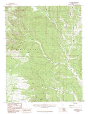
Cream Pots Topo Map Utah
To zoom in, hover over the map of Cream Pots
USGS Topo Quad 37109f6 - 1:24,000 scale
| Topo Map Name: | Cream Pots |
| USGS Topo Quad ID: | 37109f6 |
| Print Size: | ca. 21 1/4" wide x 27" high |
| Southeast Coordinates: | 37.625° N latitude / 109.625° W longitude |
| Map Center Coordinates: | 37.6875° N latitude / 109.6875° W longitude |
| U.S. State: | UT |
| Filename: | o37109f6.jpg |
| Download Map JPG Image: | Cream Pots topo map 1:24,000 scale |
| Map Type: | Topographic |
| Topo Series: | 7.5´ |
| Map Scale: | 1:24,000 |
| Source of Map Images: | United States Geological Survey (USGS) |
| Alternate Map Versions: |
Elk Ridge 4 NW UT 1954 Download PDF Buy paper map Cream Pots UT 1985, updated 1985 Download PDF Buy paper map Cream Pots UT 1985, updated 1985 Download PDF Buy paper map Cream Pots UT 2001, updated 2004 Download PDF Buy paper map Cream Pots UT 2011 Download PDF Buy paper map Cream Pots UT 2014 Download PDF Buy paper map |
| FStopo: | US Forest Service topo Cream Pots is available: Download FStopo PDF Download FStopo TIF |
1:24,000 Topo Quads surrounding Cream Pots
> Back to 37109e1 at 1:100,000 scale
> Back to 37108a1 at 1:250,000 scale
> Back to U.S. Topo Maps home
Cream Pots topo map: Gazetteer
Cream Pots: Capes
East Point elevation 2616m 8582′Milk Ranch Point elevation 2263m 7424′
Cream Pots: Flats
Cream Pots elevation 1969m 6459′Dwarf elevation 2014m 6607′
Cream Pots: Populated Places
Indian Village elevation 1723m 5652′Cream Pots: Streams
Cottonwood Creek elevation 1756m 5761′Cream Pots: Summits
Black Steer Knoll elevation 1979m 6492′Cream Pots: Valleys
Allen Canyon elevation 1732m 5682′Dry Wash elevation 1715m 5626′
Hammond Canyon elevation 1713m 5620′
Posey Canyon elevation 1844m 6049′
Cream Pots digital topo map on disk
Buy this Cream Pots topo map showing relief, roads, GPS coordinates and other geographical features, as a high-resolution digital map file on DVD:


