Eastland Nw Topo Map Utah
To zoom in, hover over the map of Eastland Nw
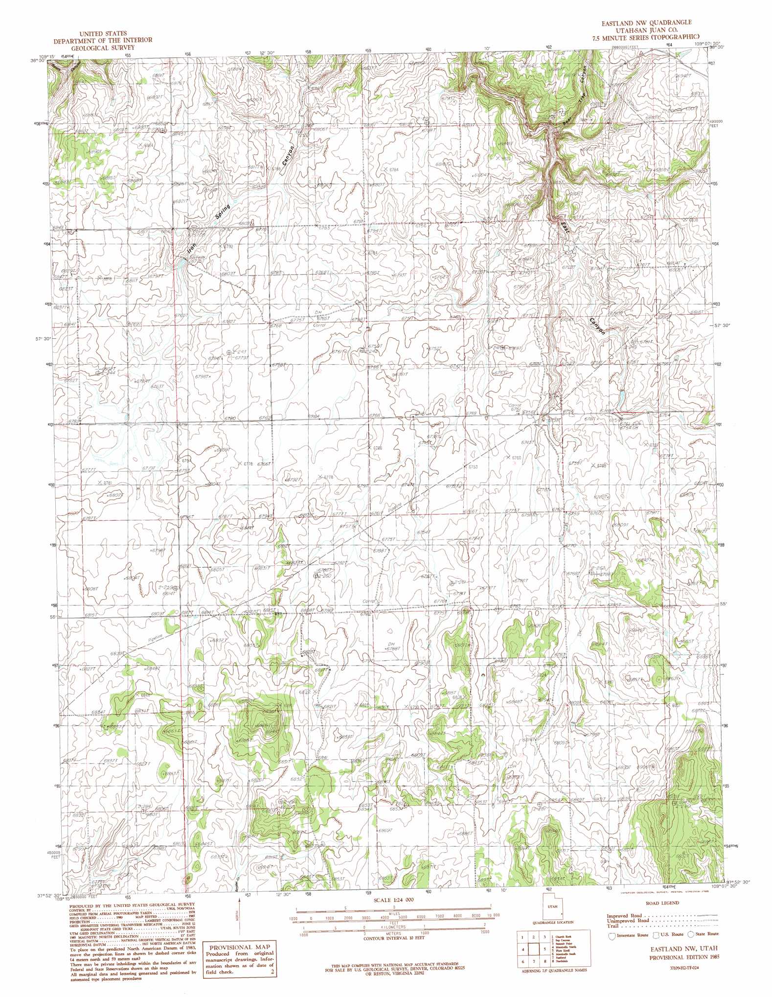
USGS Topo Quad 37109h2 - 1:24,000 scale
| Topo Map Name: | Eastland Nw |
| USGS Topo Quad ID: | 37109h2 |
| Print Size: | ca. 21 1/4" wide x 27" high |
| Southeast Coordinates: | 37.875° N latitude / 109.125° W longitude |
| Map Center Coordinates: | 37.9375° N latitude / 109.1875° W longitude |
| U.S. State: | UT |
| Filename: | o37109h2.jpg |
| Download Map JPG Image: | Eastland Nw topo map 1:24,000 scale |
| Map Type: | Topographic |
| Topo Series: | 7.5´ |
| Map Scale: | 1:24,000 |
| Source of Map Images: | United States Geological Survey (USGS) |
| Alternate Map Versions: |
Verdure 1 NW UT 1959, updated 1959 Download PDF Buy paper map Eastland NW UT 1985, updated 1985 Download PDF Buy paper map Eastland NW UT 2010 Download PDF Buy paper map Eastland NW UT 2014 Download PDF Buy paper map |
1:24,000 Topo Quads surrounding Eastland Nw
Hatch Rock |
Sandstone Draw |
Lisbon Valley |
Lisbon Gap |
Anderson Mesa |
Photograph Gap |
Church Rock |
Sop Canyon |
Summit Point |
Horse Range Mesa |
Monticello Lake |
Monticello North |
Eastland Nw |
Piute Point |
Egnar |
Abajo Peak |
Monticello South |
Eastland |
Northdale |
Dove Creek |
Blanding North |
Devil Mesa |
Horsehead Point |
Burnt Cabin Creek |
Champagne Spring |
> Back to 37109e1 at 1:100,000 scale
> Back to 37108a1 at 1:250,000 scale
> Back to U.S. Topo Maps home
Eastland Nw topo map: Gazetteer
Eastland Nw: Dams
Iron Springs Dam elevation 2068m 6784′Eastland Nw: Reservoirs
Iron Springs Reservoir elevation 2067m 6781′Eastland Nw: Springs
Iron Spring elevation 2054m 6738′Eastland Nw: Valleys
Bear Trap Canyon elevation 2031m 6663′Eastland Nw digital topo map on disk
Buy this Eastland Nw topo map showing relief, roads, GPS coordinates and other geographical features, as a high-resolution digital map file on DVD: