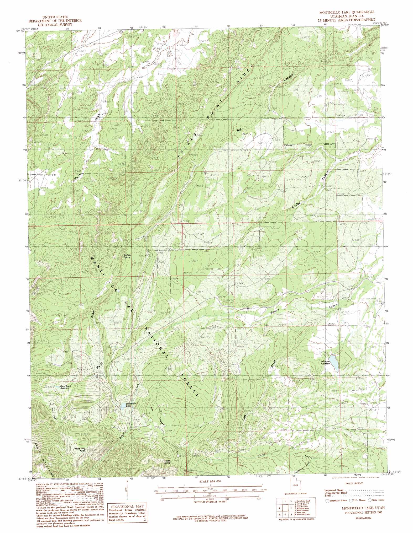
Monticello Lake Topo Map Utah
To zoom in, hover over the map of Monticello Lake
USGS Topo Quad 37109h4 - 1:24,000 scale
| Topo Map Name: | Monticello Lake |
| USGS Topo Quad ID: | 37109h4 |
| Print Size: | ca. 21 1/4" wide x 27" high |
| Southeast Coordinates: | 37.875° N latitude / 109.375° W longitude |
| Map Center Coordinates: | 37.9375° N latitude / 109.4375° W longitude |
| U.S. State: | UT |
| Filename: | o37109h4.jpg |
| Download Map JPG Image: | Monticello Lake topo map 1:24,000 scale |
| Map Type: | Topographic |
| Topo Series: | 7.5´ |
| Map Scale: | 1:24,000 |
| Source of Map Images: | United States Geological Survey (USGS) |
| Alternate Map Versions: |
Verdure 2 NW UT 1958, updated 1958 Download PDF Buy paper map Monticello Lake UT 1985, updated 1985 Download PDF Buy paper map Monticello Lake UT 2001, updated 2004 Download PDF Buy paper map Monticello Lake UT 2011 Download PDF Buy paper map Monticello Lake UT 2014 Download PDF Buy paper map |
| FStopo: | US Forest Service topo Monticello Lake is available: Download FStopo PDF Download FStopo TIF |
1:24,000 Topo Quads surrounding Monticello Lake
North Six-Shooter Peak |
Harts Point North |
Hatch Rock |
Sandstone Draw |
Lisbon Valley |
South Six-Shooter Peak |
Harts Point South |
Photograph Gap |
Church Rock |
Sop Canyon |
Cathedral Butte |
Shay Mountain |
Monticello Lake |
Monticello North |
Eastland Nw |
Chippean Rocks |
Mount Linnaeus |
Abajo Peak |
Monticello South |
Eastland |
Cream Pots |
Mancos Jim Butte |
Blanding North |
Devil Mesa |
Horsehead Point |
> Back to 37109e1 at 1:100,000 scale
> Back to 37108a1 at 1:250,000 scale
> Back to U.S. Topo Maps home
Monticello Lake topo map: Gazetteer
Monticello Lake: Dams
Gordon Dam elevation 2255m 7398′Monticello Lake Dam elevation 2623m 8605′
Upper Bailey Dam elevation 2186m 7171′
Monticello Lake: Lakes
Monticello Lake elevation 2623m 8605′Monticello Lake: Reservoirs
Gordon Reservoir elevation 2255m 7398′Race Track Reservoir elevation 2665m 8743′
Upper Bailey Reservoir elevation 2186m 7171′
Monticello Lake: Ridges
Peters Point Ridge elevation 2285m 7496′Pine Ridge elevation 2692m 8832′
Monticello Lake: Springs
Jackson Spring elevation 2383m 7818′Taylor Spring elevation 2695m 8841′
Monticello Lake: Summits
Prairie Dog Knoll elevation 3027m 9931′Monticello Lake: Trails
The Race Track elevation 2756m 9041′Monticello Lake: Valleys
Clay Draw elevation 2201m 7221′Monticello Lake digital topo map on disk
Buy this Monticello Lake topo map showing relief, roads, GPS coordinates and other geographical features, as a high-resolution digital map file on DVD: