No Mans Mesa South Topo Map Utah
To zoom in, hover over the map of No Mans Mesa South
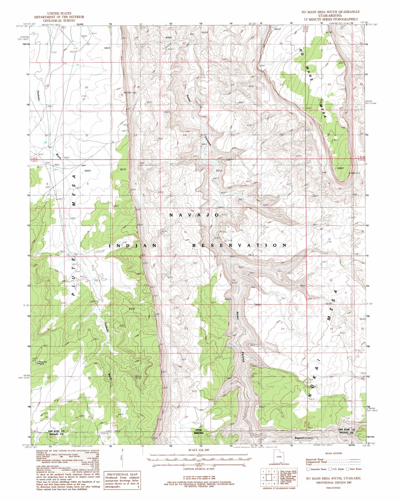
USGS Topo Quad 37110a5 - 1:24,000 scale
| Topo Map Name: | No Mans Mesa South |
| USGS Topo Quad ID: | 37110a5 |
| Print Size: | ca. 21 1/4" wide x 27" high |
| Southeast Coordinates: | 37° N latitude / 110.5° W longitude |
| Map Center Coordinates: | 37.0625° N latitude / 110.5625° W longitude |
| U.S. States: | UT, AZ |
| Filename: | o37110a5.jpg |
| Download Map JPG Image: | No Mans Mesa South topo map 1:24,000 scale |
| Map Type: | Topographic |
| Topo Series: | 7.5´ |
| Map Scale: | 1:24,000 |
| Source of Map Images: | United States Geological Survey (USGS) |
| Alternate Map Versions: |
Navajo Mtn. 4 SE UT 1952, updated 1955 Download PDF Buy paper map No Mans Mesa South UT 1987, updated 1987 Download PDF Buy paper map No Mans Mesa South UT 2011 Download PDF Buy paper map No Mans Mesa South UT 2014 Download PDF Buy paper map |
1:24,000 Topo Quads surrounding No Mans Mesa South
The Rincon |
Alcove Canyon |
Nokai Dome |
Mikes Mesa |
Whirlwind Draw |
Wilson Creek |
Deep Canyon North |
No Mans Mesa North |
Monitor Butte |
Oljeto Ne |
Navajo Begay |
Deep Canyon South |
No Mans Mesa South |
Jacobs Monument |
Oljeto |
Chaiyahi Rim Ne |
Tall Mountain Nw |
Cattle Canyon |
Big Point |
Boot Mesa |
Chaiyahi Rim Se |
Oak Springs |
Tall Mountain |
Keet Seel Ruin |
Tseyi-Hatsosi |
> Back to 37110a1 at 1:100,000 scale
> Back to 37110a1 at 1:250,000 scale
> Back to U.S. Topo Maps home
No Mans Mesa South topo map: Gazetteer
No Mans Mesa South: Pillars
Thumb Rock elevation 1946m 6384′No Mans Mesa South: Summits
Piute Mesa elevation 1856m 6089′No Mans Mesa South: Trails
Wetherill Trail elevation 1525m 5003′No Mans Mesa South: Valleys
Begashinitani Canyon elevation 1448m 4750′No Mans Mesa South digital topo map on disk
Buy this No Mans Mesa South topo map showing relief, roads, GPS coordinates and other geographical features, as a high-resolution digital map file on DVD: