Slickhorn Canyon East Topo Map Utah
To zoom in, hover over the map of Slickhorn Canyon East
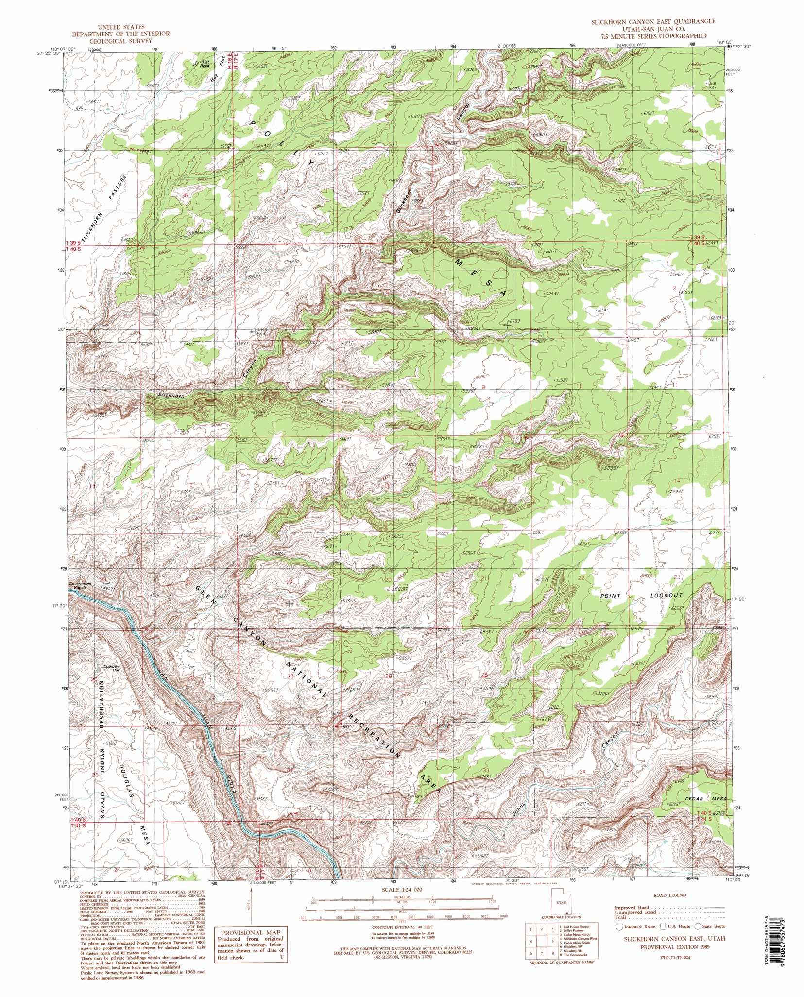
USGS Topo Quad 37110c1 - 1:24,000 scale
| Topo Map Name: | Slickhorn Canyon East |
| USGS Topo Quad ID: | 37110c1 |
| Print Size: | ca. 21 1/4" wide x 27" high |
| Southeast Coordinates: | 37.25° N latitude / 110° W longitude |
| Map Center Coordinates: | 37.3125° N latitude / 110.0625° W longitude |
| U.S. State: | UT |
| Filename: | o37110c1.jpg |
| Download Map JPG Image: | Slickhorn Canyon East topo map 1:24,000 scale |
| Map Type: | Topographic |
| Topo Series: | 7.5´ |
| Map Scale: | 1:24,000 |
| Source of Map Images: | United States Geological Survey (USGS) |
| Alternate Map Versions: |
Slickhorn Canyon East UT 1989, updated 1989 Download PDF Buy paper map Slickhorn Canyon East UT 1989, updated 1989 Download PDF Buy paper map Slickhorn Canyon East UT 1996, updated 2002 Download PDF Buy paper map Slickhorn Canyon East UT 2011 Download PDF Buy paper map Slickhorn Canyon East UT 2014 Download PDF Buy paper map |
1:24,000 Topo Quads surrounding Slickhorn Canyon East
Chocolate Drop |
Fry Spring |
Moss Back Butte |
Kane Gulch |
South Long Point |
Clay Hills |
Red House Spring |
Pollys Pasture |
Cedar Mesa North |
Snow Flat Spring Cave |
Whirlwind Draw |
Slickhorn Canyon West |
Slickhorn Canyon East |
Cedar Mesa South |
Cigarette Spring Cave |
Oljeto Ne |
Goulding Nw |
Goulding Ne |
The Goosenecks |
Mexican Hat |
Oljeto |
Goulding |
Monument Pass |
Mexican Hat Sw |
Mexican Hat Se |
> Back to 37110a1 at 1:100,000 scale
> Back to 37110a1 at 1:250,000 scale
> Back to U.S. Topo Maps home
Slickhorn Canyon East topo map: Gazetteer
Slickhorn Canyon East: Capes
Point Lookout elevation 1875m 6151′Slickhorn Canyon East: Flats
Hat Flat elevation 1683m 5521′Slickhorn Pasture elevation 1674m 5492′
Slickhorn Canyon East: Pillars
Cowboy Hat elevation 1467m 4812′Hat Rock elevation 1683m 5521′
Slickhorn Canyon East: Springs
Sulphur Spring (historical) elevation 1163m 3815′Slickhorn Canyon East: Summits
Polly Mesa elevation 1758m 5767′Slickhorn Canyon East digital topo map on disk
Buy this Slickhorn Canyon East topo map showing relief, roads, GPS coordinates and other geographical features, as a high-resolution digital map file on DVD: