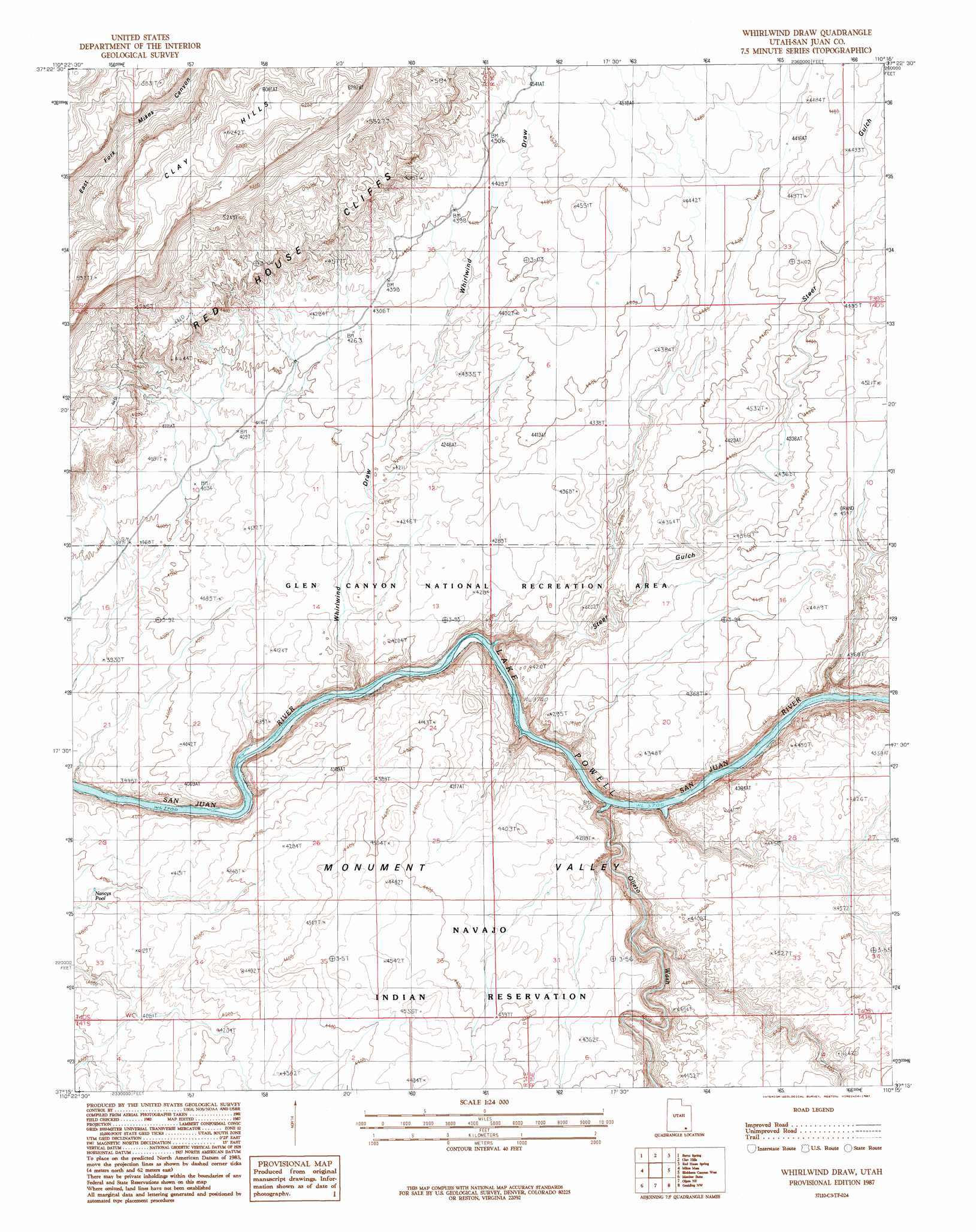
Whirlwind Draw Topo Map Utah
To zoom in, hover over the map of Whirlwind Draw
USGS Topo Quad 37110c3 - 1:24,000 scale
| Topo Map Name: | Whirlwind Draw |
| USGS Topo Quad ID: | 37110c3 |
| Print Size: | ca. 21 1/4" wide x 27" high |
| Southeast Coordinates: | 37.25° N latitude / 110.25° W longitude |
| Map Center Coordinates: | 37.3125° N latitude / 110.3125° W longitude |
| U.S. State: | UT |
| Filename: | o37110c3.jpg |
| Download Map JPG Image: | Whirlwind Draw topo map 1:24,000 scale |
| Map Type: | Topographic |
| Topo Series: | 7.5´ |
| Map Scale: | 1:24,000 |
| Source of Map Images: | United States Geological Survey (USGS) |
| Alternate Map Versions: |
Clay Hills 2 SE UT 1954, updated 1955 Download PDF Buy paper map Whirlwind Draw UT 1987, updated 1987 Download PDF Buy paper map Whirlwind Draw UT 2011 Download PDF Buy paper map Whirlwind Draw UT 2014 Download PDF Buy paper map |
1:24,000 Topo Quads surrounding Whirlwind Draw
Knowles Canyon |
Mancos Mesa |
Chocolate Drop |
Fry Spring |
Moss Back Butte |
Halls Crossing Ne |
Burnt Spring |
Clay Hills |
Red House Spring |
Pollys Pasture |
Nokai Dome |
Mikes Mesa |
Whirlwind Draw |
Slickhorn Canyon West |
Slickhorn Canyon East |
No Mans Mesa North |
Monitor Butte |
Oljeto Ne |
Goulding Nw |
Goulding Ne |
No Mans Mesa South |
Jacobs Monument |
Oljeto |
Goulding |
Monument Pass |
> Back to 37110a1 at 1:100,000 scale
> Back to 37110a1 at 1:250,000 scale
> Back to U.S. Topo Maps home
Whirlwind Draw topo map: Gazetteer
Whirlwind Draw: Cliffs
Red House Cliffs elevation 1390m 4560′Whirlwind Draw: Reservoirs
Nancys Pool elevation 1208m 3963′Whirlwind Draw: Streams
Oljato Wash elevation 1293m 4242′Whirlwind Draw: Valleys
Steer Gulch elevation 1219m 3999′Whirlwind Draw elevation 1180m 3871′
Whirlwind Draw digital topo map on disk
Buy this Whirlwind Draw topo map showing relief, roads, GPS coordinates and other geographical features, as a high-resolution digital map file on DVD: