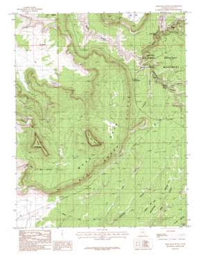
Moss Back Butte Topo Map Utah
To zoom in, hover over the map of Moss Back Butte
USGS Topo Quad 37110e1 - 1:24,000 scale
| Topo Map Name: | Moss Back Butte |
| USGS Topo Quad ID: | 37110e1 |
| Print Size: | ca. 21 1/4" wide x 27" high |
| Southeast Coordinates: | 37.5° N latitude / 110° W longitude |
| Map Center Coordinates: | 37.5625° N latitude / 110.0625° W longitude |
| U.S. State: | UT |
| Filename: | o37110e1.jpg |
| Download Map JPG Image: | Moss Back Butte topo map 1:24,000 scale |
| Map Type: | Topographic |
| Topo Series: | 7.5´ |
| Map Scale: | 1:24,000 |
| Source of Map Images: | United States Geological Survey (USGS) |
| Alternate Map Versions: |
White Canyon 4 SE UT 1954, updated 1954 Download PDF Buy paper map Moss Back Butte UT 1987, updated 1987 Download PDF Buy paper map Moss Back Butte UT 1987, updated 1987 Download PDF Buy paper map Moss Back Butte UT 1996, updated 2002 Download PDF Buy paper map Moss Back Butte UT 2011 Download PDF Buy paper map Moss Back Butte UT 2014 Download PDF Buy paper map |
1:24,000 Topo Quads surrounding Moss Back Butte
> Back to 37110e1 at 1:100,000 scale
> Back to 37110a1 at 1:250,000 scale
> Back to U.S. Topo Maps home
Moss Back Butte topo map: Gazetteer
Moss Back Butte: Arches
Indian Foot elevation 1802m 5912′Kachina Bridge elevation 1743m 5718′
Owachomo Bridge elevation 1882m 6174′
The Shoe elevation 1856m 6089′
Moss Back Butte: Bridges
Sipapu Bridge elevation 1837m 6026′Moss Back Butte: Parks
Natural Bridges National Monument elevation 1892m 6207′Natural Bridges National Monument Picnic Area elevation 1888m 6194′
Moss Back Butte: Pillars
Atomic Rock elevation 1832m 6010′Cathedral Rock elevation 1793m 5882′
Ruin Rock elevation 1812m 5944′
Moss Back Butte: Ridges
Dripping Point elevation 1855m 6085′Moss Back elevation 2015m 6610′
Moss Back Butte: Summits
Moss Back Butte elevation 2362m 7749′Tables of the Sun Hills elevation 2113m 6932′
The Needle elevation 1779m 5836′
The Windgate elevation 2256m 7401′
Moss Back Butte: Valleys
Armstrong Canyon elevation 1724m 5656′Cow Tank elevation 1730m 5675′
Deer Canyon elevation 1748m 5734′
To-ko-chi Canyon elevation 1766m 5793′
Tuwa Canyon elevation 1794m 5885′
Moss Back Butte digital topo map on disk
Buy this Moss Back Butte topo map showing relief, roads, GPS coordinates and other geographical features, as a high-resolution digital map file on DVD:


