Fivemile Valley Topo Map Utah
To zoom in, hover over the map of Fivemile Valley
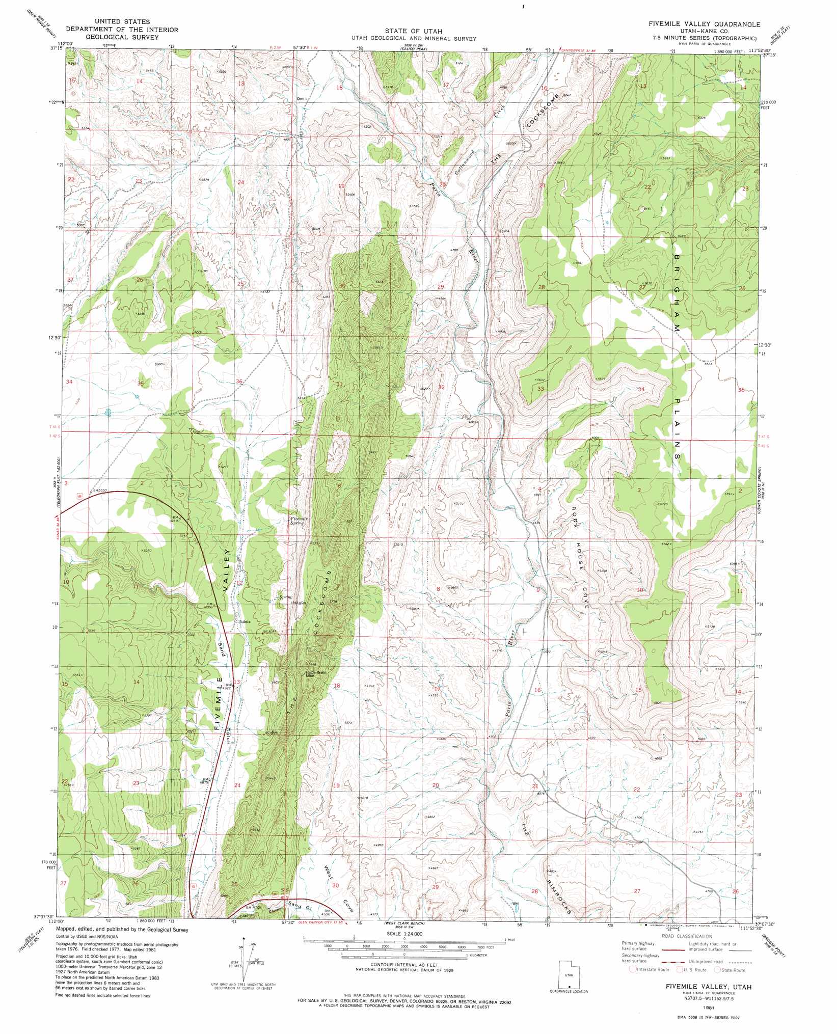
USGS Topo Quad 37111b8 - 1:24,000 scale
| Topo Map Name: | Fivemile Valley |
| USGS Topo Quad ID: | 37111b8 |
| Print Size: | ca. 21 1/4" wide x 27" high |
| Southeast Coordinates: | 37.125° N latitude / 111.875° W longitude |
| Map Center Coordinates: | 37.1875° N latitude / 111.9375° W longitude |
| U.S. State: | UT |
| Filename: | o37111b8.jpg |
| Download Map JPG Image: | Fivemile Valley topo map 1:24,000 scale |
| Map Type: | Topographic |
| Topo Series: | 7.5´ |
| Map Scale: | 1:24,000 |
| Source of Map Images: | United States Geological Survey (USGS) |
| Alternate Map Versions: |
Paria NW UT 1954, updated 1956 Download PDF Buy paper map Fivemile Valley UT 1981, updated 1981 Download PDF Buy paper map Fivemile Valley UT 1981, updated 1981 Download PDF Buy paper map Fivemile Valley UT 1981, updated 1981 Download PDF Buy paper map Fivemile Valley UT 2011 Download PDF Buy paper map Fivemile Valley UT 2014 Download PDF Buy paper map |
1:24,000 Topo Quads surrounding Fivemile Valley
Rainbow Point |
Bull Valley Gorge |
Slickrock Bench |
Butler Valley |
Horse Mountain |
Deer Spring Point |
Deer Range Point |
Calico Peak |
Horse Flat |
Fourmile Bench |
Nephi Point |
Eightmile Pass |
Fivemile Valley |
Lower Coyote Spring |
Nipple Butte |
Petrified Hollow |
Pine Hollow Canyon |
West Clark Bench |
Bridger Point |
Glen Canyon City |
Buck Pasture Canyon |
Coyote Buttes |
Poverty Flat |
Wrather Arch |
Water Pockets |
> Back to 37111a1 at 1:100,000 scale
> Back to 37110a1 at 1:250,000 scale
> Back to U.S. Topo Maps home
Fivemile Valley topo map: Gazetteer
Fivemile Valley: Flats
Brigham Plains elevation 1708m 5603′Fivemile Valley: Mines
Hattie Green Mine elevation 1651m 5416′Fivemile Valley: Populated Places
Paria elevation 1447m 4747′Fivemile Valley: Springs
Five Mile Spring elevation 1577m 5173′Fivemile Valley: Streams
Cottonwood Creek elevation 1422m 4665′Fivemile Valley: Valleys
Catstair Canyon elevation 1394m 4573′Rock House Cove elevation 1506m 4940′
Sand Gulch elevation 1506m 4940′
Fivemile Valley digital topo map on disk
Buy this Fivemile Valley topo map showing relief, roads, GPS coordinates and other geographical features, as a high-resolution digital map file on DVD: