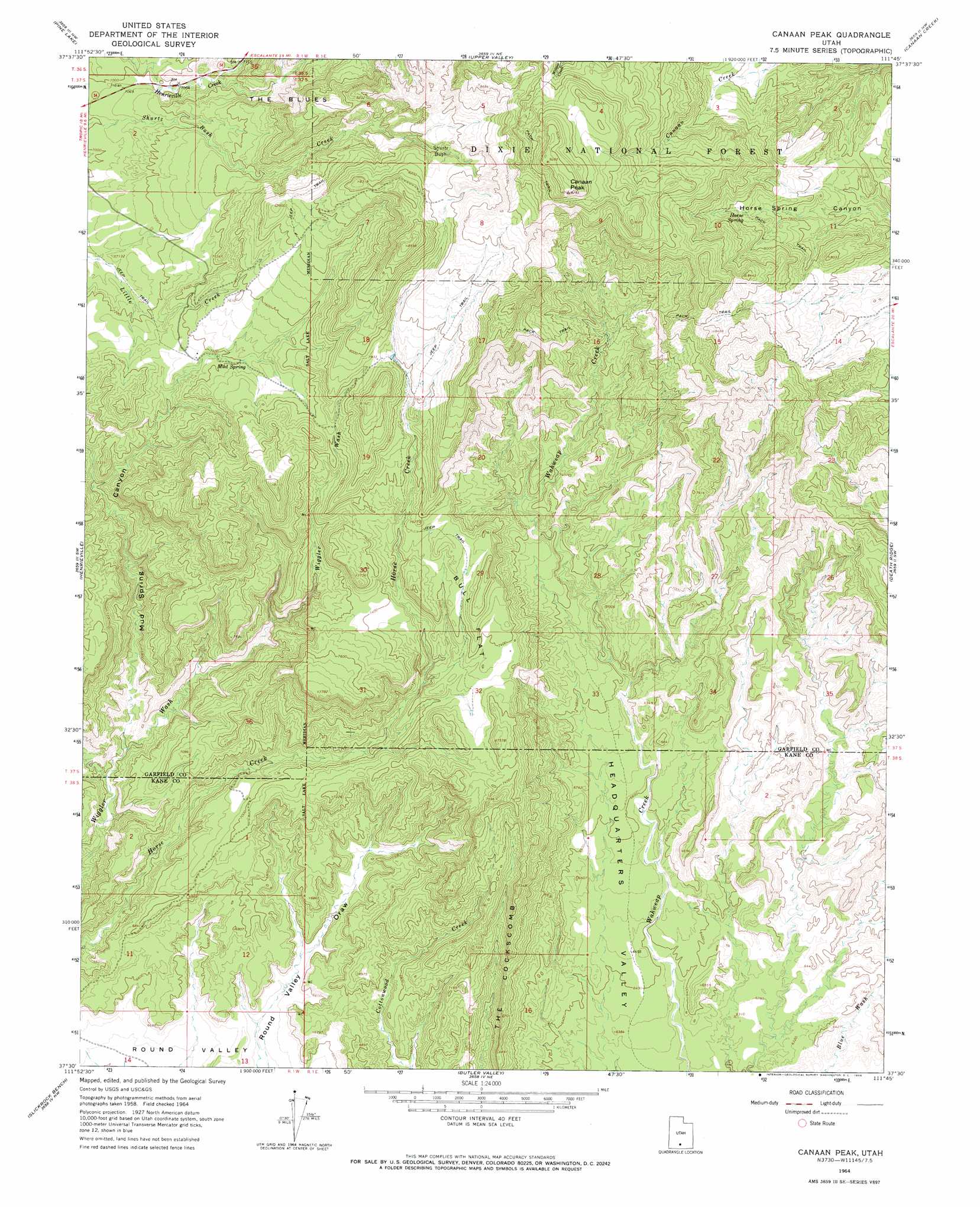
Canaan Peak Topo Map Utah
To zoom in, hover over the map of Canaan Peak
USGS Topo Quad 37111e7 - 1:24,000 scale
| Topo Map Name: | Canaan Peak |
| USGS Topo Quad ID: | 37111e7 |
| Print Size: | ca. 21 1/4" wide x 27" high |
| Southeast Coordinates: | 37.5° N latitude / 111.75° W longitude |
| Map Center Coordinates: | 37.5625° N latitude / 111.8125° W longitude |
| U.S. State: | UT |
| Filename: | o37111e7.jpg |
| Download Map JPG Image: | Canaan Peak topo map 1:24,000 scale |
| Map Type: | Topographic |
| Topo Series: | 7.5´ |
| Map Scale: | 1:24,000 |
| Source of Map Images: | United States Geological Survey (USGS) |
| Alternate Map Versions: |
Canaan Peak UT 1964, updated 1966 Download PDF Buy paper map Canaan Peak UT 2002, updated 2005 Download PDF Buy paper map Canaan Peak UT 2011 Download PDF Buy paper map Canaan Peak UT 2014 Download PDF Buy paper map |
| FStopo: | US Forest Service topo Canaan Peak is available: Download FStopo PDF Download FStopo TIF |
1:24,000 Topo Quads surrounding Canaan Peak
Flake Mountain East |
Sweetwater Creek |
Griffin Point |
Wide Hollow Reservoir |
Escalante |
Tropic Canyon |
Pine Lake |
Upper Valley |
Canaan Creek |
Dave Canyon |
Cannonville |
Henrieville |
Canaan Peak |
Death Ridge |
Carcass Canyon |
Bull Valley Gorge |
Slickrock Bench |
Butler Valley |
Horse Mountain |
Petes Cove |
Deer Range Point |
Calico Peak |
Horse Flat |
Fourmile Bench |
Ship Mountain Point |
> Back to 37111e1 at 1:100,000 scale
> Back to 37110a1 at 1:250,000 scale
> Back to U.S. Topo Maps home
Canaan Peak topo map: Gazetteer
Canaan Peak: Areas
Shurtz Bush elevation 2451m 8041′Canaan Peak: Flats
Bull Flat elevation 2342m 7683′Canaan Bottom elevation 2392m 7847′
Canaan Peak: Ridges
The Cockscomb elevation 2099m 6886′Canaan Peak: Springs
Horse Spring elevation 2416m 7926′Mud Spring elevation 2264m 7427′
Canaan Peak: Summits
Canaan Peak elevation 2794m 9166′Kaiparowitz Peak elevation 2439m 8001′
Canaan Peak: Valleys
Mud Spring Canyon elevation 2014m 6607′Canaan Peak digital topo map on disk
Buy this Canaan Peak topo map showing relief, roads, GPS coordinates and other geographical features, as a high-resolution digital map file on DVD: