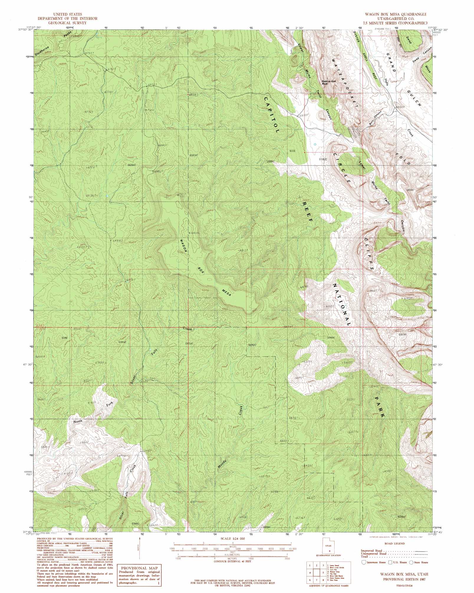
Wagon Box Mesa Topo Map Utah
To zoom in, hover over the map of Wagon Box Mesa
USGS Topo Quad 37111g1 - 1:24,000 scale
| Topo Map Name: | Wagon Box Mesa |
| USGS Topo Quad ID: | 37111g1 |
| Print Size: | ca. 21 1/4" wide x 27" high |
| Southeast Coordinates: | 37.75° N latitude / 111° W longitude |
| Map Center Coordinates: | 37.8125° N latitude / 111.0625° W longitude |
| U.S. State: | UT |
| Filename: | o37111g1.jpg |
| Download Map JPG Image: | Wagon Box Mesa topo map 1:24,000 scale |
| Map Type: | Topographic |
| Topo Series: | 7.5´ |
| Map Scale: | 1:24,000 |
| Source of Map Images: | United States Geological Survey (USGS) |
| Alternate Map Versions: |
Circle Cliffs 1 SE UT 1953, updated 1954 Download PDF Buy paper map Wagon Box Mesa UT 1987, updated 1987 Download PDF Buy paper map Wagon Box Mesa UT 1987, updated 1987 Download PDF Buy paper map Wagon Box Mesa UT 2011 Download PDF Buy paper map Wagon Box Mesa UT 2014 Download PDF Buy paper map |
1:24,000 Topo Quads surrounding Wagon Box Mesa
Lower Bowns Reservoir |
Bear Canyon |
Sandy Creek Benches |
Steele Butte |
Mount Ellen |
Steep Creek Bench |
Lamp Stand |
Bitter Creek Divide |
Cave Flat |
Mount Pennell |
King Bench |
Pioneer Mesa |
Wagon Box Mesa |
The Post |
Ant Knoll |
Red Breaks |
Silver Falls Bench |
Horse Pasture Mesa |
Deer Point |
Clay Point |
Sunset Flat |
Egypt |
Scorpion Gulch |
Stevens Canyon North |
Hall Mesa |
> Back to 37111e1 at 1:100,000 scale
> Back to 37110a1 at 1:250,000 scale
> Back to U.S. Topo Maps home
Wagon Box Mesa topo map: Gazetteer
Wagon Box Mesa: Summits
Peak-a-boo Rock elevation 1918m 6292′Studhorse Peaks elevation 2140m 7020′
Wagon Box Mesa elevation 2209m 7247′
Wagon Box Mesa: Valleys
Burr Canyon elevation 1513m 4963′Creek Canyon elevation 1506m 4940′
Swap Canyon elevation 1525m 5003′
Wagon Box Mesa digital topo map on disk
Buy this Wagon Box Mesa topo map showing relief, roads, GPS coordinates and other geographical features, as a high-resolution digital map file on DVD: