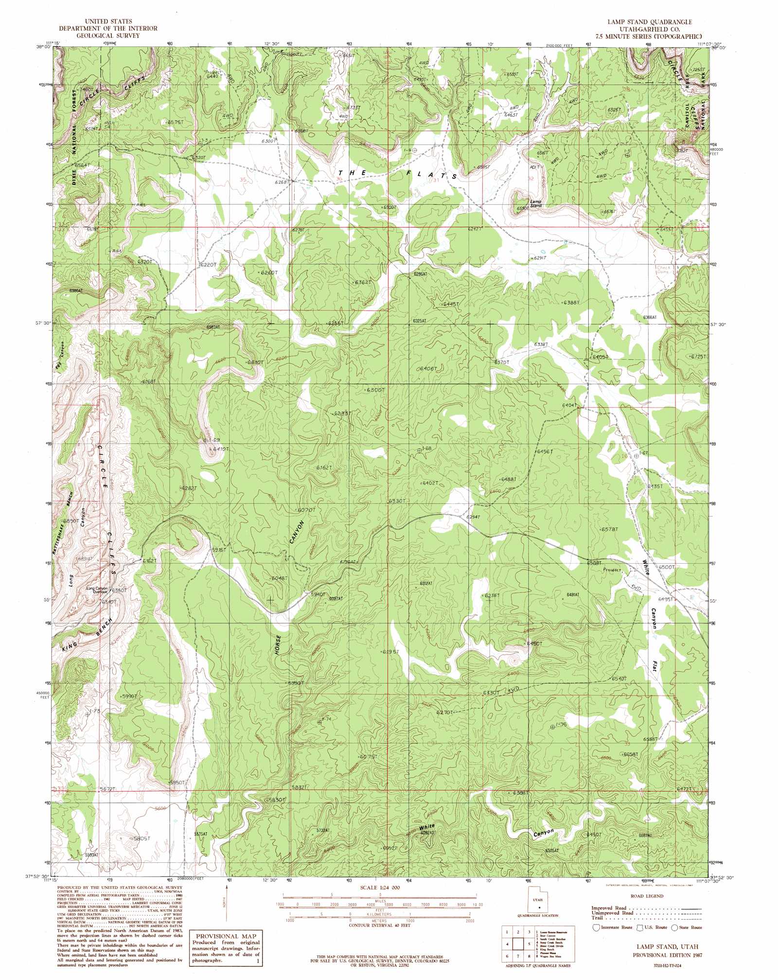
Lamp Stand Topo Map Utah
To zoom in, hover over the map of Lamp Stand
USGS Topo Quad 37111h2 - 1:24,000 scale
| Topo Map Name: | Lamp Stand |
| USGS Topo Quad ID: | 37111h2 |
| Print Size: | ca. 21 1/4" wide x 27" high |
| Southeast Coordinates: | 37.875° N latitude / 111.125° W longitude |
| Map Center Coordinates: | 37.9375° N latitude / 111.1875° W longitude |
| U.S. State: | UT |
| Filename: | o37111h2.jpg |
| Download Map JPG Image: | Lamp Stand topo map 1:24,000 scale |
| Map Type: | Topographic |
| Topo Series: | 7.5´ |
| Map Scale: | 1:24,000 |
| Source of Map Images: | United States Geological Survey (USGS) |
| Alternate Map Versions: |
Circle Cliffs 1 NW UT 1953, updated 1954 Download PDF Buy paper map Lamp Stand UT 1987, updated 1987 Download PDF Buy paper map Lamp Stand UT 1987, updated 1987 Download PDF Buy paper map Lamp Stand UT 2002, updated 2005 Download PDF Buy paper map Lamp Stand UT 2011 Download PDF Buy paper map Lamp Stand UT 2014 Download PDF Buy paper map |
| FStopo: | US Forest Service topo Lamp Stand is available: Download FStopo PDF Download FStopo TIF |
1:24,000 Topo Quads surrounding Lamp Stand
Blind Lake |
Grover |
Golden Throne |
Notom |
Stevens Mesa |
Deer Creek Lake |
Lower Bowns Reservoir |
Bear Canyon |
Sandy Creek Benches |
Steele Butte |
Boulder Town |
Steep Creek Bench |
Lamp Stand |
Bitter Creek Divide |
Cave Flat |
Calf Creek |
King Bench |
Pioneer Mesa |
Wagon Box Mesa |
The Post |
Tenmile Flat |
Red Breaks |
Silver Falls Bench |
Horse Pasture Mesa |
Deer Point |
> Back to 37111e1 at 1:100,000 scale
> Back to 37110a1 at 1:250,000 scale
> Back to U.S. Topo Maps home
Lamp Stand topo map: Gazetteer
Lamp Stand: Cliffs
Circle Cliffs elevation 2210m 7250′Lamp Stand: Flats
The Flats elevation 1904m 6246′White Canyon Flat elevation 1986m 6515′
Lamp Stand: Summits
Lamp Stand elevation 2002m 6568′Lamp Stand digital topo map on disk
Buy this Lamp Stand topo map showing relief, roads, GPS coordinates and other geographical features, as a high-resolution digital map file on DVD: