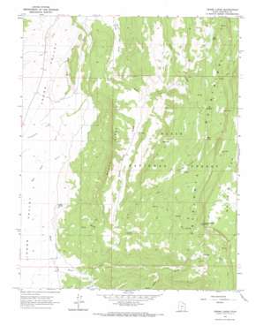
Grass Lakes Topo Map Utah
To zoom in, hover over the map of Grass Lakes
USGS Topo Quad 37111h8 - 1:24,000 scale
| Topo Map Name: | Grass Lakes |
| USGS Topo Quad ID: | 37111h8 |
| Print Size: | ca. 21 1/4" wide x 27" high |
| Southeast Coordinates: | 37.875° N latitude / 111.875° W longitude |
| Map Center Coordinates: | 37.9375° N latitude / 111.9375° W longitude |
| U.S. State: | UT |
| Filename: | o37111h8.jpg |
| Download Map JPG Image: | Grass Lakes topo map 1:24,000 scale |
| Map Type: | Topographic |
| Topo Series: | 7.5´ |
| Map Scale: | 1:24,000 |
| Source of Map Images: | United States Geological Survey (USGS) |
| Alternate Map Versions: |
Grass Lakes UT 1964, updated 1965 Download PDF Buy paper map Grass Lakes UT 2002, updated 2005 Download PDF Buy paper map Grass Lakes UT 2011 Download PDF Buy paper map Grass Lakes UT 2014 Download PDF Buy paper map |
| FStopo: | US Forest Service topo Grass Lakes is available: Download FStopo PDF Download FStopo TIF |
1:24,000 Topo Quads surrounding Grass Lakes
> Back to 37111e1 at 1:100,000 scale
> Back to 37110a1 at 1:250,000 scale
> Back to U.S. Topo Maps home
Grass Lakes topo map: Gazetteer
Grass Lakes: Cliffs
Mud Springs Point elevation 3274m 10741′Grass Lakes: Dams
Pacer Lake Reservoir Dam elevation 2768m 9081′Round Willow Bottom Dam elevation 3272m 10734′
Grass Lakes: Lakes
Bug Lake elevation 3156m 10354′Grass Lakes elevation 2922m 9586′
Mud Lake elevation 2812m 9225′
Otter Lake elevation 2962m 9717′
Pacer Lake elevation 2831m 9288′
Riddle Lake elevation 2517m 8257′
Trail Lake elevation 3011m 9878′
Twin Lakes elevation 2763m 9064′
Grass Lakes: Reservoirs
Pacer Lake elevation 2768m 9081′Robs Reservoir elevation 2917m 9570′
Round Willow Bottom Reservoir elevation 3272m 10734′
Grass Lakes: Ridges
Black Ridge elevation 2622m 8602′Grass Lakes: Springs
Cougar Spring elevation 2247m 7372′Mud Spring elevation 3273m 10738′
Grass Lakes: Streams
Birch Creek elevation 2237m 7339′Cottonwood Creek elevation 2193m 7194′
Cow Creek elevation 2141m 7024′
Horse Creek elevation 2219m 7280′
Ranch Creek elevation 2255m 7398′
Grass Lakes: Summits
Griffin Top elevation 3274m 10741′Grass Lakes: Valleys
North Creek Draw elevation 2439m 8001′Grass Lakes digital topo map on disk
Buy this Grass Lakes topo map showing relief, roads, GPS coordinates and other geographical features, as a high-resolution digital map file on DVD:


