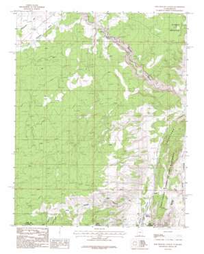
Pine Hollow Canyon Topo Map Utah
To zoom in, hover over the map of Pine Hollow Canyon
USGS Topo Quad 37112a1 - 1:24,000 scale
| Topo Map Name: | Pine Hollow Canyon |
| USGS Topo Quad ID: | 37112a1 |
| Print Size: | ca. 21 1/4" wide x 27" high |
| Southeast Coordinates: | 37° N latitude / 112° W longitude |
| Map Center Coordinates: | 37.0625° N latitude / 112.0625° W longitude |
| U.S. States: | UT, AZ |
| Filename: | o37112a1.jpg |
| Download Map JPG Image: | Pine Hollow Canyon topo map 1:24,000 scale |
| Map Type: | Topographic |
| Topo Series: | 7.5´ |
| Map Scale: | 1:24,000 |
| Source of Map Images: | United States Geological Survey (USGS) |
| Alternate Map Versions: |
Buckskin Gulch SE UT 1954 Download PDF Buy paper map Pine Hollow Canyon UT 1987, updated 1987 Download PDF Buy paper map Pine Hollow Canyon UT 1987, updated 1987 Download PDF Buy paper map Pine Hollow Canyon UT 2011 Download PDF Buy paper map Pine Hollow Canyon UT 2014 Download PDF Buy paper map |
1:24,000 Topo Quads surrounding Pine Hollow Canyon
> Back to 37112a1 at 1:100,000 scale
> Back to 37112a1 at 1:250,000 scale
> Back to U.S. Topo Maps home
Pine Hollow Canyon topo map: Gazetteer
Pine Hollow Canyon: Basins
Limestone Pothole elevation 1806m 5925′Pine Hollow Canyon: Gaps
Wire Pass elevation 1467m 4812′Pine Hollow Canyon: Ranges
Sand Hills elevation 1582m 5190′Pine Hollow Canyon: Streams
Coyote Wash elevation 1486m 4875′Pine Hollow Canyon: Summits
Cocks Comb elevation 1673m 5488′Pine Hollow Canyon: Valleys
Coyote Valley elevation 1486m 4875′Coyote Valley elevation 1486m 4875′
Coyote Wash elevation 1486m 4875′
Horse Canyon elevation 1876m 6154′
Maries Canyon elevation 1886m 6187′
Maries Canyon elevation 1888m 6194′
Pine Hollow Canyon elevation 1510m 4954′
Pine Hollow Canyon digital topo map on disk
Buy this Pine Hollow Canyon topo map showing relief, roads, GPS coordinates and other geographical features, as a high-resolution digital map file on DVD:


