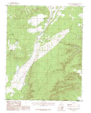
Yellowjacket Canyon Topo Map Utah
To zoom in, hover over the map of Yellowjacket Canyon
USGS Topo Quad 37112a6 - 1:24,000 scale
| Topo Map Name: | Yellowjacket Canyon |
| USGS Topo Quad ID: | 37112a6 |
| Print Size: | ca. 21 1/4" wide x 27" high |
| Southeast Coordinates: | 37° N latitude / 112.625° W longitude |
| Map Center Coordinates: | 37.0625° N latitude / 112.6875° W longitude |
| U.S. States: | UT, AZ |
| Filename: | o37112a6.jpg |
| Download Map JPG Image: | Yellowjacket Canyon topo map 1:24,000 scale |
| Map Type: | Topographic |
| Topo Series: | 7.5´ |
| Map Scale: | 1:24,000 |
| Source of Map Images: | United States Geological Survey (USGS) |
| Alternate Map Versions: |
Kanab SW UT 1954, updated 1956 Download PDF Buy paper map Yellowjacket Canyon UT 1985, updated 1985 Download PDF Buy paper map Yellowjacket Canyon UT 2011 Download PDF Buy paper map Yellowjacket Canyon UT 2014 Download PDF Buy paper map |
1:24,000 Topo Quads surrounding Yellowjacket Canyon
> Back to 37112a1 at 1:100,000 scale
> Back to 37112a1 at 1:250,000 scale
> Back to U.S. Topo Maps home
Yellowjacket Canyon topo map: Gazetteer
Yellowjacket Canyon: Capes
Ed Lamb Point elevation 2079m 6820′Yellowjacket Canyon: Parks
Coral Pink Sand Dunes State Reserve elevation 1805m 5921′Yellowjacket Picnic Site elevation 1899m 6230′
Yellowjacket Canyon: Ranges
Moquith Mountains elevation 2115m 6938′Yellowjacket Canyon: Springs
Chris Spring elevation 1804m 5918′Harris Springs elevation 1939m 6361′
Sand Spring elevation 1904m 6246′
Willow Spring elevation 1964m 6443′
Yellowjacket Spring elevation 1862m 6108′
Yellowjacket Canyon: Valleys
Cougar Canyon elevation 1598m 5242′South Fork Indian Canyon elevation 1713m 5620′
Water Canyon elevation 1681m 5515′
Yellowjacket Canyon digital topo map on disk
Buy this Yellowjacket Canyon topo map showing relief, roads, GPS coordinates and other geographical features, as a high-resolution digital map file on DVD:


