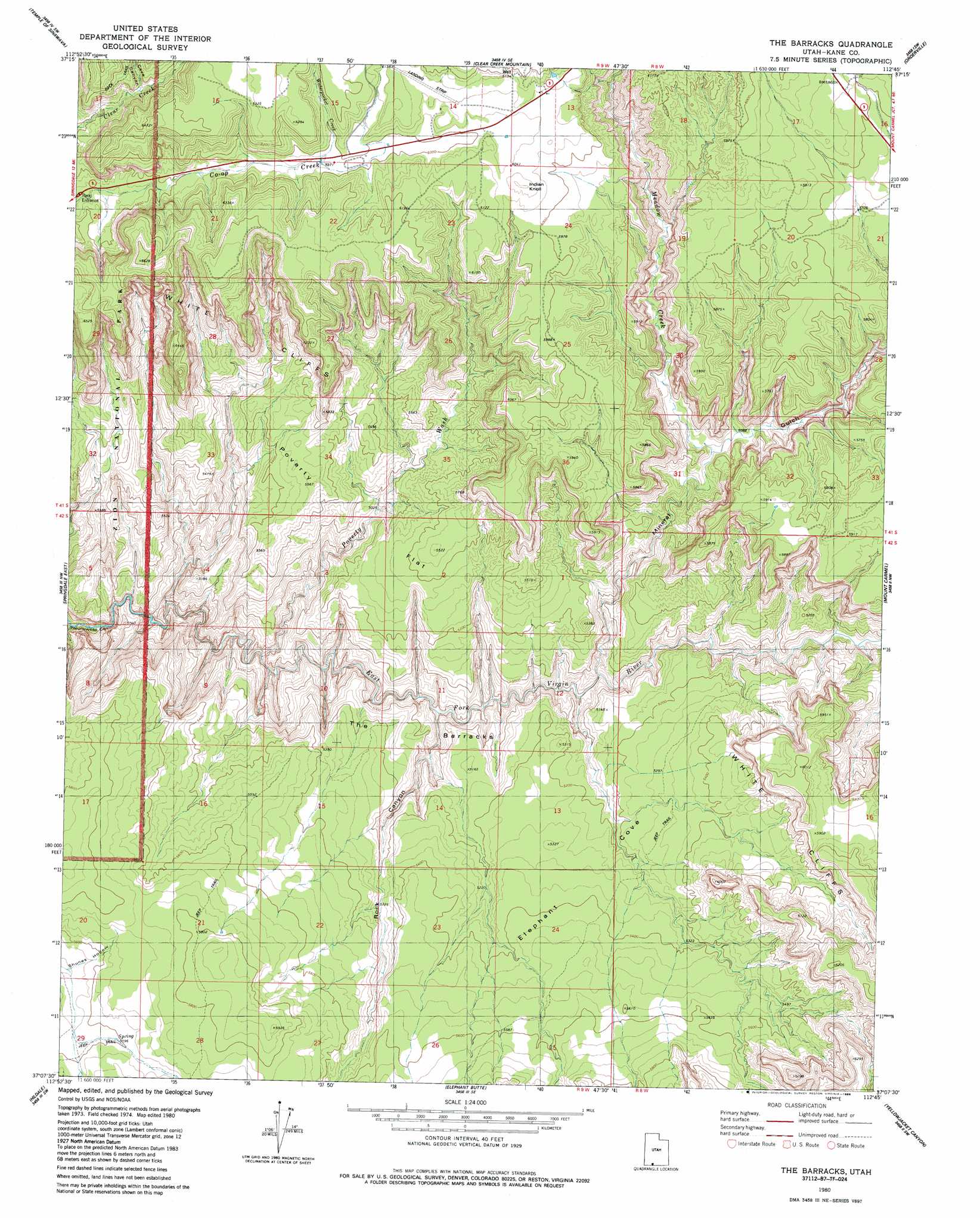
The Barracks Topo Map Utah
To zoom in, hover over the map of The Barracks
USGS Topo Quad 37112b7 - 1:24,000 scale
| Topo Map Name: | The Barracks |
| USGS Topo Quad ID: | 37112b7 |
| Print Size: | ca. 21 1/4" wide x 27" high |
| Southeast Coordinates: | 37.125° N latitude / 112.75° W longitude |
| Map Center Coordinates: | 37.1875° N latitude / 112.8125° W longitude |
| U.S. State: | UT |
| Filename: | o37112b7.jpg |
| Download Map JPG Image: | The Barracks topo map 1:24,000 scale |
| Map Type: | Topographic |
| Topo Series: | 7.5´ |
| Map Scale: | 1:24,000 |
| Source of Map Images: | United States Geological Survey (USGS) |
| Alternate Map Versions: |
Springdale NE UT 1956, updated 1956 Download PDF Buy paper map The Barracks UT 1980, updated 1980 Download PDF Buy paper map The Barracks UT 1980, updated 1985 Download PDF Buy paper map The Barracks UT 2010 Download PDF Buy paper map The Barracks UT 2014 Download PDF Buy paper map |
1:24,000 Topo Quads surrounding The Barracks
Kolob Reservoir |
Cogswell Point |
Straight Canyon |
Strawberry Point |
Long Valley Junction |
The Guardian Angels |
Temple Of Sinawava |
Clear Creek Mountain |
Orderville |
Glendale |
Springdale West |
Springdale East |
The Barracks |
Mount Carmel |
White Tower |
Smithsonian Butte |
Hildale |
Elephant Butte |
Yellowjacket Canyon |
Kanab |
Lost Spring Mountain East |
Colorado City |
Moccasin |
Kaibab |
Fredonia |
> Back to 37112a1 at 1:100,000 scale
> Back to 37112a1 at 1:250,000 scale
> Back to U.S. Topo Maps home
The Barracks topo map: Gazetteer
The Barracks: Basins
Elephant Cove elevation 1673m 5488′The Barracks: Flats
Poverty Flat elevation 1636m 5367′The Barracks: Streams
Meadow Creek elevation 1552m 5091′Waterpocket Creek elevation 1815m 5954′
The Barracks: Summits
Indian Knoll elevation 1859m 6099′The Barracks elevation 1545m 5068′
The Barracks: Valleys
Cave Canyon elevation 1792m 5879′Mineral Gulch elevation 1486m 4875′
Poverty Wash elevation 1443m 4734′
Rock Canyon elevation 1453m 4767′
The Barracks digital topo map on disk
Buy this The Barracks topo map showing relief, roads, GPS coordinates and other geographical features, as a high-resolution digital map file on DVD: