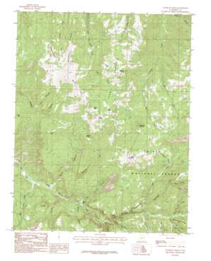
Flanigan Arch Topo Map Utah
To zoom in, hover over the map of Flanigan Arch
USGS Topo Quad 37112f8 - 1:24,000 scale
| Topo Map Name: | Flanigan Arch |
| USGS Topo Quad ID: | 37112f8 |
| Print Size: | ca. 21 1/4" wide x 27" high |
| Southeast Coordinates: | 37.625° N latitude / 112.875° W longitude |
| Map Center Coordinates: | 37.6875° N latitude / 112.9375° W longitude |
| U.S. State: | UT |
| Filename: | o37112f8.jpg |
| Download Map JPG Image: | Flanigan Arch topo map 1:24,000 scale |
| Map Type: | Topographic |
| Topo Series: | 7.5´ |
| Map Scale: | 1:24,000 |
| Source of Map Images: | United States Geological Survey (USGS) |
| Alternate Map Versions: |
Flanigan Arch UT 1985, updated 1985 Download PDF Buy paper map Flanigan Arch UT 2002, updated 2005 Download PDF Buy paper map Flanigan Arch UT 2011 Download PDF Buy paper map Flanigan Arch UT 2014 Download PDF Buy paper map |
| FStopo: | US Forest Service topo Flanigan Arch is available: Download FStopo PDF Download FStopo TIF |
1:24,000 Topo Quads surrounding Flanigan Arch
> Back to 37112e1 at 1:100,000 scale
> Back to 37112a1 at 1:250,000 scale
> Back to U.S. Topo Maps home
Flanigan Arch topo map: Gazetteer
Flanigan Arch: Arches
Flanigan Arch elevation 2344m 7690′Flanigan Arch: Flats
Martins Flat elevation 2107m 6912′Stud Flat elevation 2692m 8832′
Third House Flat elevation 2883m 9458′
Flanigan Arch: Lakes
First Lake elevation 2870m 9416′Toms Lake elevation 2799m 9183′
Flanigan Arch: Mines
Cluff Mine elevation 2185m 7168′MacFarlane Mine elevation 2193m 7194′
Flanigan Arch: Ridges
Middle Ridge elevation 2655m 8710′Windy Ridge elevation 2821m 9255′
Flanigan Arch: Springs
Bluebell Spring elevation 2647m 8684′Eagle Spring elevation 2983m 9786′
Grouse Spring elevation 2708m 8884′
Flanigan Arch: Streams
Ashdown Creek elevation 2162m 7093′Brown Creek elevation 2392m 7847′
Crow Creek elevation 2158m 7080′
Lake Creek elevation 2409m 7903′
Maple Canyon Creek elevation 2012m 6601′
Pickering Creek elevation 2159m 7083′
Rattlesnake Creek elevation 2355m 7726′
Red Creek elevation 2522m 8274′
Right Hand Creek elevation 1975m 6479′
Shooting Star Creek elevation 2370m 7775′
Spring Creek elevation 2390m 7841′
Flanigan Arch: Summits
Avavick Knoll elevation 2907m 9537′Big Hill elevation 2427m 7962′
Cedar Mountain elevation 2406m 7893′
Dairy Hill elevation 2799m 9183′
Eagle Peak elevation 3015m 9891′
High Mountain elevation 3016m 9895′
Jones Hill elevation 2739m 8986′
Sugarloaf Mountain elevation 3038m 9967′
Summit Mountain elevation 2825m 9268′
Flanigan Arch: Trails
Rattlesnake Creek Trail elevation 2736m 8976′Flanigan Arch: Valleys
Calf Hollow elevation 2358m 7736′Deep Canyon elevation 2537m 8323′
Den Hollow elevation 2397m 7864′
Ellies Canyon elevation 2045m 6709′
Hells Canyon elevation 2303m 7555′
Last Chance Canyon elevation 2097m 6879′
Long Hollow elevation 2190m 7185′
Maple Canyon elevation 2016m 6614′
Potato Hollow elevation 2350m 7709′
Tri Story Canyon elevation 2498m 8195′
Webb Canyon elevation 2225m 7299′
Whiskey Hollow elevation 2514m 8248′
Flanigan Arch digital topo map on disk
Buy this Flanigan Arch topo map showing relief, roads, GPS coordinates and other geographical features, as a high-resolution digital map file on DVD:


