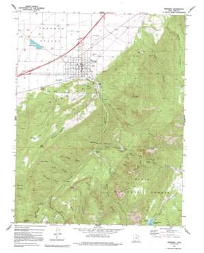
Parowan Topo Map Utah
To zoom in, hover over the map of Parowan
USGS Topo Quad 37112g7 - 1:24,000 scale
| Topo Map Name: | Parowan |
| USGS Topo Quad ID: | 37112g7 |
| Print Size: | ca. 21 1/4" wide x 27" high |
| Southeast Coordinates: | 37.75° N latitude / 112.75° W longitude |
| Map Center Coordinates: | 37.8125° N latitude / 112.8125° W longitude |
| U.S. State: | UT |
| Filename: | o37112g7.jpg |
| Download Map JPG Image: | Parowan topo map 1:24,000 scale |
| Map Type: | Topographic |
| Topo Series: | 7.5´ |
| Map Scale: | 1:24,000 |
| Source of Map Images: | United States Geological Survey (USGS) |
| Alternate Map Versions: |
Parowan UT 1971, updated 1975 Download PDF Buy paper map Parowan UT 1971, updated 1992 Download PDF Buy paper map Parowan UT 2002, updated 2005 Download PDF Buy paper map Parowan UT 2011 Download PDF Buy paper map Parowan UT 2014 Download PDF Buy paper map |
| FStopo: | US Forest Service topo Parowan is available: Download FStopo PDF Download FStopo TIF |
1:24,000 Topo Quads surrounding Parowan
> Back to 37112e1 at 1:100,000 scale
> Back to 37112a1 at 1:250,000 scale
> Back to U.S. Topo Maps home
Parowan topo map: Gazetteer
Parowan: Airports
Parowan Airport elevation 1798m 5898′Parowan: Basins
Grass Valley elevation 1939m 6361′Parowan: Dams
Yankee Meadows Dam elevation 2638m 8654′Parowan: Flats
Yankee Meadows elevation 2640m 8661′Parowan: Lakes
The Forebay elevation 2013m 6604′Parowan: Pillars
Grand Castle elevation 2588m 8490′Vermillion Castle elevation 2042m 6699′
Parowan: Populated Places
Parowan elevation 1834m 6017′Parowan: Post Offices
Parowan Post Office elevation 1832m 6010′Parowan: Reservoirs
Yankee Meadows Reservoir elevation 2638m 8654′Parowan: Springs
Mahogany Seep elevation 2328m 7637′Maple Spring elevation 2347m 7700′
Sixmile Spring elevation 2218m 7276′
Sols Spring elevation 1980m 6496′
Parowan: Streams
Benson Creek elevation 2166m 7106′Bowery Creek elevation 2028m 6653′
Center Creek elevation 2045m 6709′
Dry Lakes Creek elevation 2278m 7473′
Parowan: Summits
First Mound elevation 1841m 6040′Henderson Hill elevation 2636m 8648′
Hole in the Rock elevation 2623m 8605′
Noahs Ark elevation 2615m 8579′
P Hill elevation 2028m 6653′
Valentine Peak elevation 2454m 8051′
White Hill elevation 2722m 8930′
Parowan: Valleys
Alum Cove elevation 2168m 7112′Billy West Canyon elevation 2195m 7201′
Dry Canyon elevation 1902m 6240′
First Left Hand Canyon elevation 2012m 6601′
Free Thought Canyon elevation 2085m 6840′
Hyatt Canyon elevation 2143m 7030′
Maple Spring Hollow elevation 1912m 6272′
Moseman Canyon elevation 2267m 7437′
Order Canyon elevation 1883m 6177′
Parowan Canyon elevation 1862m 6108′
Second Left Hand Canyon elevation 2034m 6673′
Water Canyon elevation 1942m 6371′
Parowan digital topo map on disk
Buy this Parowan topo map showing relief, roads, GPS coordinates and other geographical features, as a high-resolution digital map file on DVD:


