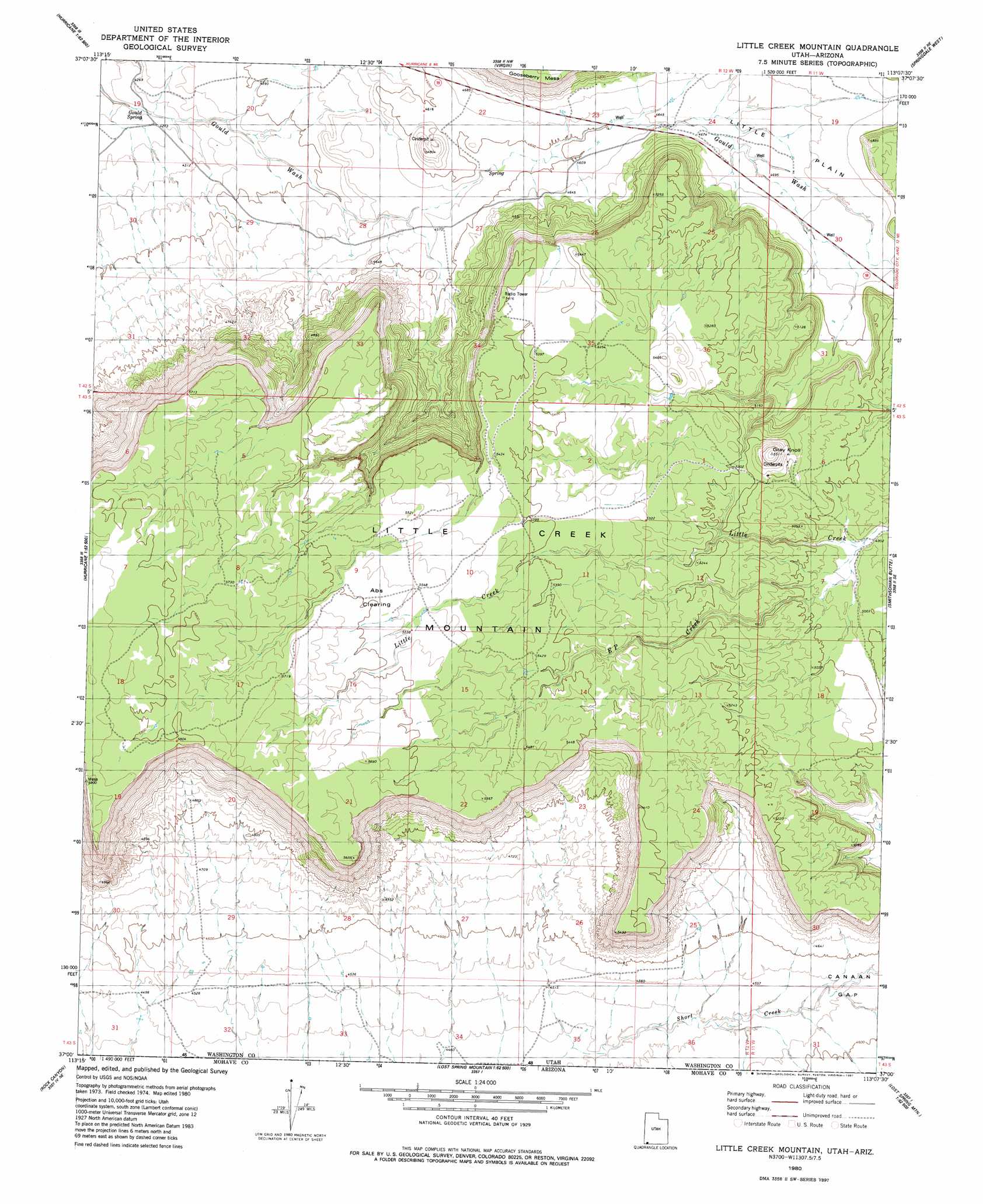
Little Creek Mountain Topo Map Utah
To zoom in, hover over the map of Little Creek Mountain
USGS Topo Quad 37113a2 - 1:24,000 scale
| Topo Map Name: | Little Creek Mountain |
| USGS Topo Quad ID: | 37113a2 |
| Print Size: | ca. 21 1/4" wide x 27" high |
| Southeast Coordinates: | 37° N latitude / 113.125° W longitude |
| Map Center Coordinates: | 37.0625° N latitude / 113.1875° W longitude |
| U.S. State: | UT |
| Filename: | o37113a2.jpg |
| Download Map JPG Image: | Little Creek Mountain topo map 1:24,000 scale |
| Map Type: | Topographic |
| Topo Series: | 7.5´ |
| Map Scale: | 1:24,000 |
| Source of Map Images: | United States Geological Survey (USGS) |
| Alternate Map Versions: |
La Verkin 4 SW UT 1954, updated 1956 Download PDF Buy paper map Little Creek Mountain UT 1980, updated 1981 Download PDF Buy paper map Little Creek Mountain UT 2011 Download PDF Buy paper map Little Creek Mountain UT 2014 Download PDF Buy paper map |
1:24,000 Topo Quads surrounding Little Creek Mountain
Signal Peak |
Pintura |
Smith Mesa |
The Guardian Angels |
Temple Of Sinawava |
Harrisburg Junction |
Hurricane |
Virgin |
Springdale West |
Springdale East |
Washington Dome |
The Divide |
Little Creek Mountain |
Smithsonian Butte |
Hildale |
Yellowhorse Flat |
Rock Canyon |
Lost Spring Mountain West |
Lost Spring Mountain East |
Colorado City |
Hole-N-Wall Canyon |
Gyp Pocket |
White Pockets |
Formaster Well |
Maroney Well |
> Back to 37113a1 at 1:100,000 scale
> Back to 37112a1 at 1:250,000 scale
> Back to U.S. Topo Maps home
Little Creek Mountain topo map: Gazetteer
Little Creek Mountain: Flats
Abs Clearing elevation 1699m 5574′Little Plain elevation 1419m 4655′
Little Creek Mountain: Springs
Gould Spring elevation 1290m 4232′Little Creek Mountain: Streams
E P Creek elevation 1498m 4914′Little Creek Mountain: Summits
Gray Knoll elevation 1677m 5501′Little Creek Mountain digital topo map on disk
Buy this Little Creek Mountain topo map showing relief, roads, GPS coordinates and other geographical features, as a high-resolution digital map file on DVD: