The Divide Topo Map Utah
To zoom in, hover over the map of The Divide
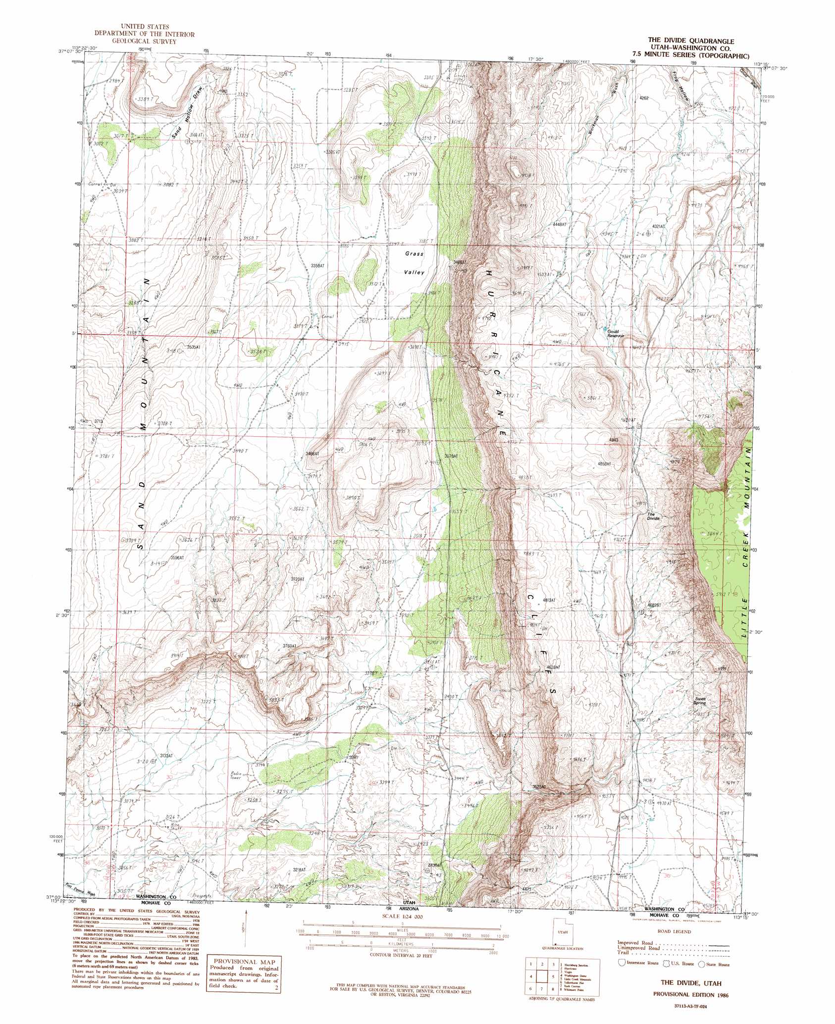
USGS Topo Quad 37113a3 - 1:24,000 scale
| Topo Map Name: | The Divide |
| USGS Topo Quad ID: | 37113a3 |
| Print Size: | ca. 21 1/4" wide x 27" high |
| Southeast Coordinates: | 37° N latitude / 113.25° W longitude |
| Map Center Coordinates: | 37.0625° N latitude / 113.3125° W longitude |
| U.S. State: | UT |
| Filename: | o37113a3.jpg |
| Download Map JPG Image: | The Divide topo map 1:24,000 scale |
| Map Type: | Topographic |
| Topo Series: | 7.5´ |
| Map Scale: | 1:24,000 |
| Source of Map Images: | United States Geological Survey (USGS) |
| Alternate Map Versions: |
La Verkin 3 SE UT 1954, updated 1956 Download PDF Buy paper map The Divide UT 1986, updated 1987 Download PDF Buy paper map The Divide UT 2011 Download PDF Buy paper map The Divide UT 2014 Download PDF Buy paper map |
1:24,000 Topo Quads surrounding The Divide
Saddle Mountain |
Signal Peak |
Pintura |
Smith Mesa |
The Guardian Angels |
Washington |
Harrisburg Junction |
Hurricane |
Virgin |
Springdale West |
Saint George |
Washington Dome |
The Divide |
Little Creek Mountain |
Smithsonian Butte |
Lizard Point |
Yellowhorse Flat |
Rock Canyon |
Lost Spring Mountain West |
Lost Spring Mountain East |
Wolf Hole Mountain East |
Hole-N-Wall Canyon |
Gyp Pocket |
White Pockets |
Formaster Well |
> Back to 37113a1 at 1:100,000 scale
> Back to 37112a1 at 1:250,000 scale
> Back to U.S. Topo Maps home
The Divide topo map: Gazetteer
The Divide: Basins
Sand Hollow Draw elevation 972m 3188′The Divide: Dams
Frog Hollow Debris Basin Dam elevation 1279m 4196′The Divide: Reservoirs
Frog Hollow Debris Basin Reservoir elevation 1279m 4196′Gould Reservoir elevation 1363m 4471′
The Divide: Ridges
The Divide elevation 1513m 4963′The Divide: Springs
Sweet Spring elevation 1415m 4642′The Divide: Summits
Little Creek Mountain elevation 1786m 5859′The Divide: Valleys
Grass Valley elevation 1023m 3356′The Divide digital topo map on disk
Buy this The Divide topo map showing relief, roads, GPS coordinates and other geographical features, as a high-resolution digital map file on DVD: