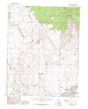
Washington Topo Map Utah
To zoom in, hover over the map of Washington
USGS Topo Quad 37113b5 - 1:24,000 scale
| Topo Map Name: | Washington |
| USGS Topo Quad ID: | 37113b5 |
| Print Size: | ca. 21 1/4" wide x 27" high |
| Southeast Coordinates: | 37.125° N latitude / 113.5° W longitude |
| Map Center Coordinates: | 37.1875° N latitude / 113.5625° W longitude |
| U.S. State: | UT |
| Filename: | o37113b5.jpg |
| Download Map JPG Image: | Washington topo map 1:24,000 scale |
| Map Type: | Topographic |
| Topo Series: | 7.5´ |
| Map Scale: | 1:24,000 |
| Source of Map Images: | United States Geological Survey (USGS) |
| Alternate Map Versions: |
St. George NE UT 1956, updated 1956 Download PDF Buy paper map Washington UT 1986, updated 1987 Download PDF Buy paper map Washington UT 2011 Download PDF Buy paper map Washington UT 2014 Download PDF Buy paper map |
| FStopo: | US Forest Service topo Washington is available: Download FStopo PDF Download FStopo TIF |
1:24,000 Topo Quads surrounding Washington
> Back to 37113a1 at 1:100,000 scale
> Back to 37112a1 at 1:250,000 scale
> Back to U.S. Topo Maps home
Washington topo map: Gazetteer
Washington: Benches
Cedar Bench elevation 1550m 5085′Washington: Dams
Sait George City Dam elevation 1062m 3484′Santa Clara Dam elevation 974m 3195′
Washington: Flats
Big Sand elevation 1152m 3779′Washington Flat elevation 1539m 5049′
Washington: Parks
Redlands RV Parks elevation 856m 2808′Washington: Populated Places
Washington elevation 851m 2791′Washington: Post Offices
Washington Post Office elevation 847m 2778′Washington: Reservoirs
Black Knolls Reservoir elevation 1062m 3484′Santa Clara Reservoir elevation 974m 3195′
Washington: Ridges
Lava Ridge elevation 1463m 4799′Middleton Black Ridge elevation 951m 3120′
Washington: Springs
Gray Spring elevation 905m 2969′Green Spring elevation 884m 2900′
Miller Spring elevation 915m 3001′
West Saint George Spring elevation 902m 2959′
Washington: Summits
Black Knolls elevation 1031m 3382′T-Bone Hill elevation 1058m 3471′
Twin Peaks elevation 1610m 5282′
Yellow Knolls elevation 1287m 4222′
Washington: Valleys
Alger Hollow elevation 1379m 4524′Black Gulch elevation 1110m 3641′
Buckskin Hollow elevation 994m 3261′
East Valley elevation 1097m 3599′
Spring Hollow elevation 1515m 4970′
Twist Hollow elevation 955m 3133′
Washington Hollow elevation 987m 3238′
Washington digital topo map on disk
Buy this Washington topo map showing relief, roads, GPS coordinates and other geographical features, as a high-resolution digital map file on DVD:


