Pintura Topo Map Utah
To zoom in, hover over the map of Pintura
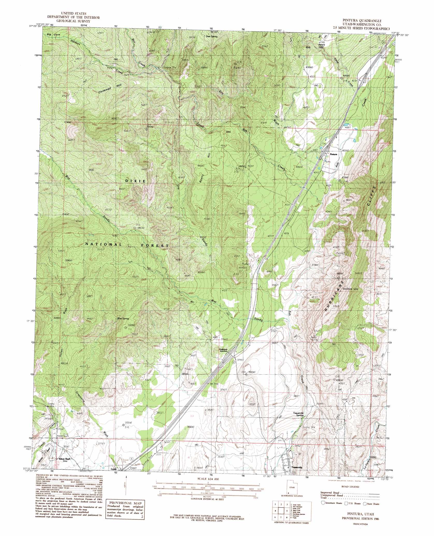
USGS Topo Quad 37113c3 - 1:24,000 scale
| Topo Map Name: | Pintura |
| USGS Topo Quad ID: | 37113c3 |
| Print Size: | ca. 21 1/4" wide x 27" high |
| Southeast Coordinates: | 37.25° N latitude / 113.25° W longitude |
| Map Center Coordinates: | 37.3125° N latitude / 113.3125° W longitude |
| U.S. State: | UT |
| Filename: | o37113c3.jpg |
| Download Map JPG Image: | Pintura topo map 1:24,000 scale |
| Map Type: | Topographic |
| Topo Series: | 7.5´ |
| Map Scale: | 1:24,000 |
| Source of Map Images: | United States Geological Survey (USGS) |
| Alternate Map Versions: |
La Verkin 2 SE UT 1954, updated 1956 Download PDF Buy paper map Pintura UT 1986, updated 1987 Download PDF Buy paper map Pintura UT 2002, updated 2005 Download PDF Buy paper map Pintura UT 2011 Download PDF Buy paper map Pintura UT 2014 Download PDF Buy paper map |
| FStopo: | US Forest Service topo Pintura is available: Download FStopo PDF Download FStopo TIF |
1:24,000 Topo Quads surrounding Pintura
Pinto |
Page Ranch |
Stoddard Mountain |
Kanarraville |
Cedar Mountain |
Central East |
Grass Valley |
New Harmony |
Kolob Arch |
Kolob Reservoir |
Saddle Mountain |
Signal Peak |
Pintura |
Smith Mesa |
The Guardian Angels |
Washington |
Harrisburg Junction |
Hurricane |
Virgin |
Springdale West |
Saint George |
Washington Dome |
The Divide |
Little Creek Mountain |
Smithsonian Butte |
> Back to 37113a1 at 1:100,000 scale
> Back to 37112a1 at 1:250,000 scale
> Back to U.S. Topo Maps home
Pintura topo map: Gazetteer
Pintura: Bends
Peters Leap elevation 1446m 4744′Pintura: Flats
Sandy Flat elevation 1145m 3756′Pintura: Populated Places
Anderson Junction elevation 1171m 3841′Pintura elevation 1247m 4091′
Silver Reef elevation 1157m 3795′
Toquerville elevation 1033m 3389′
Pintura: Post Offices
Toquerville Post Office elevation 1029m 3375′Pintura: Springs
Blue Spring elevation 1392m 4566′Deer Spring elevation 1777m 5830′
Toquerville Springs elevation 1051m 3448′
Pintura: Streams
Harmon Creek elevation 1618m 5308′Leap Creek elevation 1268m 4160′
Mill Creek elevation 1618m 5308′
South Ash Creek elevation 1218m 3996′
Pintura: Summits
Beatty Hill elevation 1478m 4849′Chimney Hill elevation 1879m 6164′
Pintura: Trails
Blake Harmon Trail elevation 2037m 6683′Dry Sandy Trail elevation 1217m 3992′
Wet Sandy Trail elevation 1709m 5606′
Pintura: Valleys
Dry Sandy elevation 1122m 3681′Dry Wash elevation 1217m 3992′
Italian Wash elevation 1183m 3881′
Pintura digital topo map on disk
Buy this Pintura topo map showing relief, roads, GPS coordinates and other geographical features, as a high-resolution digital map file on DVD: