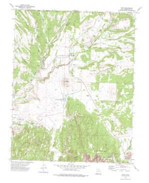
Veyo Topo Map Utah
To zoom in, hover over the map of Veyo
USGS Topo Quad 37113c6 - 1:24,000 scale
| Topo Map Name: | Veyo |
| USGS Topo Quad ID: | 37113c6 |
| Print Size: | ca. 21 1/4" wide x 27" high |
| Southeast Coordinates: | 37.25° N latitude / 113.625° W longitude |
| Map Center Coordinates: | 37.3125° N latitude / 113.6875° W longitude |
| U.S. State: | UT |
| Filename: | o37113c6.jpg |
| Download Map JPG Image: | Veyo topo map 1:24,000 scale |
| Map Type: | Topographic |
| Topo Series: | 7.5´ |
| Map Scale: | 1:24,000 |
| Source of Map Images: | United States Geological Survey (USGS) |
| Alternate Map Versions: |
Veyo UT 1972, updated 1976 Download PDF Buy paper map Veyo UT 1972, updated 1983 Download PDF Buy paper map Veyo UT 2002, updated 2005 Download PDF Buy paper map Veyo UT 2011 Download PDF Buy paper map Veyo UT 2014 Download PDF Buy paper map |
| FStopo: | US Forest Service topo Veyo is available: Download FStopo PDF Download FStopo TIF |
1:24,000 Topo Quads surrounding Veyo
> Back to 37113a1 at 1:100,000 scale
> Back to 37112a1 at 1:250,000 scale
> Back to U.S. Topo Maps home
Veyo topo map: Gazetteer
Veyo: Dams
Lower Sand Cove Dam elevation 1244m 4081′Upper Sand Cove Dam elevation 1379m 4524′
Veyo: Parks
Snow Canyon State Park elevation 1394m 4573′Veyo: Populated Places
Dammeron Valley elevation 1402m 4599′Veyo elevation 1362m 4468′
Veyo: Reservoirs
Lower Sand Cove Reservoir elevation 1244m 4081′Upper Sand Cove Reservoir elevation 1379m 4524′
Veyo: Ridges
Long Ridge elevation 1385m 4543′Veyo: Streams
Magotsu Creek elevation 1177m 3861′Veyo: Summits
Veyo Volcano elevation 1592m 5223′Veyo: Valleys
Cedar Spring Wash elevation 1378m 4520′Cottonwood Wash elevation 1195m 3920′
Cove Wash elevation 1278m 4192′
Granite Wash elevation 1379m 4524′
Manera Wash elevation 1216m 3989′
Moody Wash elevation 1172m 3845′
The Gulch elevation 1245m 4084′
Tobin Wash elevation 1135m 3723′
Wide Canyon elevation 1395m 4576′
Veyo digital topo map on disk
Buy this Veyo topo map showing relief, roads, GPS coordinates and other geographical features, as a high-resolution digital map file on DVD:


