Motoqua Topo Map Utah
To zoom in, hover over the map of Motoqua
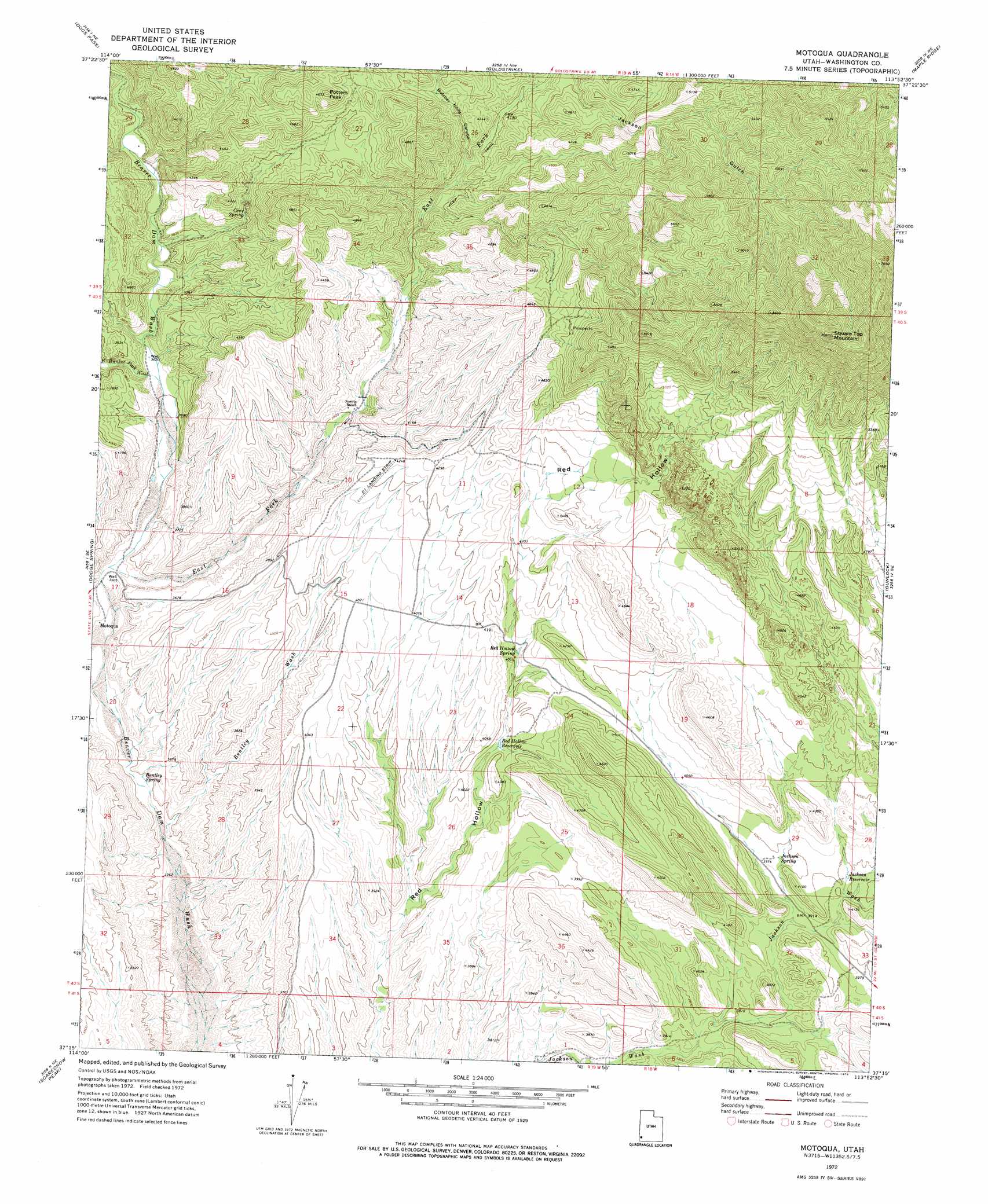
USGS Topo Quad 37113c8 - 1:24,000 scale
| Topo Map Name: | Motoqua |
| USGS Topo Quad ID: | 37113c8 |
| Print Size: | ca. 21 1/4" wide x 27" high |
| Southeast Coordinates: | 37.25° N latitude / 113.875° W longitude |
| Map Center Coordinates: | 37.3125° N latitude / 113.9375° W longitude |
| U.S. State: | UT |
| Filename: | o37113c8.jpg |
| Download Map JPG Image: | Motoqua topo map 1:24,000 scale |
| Map Type: | Topographic |
| Topo Series: | 7.5´ |
| Map Scale: | 1:24,000 |
| Source of Map Images: | United States Geological Survey (USGS) |
| Alternate Map Versions: |
Motoqua UT 1972, updated 1976 Download PDF Buy paper map Motoqua UT 2011 Download PDF Buy paper map Motoqua UT 2014 Download PDF Buy paper map |
1:24,000 Topo Quads surrounding Motoqua
Acoma |
Pine Park |
Water Canyon Peak |
Hebron |
Enterprise |
Bunker Peak |
Docs Pass |
Goldstrike |
Maple Ridge |
Central West |
Jacks Mountain |
Dodge Spring |
Motoqua |
Gunlock |
Veyo |
Lime Mountain |
Scarecrow Peak |
West Mountain Peak |
Shivwits |
Santa Clara |
Tule Spring |
Terry Benches |
Castle Cliff |
Jarvis Peak |
White Hills |
> Back to 37113a1 at 1:100,000 scale
> Back to 37112a1 at 1:250,000 scale
> Back to U.S. Topo Maps home
Motoqua topo map: Gazetteer
Motoqua: Populated Places
Motoqua elevation 1064m 3490′Motoqua: Ranges
Mormon Range elevation 1143m 3750′Motoqua: Reservoirs
Jackson Reservoir elevation 1207m 3959′Red Hollow Reservoir elevation 1203m 3946′
Motoqua: Springs
Bentley Spring elevation 1035m 3395′Cane Spring elevation 1211m 3973′
Jackson Spring elevation 1211m 3973′
Red Hollow Spring elevation 1232m 4041′
Motoqua: Streams
East Bunker Peak Wash elevation 1100m 3608′Motoqua: Summits
Potters Peak elevation 1479m 4852′Square Top Mountain elevation 2150m 7053′
Motoqua: Valleys
Bentley Wash elevation 1019m 3343′Butcher Knife Canyon elevation 1250m 4101′
East Bunker Peak Wash elevation 1100m 3608′
East Fork Beaver Dam Wash elevation 1076m 3530′
Horse Canyon elevation 1155m 3789′
Motoqua digital topo map on disk
Buy this Motoqua topo map showing relief, roads, GPS coordinates and other geographical features, as a high-resolution digital map file on DVD: