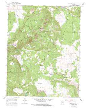
Cedar Mountain Topo Map Utah
To zoom in, hover over the map of Cedar Mountain
USGS Topo Quad 37113e1 - 1:24,000 scale
| Topo Map Name: | Cedar Mountain |
| USGS Topo Quad ID: | 37113e1 |
| Print Size: | ca. 21 1/4" wide x 27" high |
| Southeast Coordinates: | 37.5° N latitude / 113° W longitude |
| Map Center Coordinates: | 37.5625° N latitude / 113.0625° W longitude |
| U.S. State: | UT |
| Filename: | o37113e1.jpg |
| Download Map JPG Image: | Cedar Mountain topo map 1:24,000 scale |
| Map Type: | Topographic |
| Topo Series: | 7.5´ |
| Map Scale: | 1:24,000 |
| Source of Map Images: | United States Geological Survey (USGS) |
| Alternate Map Versions: |
Cedar Mountain UT 1950, updated 1974 Download PDF Buy paper map Cedar Mountain UT 1950, updated 1979 Download PDF Buy paper map Cedar Mountain UT 1952 Download PDF Buy paper map Cedar Mountain UT 2011 Download PDF Buy paper map Cedar Mountain UT 2014 Download PDF Buy paper map |
1:24,000 Topo Quads surrounding Cedar Mountain
> Back to 37113e1 at 1:100,000 scale
> Back to 37112a1 at 1:250,000 scale
> Back to U.S. Topo Maps home
Cedar Mountain topo map: Gazetteer
Cedar Mountain: Cliffs
Graff Point elevation 2738m 8982′Lee Point elevation 2530m 8300′
Cedar Mountain: Dams
Cedar City Corp Storage Dam elevation 2669m 8756′Cedar Mountain: Flats
Co-op Flat elevation 2811m 9222′Long Flat elevation 2815m 9235′
Oak Spring Flat elevation 2388m 7834′
Cedar Mountain: Mines
Tucker Coal Mine elevation 2460m 8070′Cedar Mountain: Reservoirs
Cedar City Corp Storage Reservoir elevation 2669m 8756′Cedar Mountain: Springs
Cooks Spring elevation 2789m 9150′Co-op Spring elevation 2846m 9337′
Day Spring elevation 2805m 9202′
Oak Spring elevation 2408m 7900′
Pine Spring elevation 2952m 9685′
Cedar Mountain: Streams
Hicks Creek elevation 1766m 5793′Reeves Creek elevation 2207m 7240′
Shiver Creek elevation 2559m 8395′
Cedar Mountain: Summits
Bean Hill elevation 2769m 9084′Co-op Knoll elevation 2975m 9760′
Kanarra Mountain elevation 2892m 9488′
Pine Spring Knoll elevation 3053m 10016′
Pryor Knoll elevation 2985m 9793′
Square Mountain elevation 2738m 8982′
Sugarloaf Mountain elevation 2424m 7952′
The Pyramids elevation 2310m 7578′
Three Knolls elevation 2988m 9803′
Three Knolls Summit elevation 2691m 8828′
Cedar Mountain: Valleys
Blue Valley elevation 2559m 8395′Cabbage Valley elevation 2208m 7244′
Death Hollow elevation 2634m 8641′
Horse Hollow elevation 2633m 8638′
Shirts Canyon elevation 1862m 6108′
Woods Hollow elevation 2121m 6958′
Cedar Mountain digital topo map on disk
Buy this Cedar Mountain topo map showing relief, roads, GPS coordinates and other geographical features, as a high-resolution digital map file on DVD:


