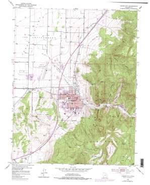
Cedar City Topo Map Utah
To zoom in, hover over the map of Cedar City
USGS Topo Quad 37113f1 - 1:24,000 scale
| Topo Map Name: | Cedar City |
| USGS Topo Quad ID: | 37113f1 |
| Print Size: | ca. 21 1/4" wide x 27" high |
| Southeast Coordinates: | 37.625° N latitude / 113° W longitude |
| Map Center Coordinates: | 37.6875° N latitude / 113.0625° W longitude |
| U.S. State: | UT |
| Filename: | o37113f1.jpg |
| Download Map JPG Image: | Cedar City topo map 1:24,000 scale |
| Map Type: | Topographic |
| Topo Series: | 7.5´ |
| Map Scale: | 1:24,000 |
| Source of Map Images: | United States Geological Survey (USGS) |
| Alternate Map Versions: |
Cedar City UT 1950, updated 1952 Download PDF Buy paper map Cedar City UT 1950, updated 1965 Download PDF Buy paper map Cedar City UT 1950, updated 1973 Download PDF Buy paper map Cedar City UT 1950, updated 1979 Download PDF Buy paper map Cedar City UT 1950, updated 1984 Download PDF Buy paper map Cedar City UT 1950, updated 1984 Download PDF Buy paper map Cedar City UT 2011 Download PDF Buy paper map Cedar City UT 2014 Download PDF Buy paper map |
1:24,000 Topo Quads surrounding Cedar City
> Back to 37113e1 at 1:100,000 scale
> Back to 37112a1 at 1:250,000 scale
> Back to U.S. Topo Maps home
Cedar City topo map: Gazetteer
Cedar City: Airports
Cedar City Heliport elevation 1704m 5590′Cedar City Municipal Airport elevation 1707m 5600′
Cedar City: Basins
The Iron Bowl elevation 1819m 5967′Cedar City: Dams
Greens Lake Retarding Dam Number Four elevation 2407m 7896′Cedar City: Lakes
Green Lake elevation 2471m 8106′Cedar City: Parks
Iron Mission State Park elevation 1761m 5777′Cedar City: Populated Places
Cedar City elevation 1782m 5846′Cedar City: Post Offices
Cedar City Post Office elevation 1789m 5869′Cedar City: Reservoirs
Greens Lake Retarding Basin Number Four elevation 2407m 7896′Cedar City: Streams
Coal Creek elevation 1690m 5544′Squaw Creek elevation 1793m 5882′
Cedar City: Summits
Cedar Mountain elevation 2782m 9127′Cross Hollow Hills elevation 1859m 6099′
Lone Tree Mountain elevation 2748m 9015′
The Knoll elevation 1809m 5935′
The Red Hill elevation 2098m 6883′
White Mountain elevation 1942m 6371′
Cedar City: Valleys
Cedar Canyon elevation 1802m 5912′Cross Hollow elevation 1707m 5600′
Fiddlers Canyon elevation 1858m 6095′
Green Hollow elevation 1877m 6158′
Rock Canyon elevation 1872m 6141′
Salt Creek Canyon elevation 1854m 6082′
Stephens Canyon elevation 1806m 5925′
Cedar City: Woods
The Cottonwoods elevation 1695m 5561′Cedar City digital topo map on disk
Buy this Cedar City topo map showing relief, roads, GPS coordinates and other geographical features, as a high-resolution digital map file on DVD:


