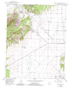
Cedar City Nw Topo Map Utah
To zoom in, hover over the map of Cedar City Nw
USGS Topo Quad 37113f2 - 1:24,000 scale
| Topo Map Name: | Cedar City Nw |
| USGS Topo Quad ID: | 37113f2 |
| Print Size: | ca. 21 1/4" wide x 27" high |
| Southeast Coordinates: | 37.625° N latitude / 113.125° W longitude |
| Map Center Coordinates: | 37.6875° N latitude / 113.1875° W longitude |
| U.S. State: | UT |
| Filename: | o37113f2.jpg |
| Download Map JPG Image: | Cedar City Nw topo map 1:24,000 scale |
| Map Type: | Topographic |
| Topo Series: | 7.5´ |
| Map Scale: | 1:24,000 |
| Source of Map Images: | United States Geological Survey (USGS) |
| Alternate Map Versions: |
Cedar City NW UT 1949 Download PDF Buy paper map Cedar City NW UT 1949, updated 1960 Download PDF Buy paper map Cedar City NW UT 1949, updated 1979 Download PDF Buy paper map Cedar City NW UT 1949, updated 1987 Download PDF Buy paper map Cedar City NW UT 1950 Download PDF Buy paper map Cedar City NW UT 2011 Download PDF Buy paper map Cedar City NW UT 2014 Download PDF Buy paper map |
1:24,000 Topo Quads surrounding Cedar City Nw
> Back to 37113e1 at 1:100,000 scale
> Back to 37112a1 at 1:250,000 scale
> Back to U.S. Topo Maps home
Cedar City Nw topo map: Gazetteer
Cedar City Nw: Flats
The Bottoms elevation 1661m 5449′Cedar City Nw: Gaps
Eightmile Pass elevation 1848m 6062′Cedar City Nw: Lakes
Quichapa Lake elevation 1662m 5452′Cedar City Nw: Mines
Armstrong Mine elevation 1841m 6040′East Pioche Mine elevation 1736m 5695′
Great Western Mine elevation 1778m 5833′
Lindsay Hill Mine elevation 1804m 5918′
Smith Mine elevation 1721m 5646′
Vermillion Mine elevation 1734m 5688′
West Pioche Mine elevation 1758m 5767′
Cedar City Nw: Populated Places
Halivah elevation 1674m 5492′Iron Springs elevation 1642m 5387′
Cedar City Nw: Springs
Eightmile Springs elevation 1665m 5462′Cedar City Nw: Streams
Duncan Creek elevation 1682m 5518′Shirts Creek elevation 1660m 5446′
Cedar City Nw: Summits
Bauers Knoll elevation 1685m 5528′Eightmile Hills elevation 2038m 6686′
Granite Mountain elevation 1998m 6555′
Cedar City Nw digital topo map on disk
Buy this Cedar City Nw topo map showing relief, roads, GPS coordinates and other geographical features, as a high-resolution digital map file on DVD:


