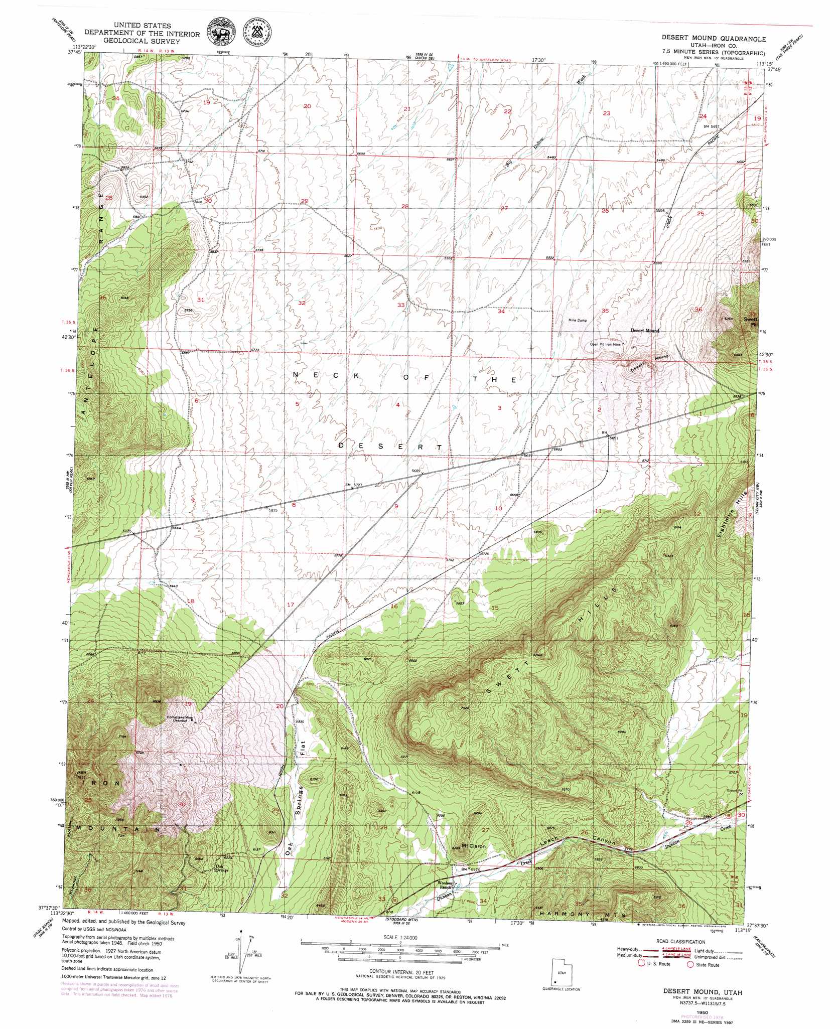
Desert Mound Topo Map Utah
To zoom in, hover over the map of Desert Mound
USGS Topo Quad 37113f3 - 1:24,000 scale
| Topo Map Name: | Desert Mound |
| USGS Topo Quad ID: | 37113f3 |
| Print Size: | ca. 21 1/4" wide x 27" high |
| Southeast Coordinates: | 37.625° N latitude / 113.25° W longitude |
| Map Center Coordinates: | 37.6875° N latitude / 113.3125° W longitude |
| U.S. State: | UT |
| Filename: | o37113f3.jpg |
| Download Map JPG Image: | Desert Mound topo map 1:24,000 scale |
| Map Type: | Topographic |
| Topo Series: | 7.5´ |
| Map Scale: | 1:24,000 |
| Source of Map Images: | United States Geological Survey (USGS) |
| Alternate Map Versions: |
Desert Mound UT 1950, updated 1979 Download PDF Buy paper map Desert Mound UT 1951 Download PDF Buy paper map Desert Mound UT 1951 Download PDF Buy paper map Desert Mound UT 2011 Download PDF Buy paper map Desert Mound UT 2014 Download PDF Buy paper map |
1:24,000 Topo Quads surrounding Desert Mound
Zane |
Avon Nw |
Avon |
Enoch Nw |
Enoch Ne |
Clark Farm |
Antelope Peak |
Avon Se |
The Three Peaks |
Enoch |
Newcastle |
Silver Peak |
Desert Mound |
Cedar City Nw |
Cedar City |
Pinto |
Page Ranch |
Stoddard Mountain |
Kanarraville |
Cedar Mountain |
Central East |
Grass Valley |
New Harmony |
Kolob Arch |
Kolob Reservoir |
> Back to 37113e1 at 1:100,000 scale
> Back to 37112a1 at 1:250,000 scale
> Back to U.S. Topo Maps home
Desert Mound topo map: Gazetteer
Desert Mound: Flats
Oak Springs Flat elevation 1826m 5990′Desert Mound: Mines
Homestake Mine elevation 1910m 6266′Desert Mound: Plains
Neck of the Desert elevation 1728m 5669′Desert Mound: Populated Places
Desert Mound elevation 1725m 5659′Desert Mound: Springs
Oak Springs elevation 1946m 6384′Desert Mound: Summits
Desert Mound elevation 1738m 5702′Iron Mountain elevation 2382m 7814′
Mount Claron elevation 1897m 6223′
Swett Hills elevation 2079m 6820′
Swett Peak elevation 2040m 6692′
Desert Mound: Valleys
Leach Canyon elevation 1751m 5744′Desert Mound digital topo map on disk
Buy this Desert Mound topo map showing relief, roads, GPS coordinates and other geographical features, as a high-resolution digital map file on DVD: