Antelope Peak Topo Map Utah
To zoom in, hover over the map of Antelope Peak
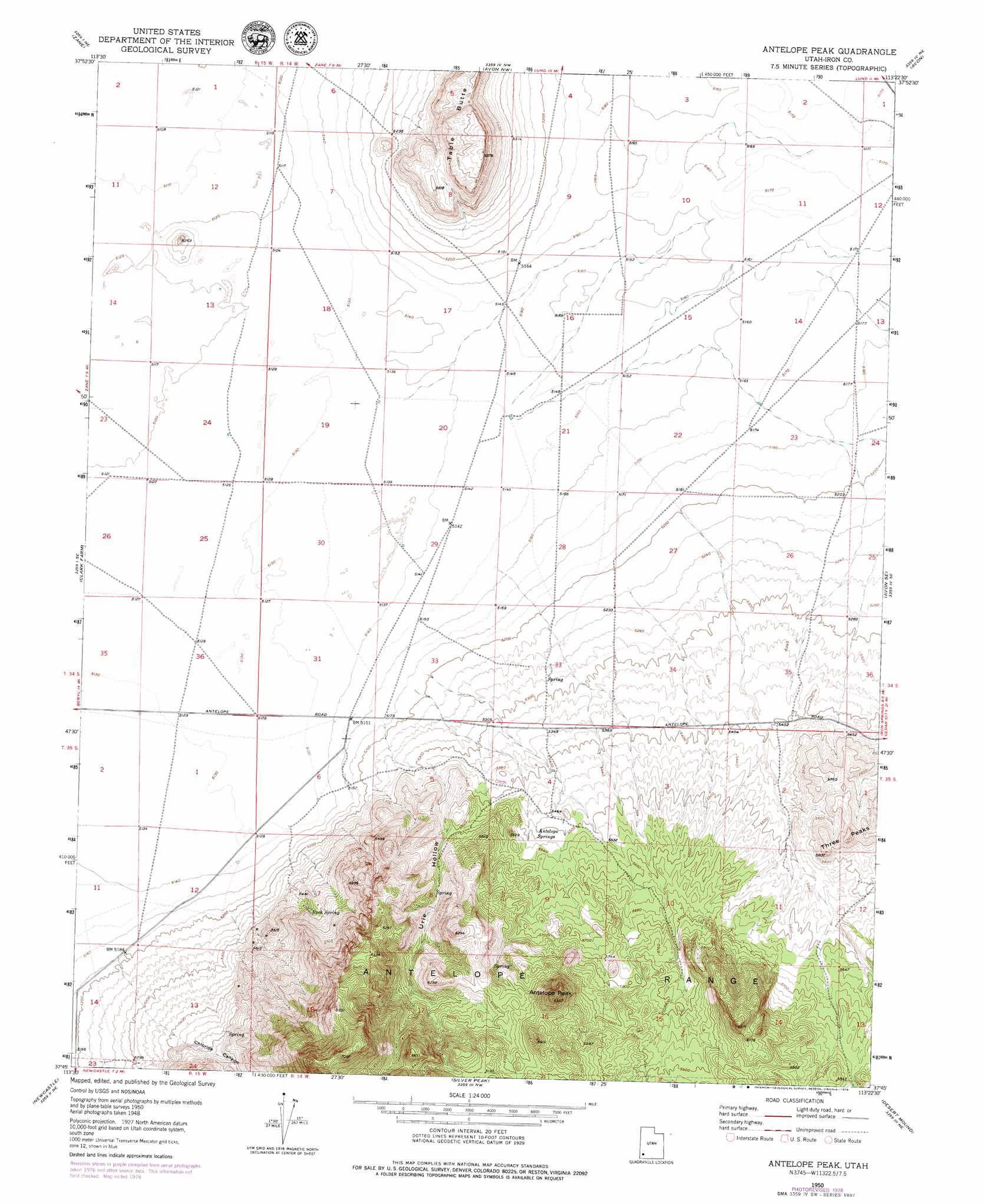
USGS Topo Quad 37113g4 - 1:24,000 scale
| Topo Map Name: | Antelope Peak |
| USGS Topo Quad ID: | 37113g4 |
| Print Size: | ca. 21 1/4" wide x 27" high |
| Southeast Coordinates: | 37.75° N latitude / 113.375° W longitude |
| Map Center Coordinates: | 37.8125° N latitude / 113.4375° W longitude |
| U.S. State: | UT |
| Filename: | o37113g4.jpg |
| Download Map JPG Image: | Antelope Peak topo map 1:24,000 scale |
| Map Type: | Topographic |
| Topo Series: | 7.5´ |
| Map Scale: | 1:24,000 |
| Source of Map Images: | United States Geological Survey (USGS) |
| Alternate Map Versions: |
Antelope Peak UT 1950, updated 1952 Download PDF Buy paper map Antelope Peak UT 1950, updated 1977 Download PDF Buy paper map Antelope Peak UT 2011 Download PDF Buy paper map Antelope Peak UT 2014 Download PDF Buy paper map |
1:24,000 Topo Quads surrounding Antelope Peak
Bible Spring |
Mountain Spring Peak |
Lund |
Latimer |
Badger Peak |
Beryl |
Zane |
Avon Nw |
Avon |
Enoch Nw |
Yale Crossing |
Clark Farm |
Antelope Peak |
Avon Se |
The Three Peaks |
Beryl Junction |
Newcastle |
Silver Peak |
Desert Mound |
Cedar City Nw |
Enterprise |
Pinto |
Page Ranch |
Stoddard Mountain |
Kanarraville |
> Back to 37113e1 at 1:100,000 scale
> Back to 37112a1 at 1:250,000 scale
> Back to U.S. Topo Maps home
Antelope Peak topo map: Gazetteer
Antelope Peak: Springs
Antelope Springs elevation 1676m 5498′Rock Spring elevation 1662m 5452′
Antelope Peak: Summits
Antelope Peak elevation 1974m 6476′Antelope Peak: Valleys
Chloride Canyon elevation 1578m 5177′Sand Spring Canyon elevation 1607m 5272′
Urie Hollow elevation 1579m 5180′
Antelope Peak digital topo map on disk
Buy this Antelope Peak topo map showing relief, roads, GPS coordinates and other geographical features, as a high-resolution digital map file on DVD: