Avon Nw Topo Map Utah
To zoom in, hover over the map of Avon Nw
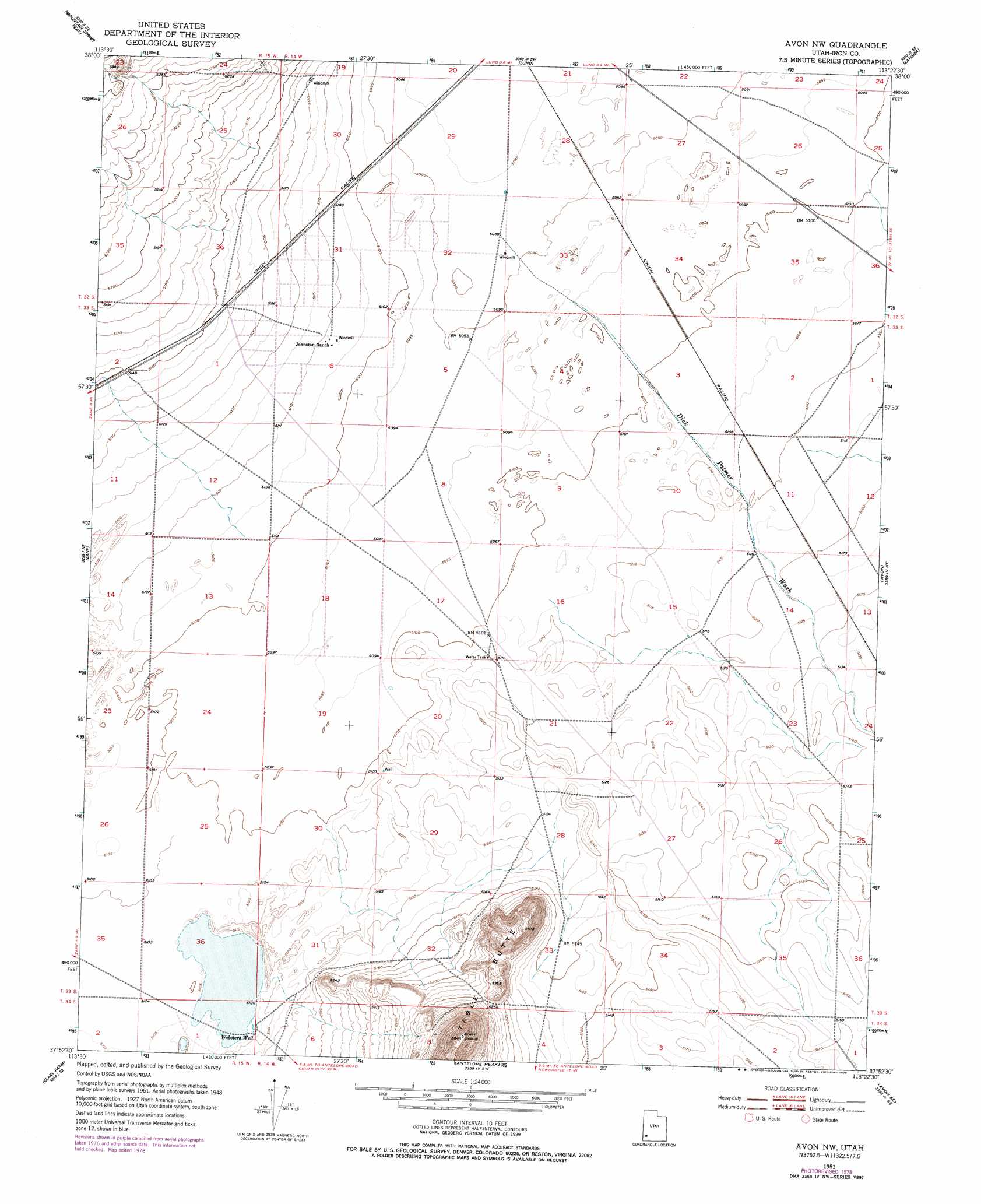
USGS Topo Quad 37113h4 - 1:24,000 scale
| Topo Map Name: | Avon Nw |
| USGS Topo Quad ID: | 37113h4 |
| Print Size: | ca. 21 1/4" wide x 27" high |
| Southeast Coordinates: | 37.875° N latitude / 113.375° W longitude |
| Map Center Coordinates: | 37.9375° N latitude / 113.4375° W longitude |
| U.S. State: | UT |
| Filename: | o37113h4.jpg |
| Download Map JPG Image: | Avon Nw topo map 1:24,000 scale |
| Map Type: | Topographic |
| Topo Series: | 7.5´ |
| Map Scale: | 1:24,000 |
| Source of Map Images: | United States Geological Survey (USGS) |
| Alternate Map Versions: |
Avon NW UT 1951, updated 1952 Download PDF Buy paper map Avon NW UT 1951, updated 1973 Download PDF Buy paper map Avon NW UT 1951, updated 1979 Download PDF Buy paper map Avon NW UT 2011 Download PDF Buy paper map Avon NW UT 2014 Download PDF Buy paper map |
1:24,000 Topo Quads surrounding Avon Nw
Observation Knoll |
The Tetons |
Blue Mountain |
Burns Knoll |
Thermo |
Bible Spring |
Mountain Spring Peak |
Lund |
Latimer |
Badger Peak |
Beryl |
Zane |
Avon Nw |
Avon |
Enoch Nw |
Yale Crossing |
Clark Farm |
Antelope Peak |
Avon Se |
The Three Peaks |
Beryl Junction |
Newcastle |
Silver Peak |
Desert Mound |
Cedar City Nw |
> Back to 37113e1 at 1:100,000 scale
> Back to 37112a1 at 1:250,000 scale
> Back to U.S. Topo Maps home
Avon Nw topo map: Gazetteer
Avon Nw: Airports
Sun Valley Estates Airport elevation 1559m 5114′Avon Nw: Summits
Table Butte elevation 1784m 5853′Avon Nw: Valleys
Dick Palmer Wash elevation 1554m 5098′Fourmile Wash elevation 1557m 5108′
Avon Nw: Wells
Websters Well elevation 1558m 5111′Avon Nw digital topo map on disk
Buy this Avon Nw topo map showing relief, roads, GPS coordinates and other geographical features, as a high-resolution digital map file on DVD: