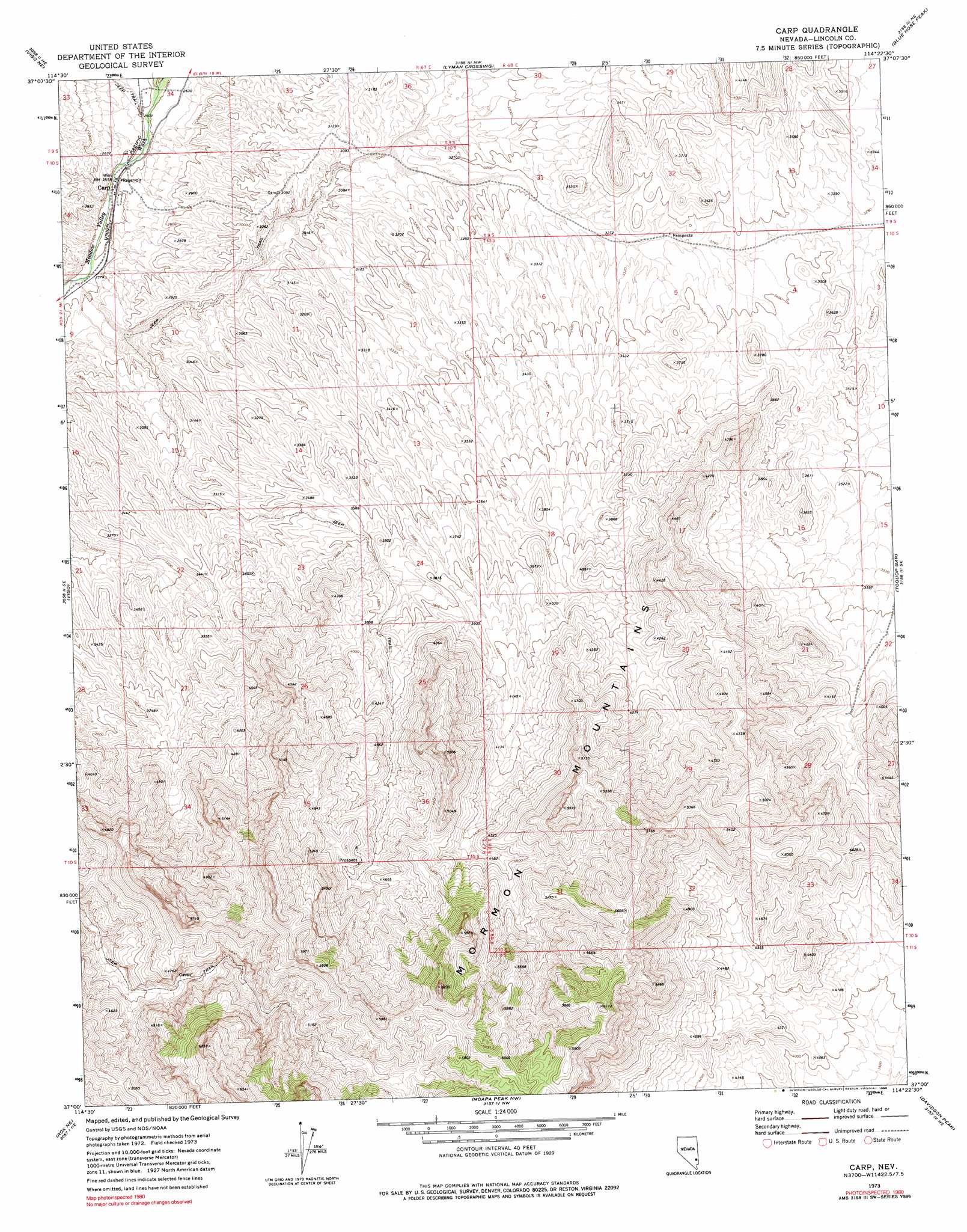
Carp Topo Map Nevada
To zoom in, hover over the map of Carp
USGS Topo Quad 37114a4 - 1:24,000 scale
| Topo Map Name: | Carp |
| USGS Topo Quad ID: | 37114a4 |
| Print Size: | ca. 21 1/4" wide x 27" high |
| Southeast Coordinates: | 37° N latitude / 114.375° W longitude |
| Map Center Coordinates: | 37.0625° N latitude / 114.4375° W longitude |
| U.S. State: | NV |
| Filename: | o37114a4.jpg |
| Download Map JPG Image: | Carp topo map 1:24,000 scale |
| Map Type: | Topographic |
| Topo Series: | 7.5´ |
| Map Scale: | 1:24,000 |
| Source of Map Images: | United States Geological Survey (USGS) |
| Alternate Map Versions: |
Carp NV 1973, updated 1977 Download PDF Buy paper map Carp NV 1973, updated 1980 Download PDF Buy paper map Carp NV 2012 Download PDF Buy paper map Carp NV 2014 Download PDF Buy paper map |
1:24,000 Topo Quads surrounding Carp
Elgin Sw |
Elgin |
Leith |
Garden Spring |
Jacks Mountain |
Vigo Nw |
Vigo Ne |
Lyman Crossing |
Blue Nose Peak |
Lime Mountain |
Sunflower Mountain |
Vigo |
Carp |
Toquop Gap |
Tule Spring |
Rox |
Rox Ne |
Moapa Peak Nw |
Davidson Peak |
Mesquite Nw |
Farrier |
Rox Se |
Moapa Peak |
Moapa Peak Se |
Flat Top Mesa |
> Back to 37114a1 at 1:100,000 scale
> Back to 37114a1 at 1:250,000 scale
> Back to U.S. Topo Maps home
Carp topo map: Gazetteer
Carp: Populated Places
Carp elevation 786m 2578′Carp: Post Offices
Carp Post Office elevation 786m 2578′Carp: Valleys
Long Valley elevation 786m 2578′Carp digital topo map on disk
Buy this Carp topo map showing relief, roads, GPS coordinates and other geographical features, as a high-resolution digital map file on DVD: