Sunflower Mountain Topo Map Nevada
To zoom in, hover over the map of Sunflower Mountain
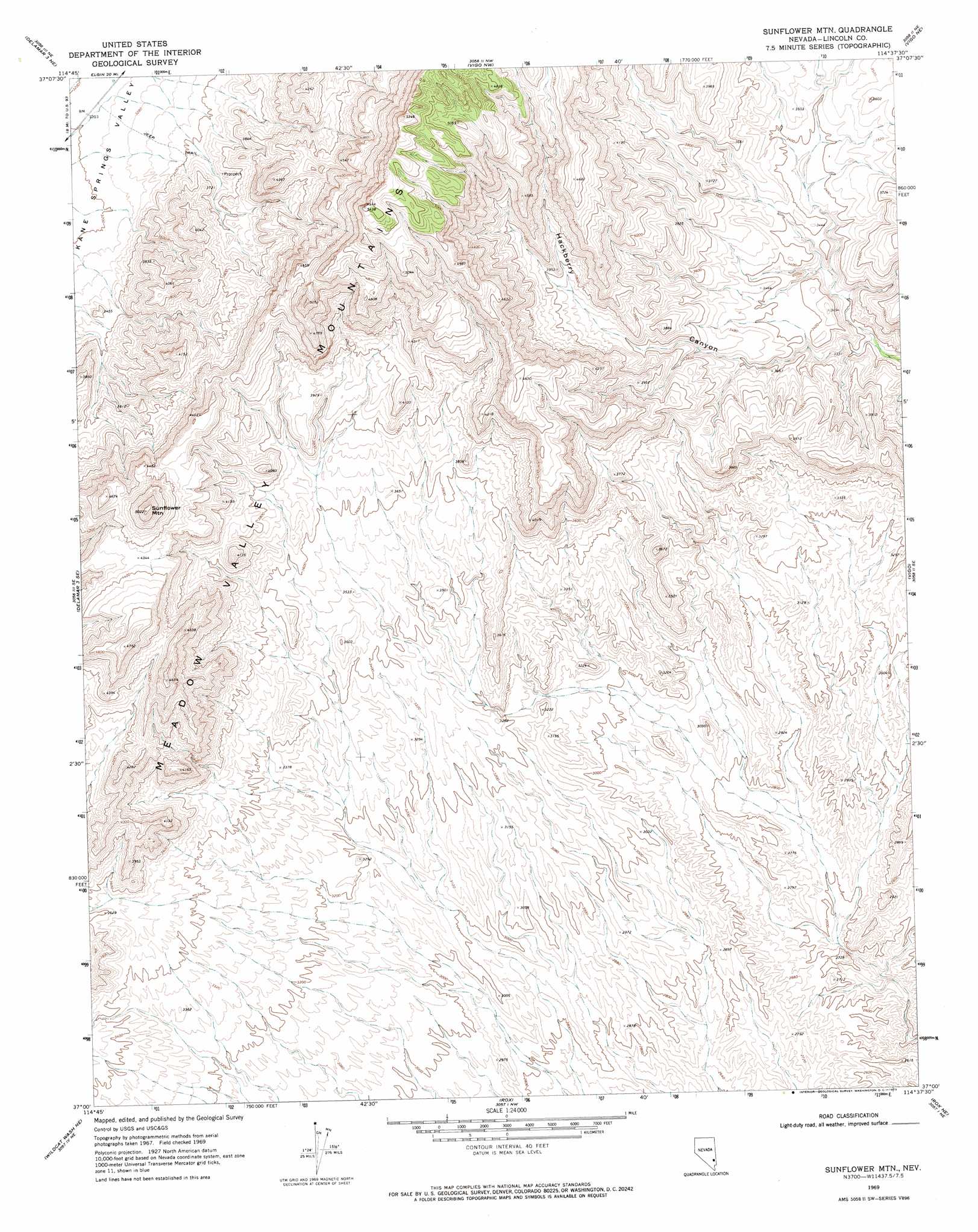
USGS Topo Quad 37114a6 - 1:24,000 scale
| Topo Map Name: | Sunflower Mountain |
| USGS Topo Quad ID: | 37114a6 |
| Print Size: | ca. 21 1/4" wide x 27" high |
| Southeast Coordinates: | 37° N latitude / 114.625° W longitude |
| Map Center Coordinates: | 37.0625° N latitude / 114.6875° W longitude |
| U.S. State: | NV |
| Filename: | o37114a6.jpg |
| Download Map JPG Image: | Sunflower Mountain topo map 1:24,000 scale |
| Map Type: | Topographic |
| Topo Series: | 7.5´ |
| Map Scale: | 1:24,000 |
| Source of Map Images: | United States Geological Survey (USGS) |
| Alternate Map Versions: |
Sunflower Mtn NV 1969, updated 1973 Download PDF Buy paper map Sunflower Mountain NV 2012 Download PDF Buy paper map Sunflower Mountain NV 2015 Download PDF Buy paper map |
1:24,000 Topo Quads surrounding Sunflower Mountain
Delamar Lake |
Gregerson Basin |
Elgin Sw |
Elgin |
Leith |
Delamar 3 Nw |
Delamar 3 Ne |
Vigo Nw |
Vigo Ne |
Lyman Crossing |
Delamar 3 Sw |
Delamar 3 Se |
Sunflower Mountain |
Vigo |
Carp |
Wildcat Wash Nw |
Wildcat Wash Ne |
Rox |
Rox Ne |
Moapa Peak Nw |
Wildcat Wash Sw |
Wildcat Wash Se |
Farrier |
Rox Se |
Moapa Peak |
> Back to 37114a1 at 1:100,000 scale
> Back to 37114a1 at 1:250,000 scale
> Back to U.S. Topo Maps home
Sunflower Mountain topo map: Gazetteer
Sunflower Mountain: Ranges
Meadow Valley Mountains elevation 1232m 4041′Sunflower Mountain: Springs
Willow Spring elevation 935m 3067′Sunflower Mountain: Summits
Sunflower Mountain elevation 1529m 5016′Sunflower Mountain digital topo map on disk
Buy this Sunflower Mountain topo map showing relief, roads, GPS coordinates and other geographical features, as a high-resolution digital map file on DVD: