Dodge Spring Topo Map Nevada
To zoom in, hover over the map of Dodge Spring
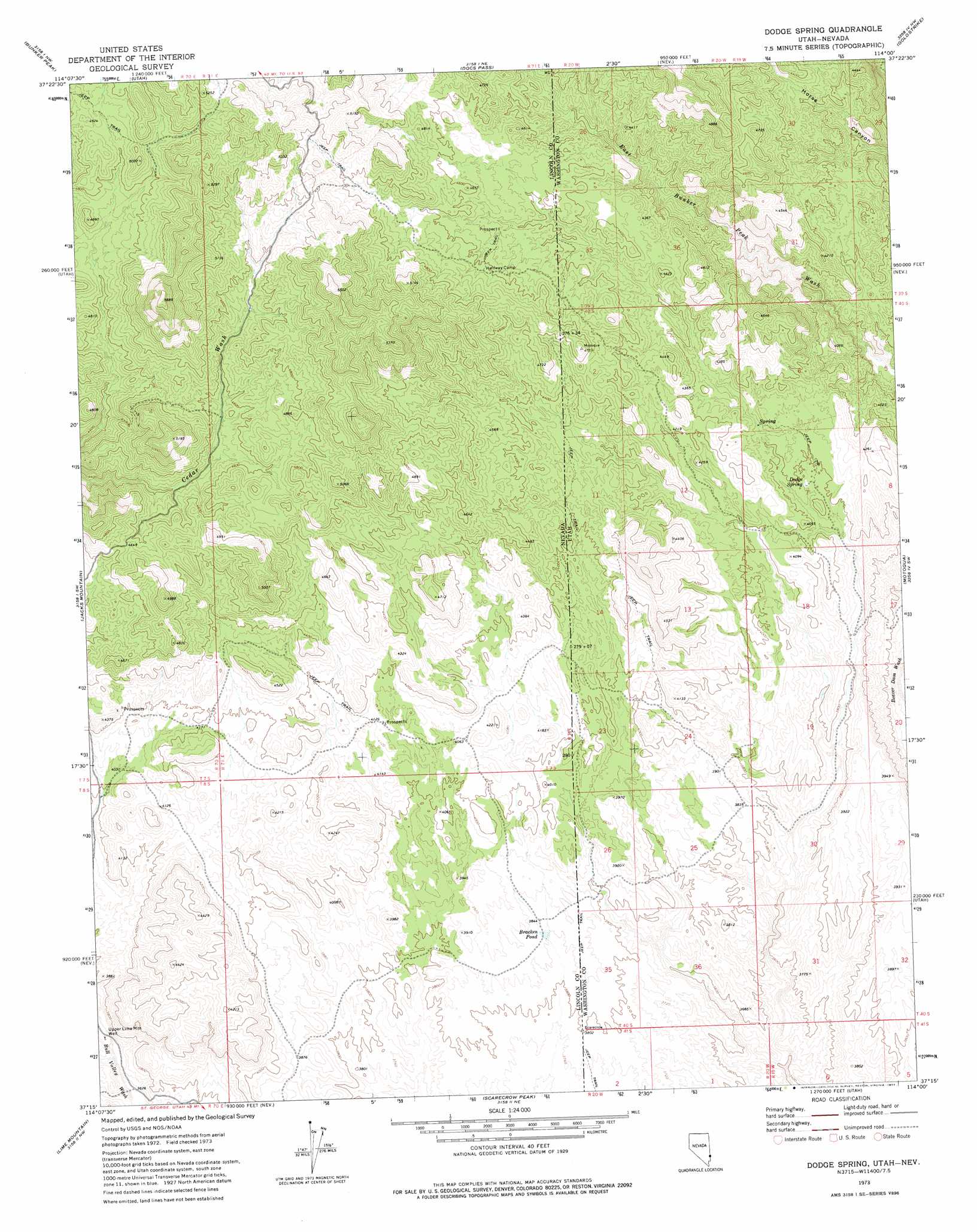
USGS Topo Quad 37114c1 - 1:24,000 scale
| Topo Map Name: | Dodge Spring |
| USGS Topo Quad ID: | 37114c1 |
| Print Size: | ca. 21 1/4" wide x 27" high |
| Southeast Coordinates: | 37.25° N latitude / 114° W longitude |
| Map Center Coordinates: | 37.3125° N latitude / 114.0625° W longitude |
| U.S. States: | NV, UT |
| Filename: | o37114c1.jpg |
| Download Map JPG Image: | Dodge Spring topo map 1:24,000 scale |
| Map Type: | Topographic |
| Topo Series: | 7.5´ |
| Map Scale: | 1:24,000 |
| Source of Map Images: | United States Geological Survey (USGS) |
| Alternate Map Versions: |
Dodge Spring UT 1973, updated 1977 Download PDF Buy paper map Dodge Spring UT 2011 Download PDF Buy paper map Dodge Spring UT 2014 Download PDF Buy paper map |
1:24,000 Topo Quads surrounding Dodge Spring
Islen |
Acoma |
Pine Park |
Water Canyon Peak |
Hebron |
Fife Mountain |
Bunker Peak |
Docs Pass |
Goldstrike |
Maple Ridge |
Garden Spring |
Jacks Mountain |
Dodge Spring |
Motoqua |
Gunlock |
Blue Nose Peak |
Lime Mountain |
Scarecrow Peak |
West Mountain Peak |
Shivwits |
Toquop Gap |
Tule Spring |
Terry Benches |
Castle Cliff |
Jarvis Peak |
> Back to 37114a1 at 1:100,000 scale
> Back to 37114a1 at 1:250,000 scale
> Back to U.S. Topo Maps home
Dodge Spring topo map: Gazetteer
Dodge Spring: Reservoirs
Bracken Pond elevation 1174m 3851′Ooze Flat Reservoir elevation 1289m 4229′
Dodge Spring: Springs
Betsy Spring elevation 1420m 4658′Dodge Spring elevation 1208m 3963′
Rueben Spring elevation 1437m 4714′
Dodge Spring: Wells
Upper Lime Mountain Well elevation 1118m 3667′Dodge Spring digital topo map on disk
Buy this Dodge Spring topo map showing relief, roads, GPS coordinates and other geographical features, as a high-resolution digital map file on DVD: