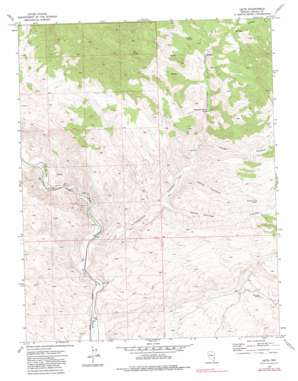
Leith Topo Map Nevada
To zoom in, hover over the map of Leith
USGS Topo Quad 37114c4 - 1:24,000 scale
| Topo Map Name: | Leith |
| USGS Topo Quad ID: | 37114c4 |
| Print Size: | ca. 21 1/4" wide x 27" high |
| Southeast Coordinates: | 37.25° N latitude / 114.375° W longitude |
| Map Center Coordinates: | 37.3125° N latitude / 114.4375° W longitude |
| U.S. State: | NV |
| Filename: | o37114c4.jpg |
| Download Map JPG Image: | Leith topo map 1:24,000 scale |
| Map Type: | Topographic |
| Topo Series: | 7.5´ |
| Map Scale: | 1:24,000 |
| Source of Map Images: | United States Geological Survey (USGS) |
| Alternate Map Versions: |
Leith NV 1973, updated 1976 Download PDF Buy paper map Leith NV 1973, updated 1982 Download PDF Buy paper map Leith NV 2012 Download PDF Buy paper map Leith NV 2014 Download PDF Buy paper map |
1:24,000 Topo Quads surrounding Leith
> Back to 37114a1 at 1:100,000 scale
> Back to 37114a1 at 1:250,000 scale
> Back to U.S. Topo Maps home
Leith topo map: Gazetteer
Leith: Mines
Cherokee Mine elevation 1377m 4517′Leith: Populated Places
Kiernan (historical) elevation 946m 3103′Kyle elevation 985m 3231′
Viola (historical) elevation 1379m 4524′
Leith: Post Offices
Kiernan Post Office elevation 946m 3103′Leith: Springs
Fountain of Youth Spring elevation 1211m 3973′Mudhole Spring elevation 1378m 4520′
Oil Spring elevation 1535m 5036′
Leith: Streams
Coldwater Creek elevation 1340m 4396′Pine Creek elevation 1338m 4389′
Leith: Valleys
Cottonwood Canyon elevation 940m 3083′Cougar Canyon elevation 1163m 3815′
Horse Pasture Canyon elevation 1106m 3628′
Horse Springs Canyon elevation 1059m 3474′
Leith Canyon elevation 897m 2942′
Leith digital topo map on disk
Buy this Leith topo map showing relief, roads, GPS coordinates and other geographical features, as a high-resolution digital map file on DVD:


