Rose Valley Topo Map Nevada
To zoom in, hover over the map of Rose Valley
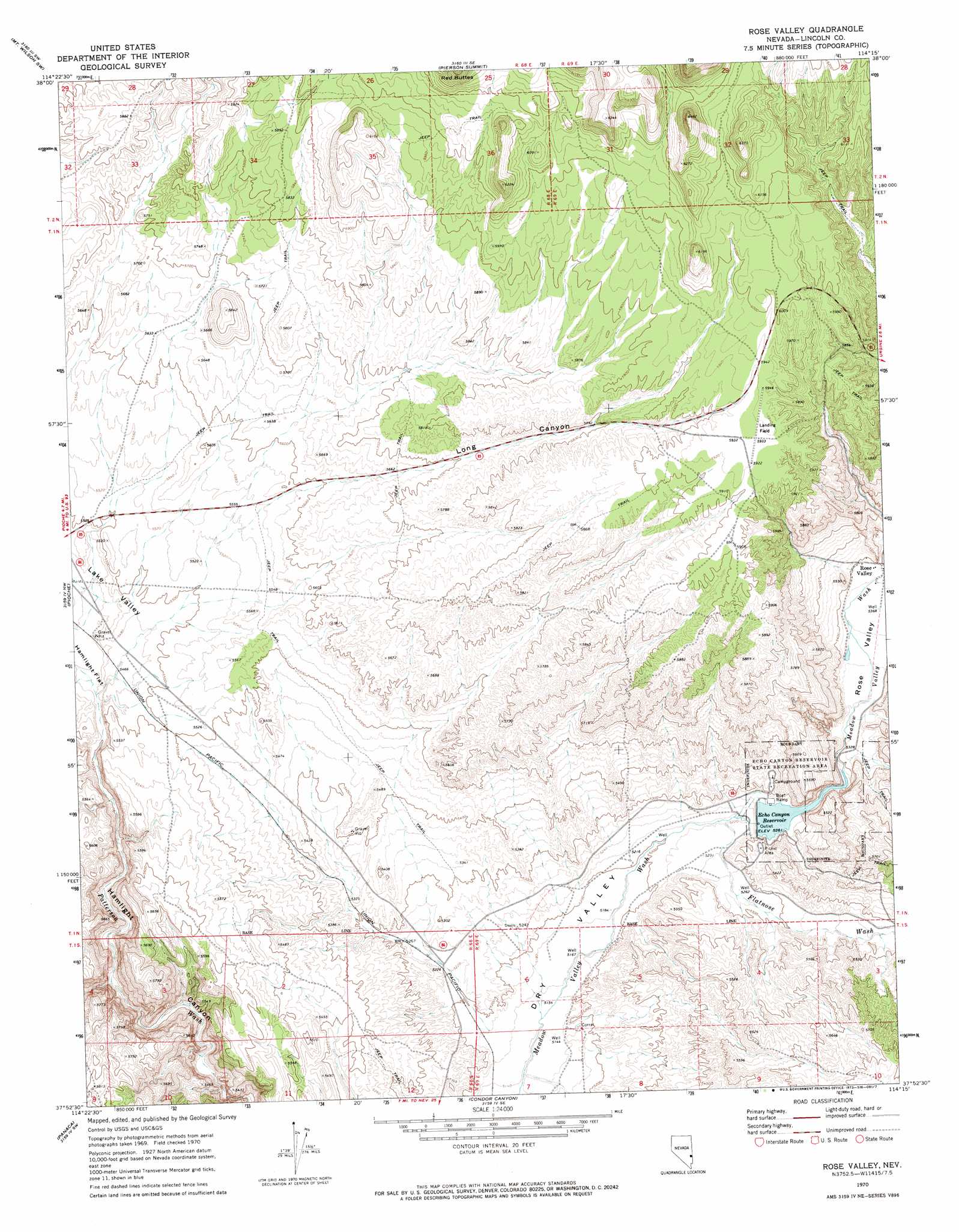
USGS Topo Quad 37114h3 - 1:24,000 scale
| Topo Map Name: | Rose Valley |
| USGS Topo Quad ID: | 37114h3 |
| Print Size: | ca. 21 1/4" wide x 27" high |
| Southeast Coordinates: | 37.875° N latitude / 114.25° W longitude |
| Map Center Coordinates: | 37.9375° N latitude / 114.3125° W longitude |
| U.S. State: | NV |
| Filename: | o37114h3.jpg |
| Download Map JPG Image: | Rose Valley topo map 1:24,000 scale |
| Map Type: | Topographic |
| Topo Series: | 7.5´ |
| Map Scale: | 1:24,000 |
| Source of Map Images: | United States Geological Survey (USGS) |
| Alternate Map Versions: |
Rose Valley NV 1970, updated 1973 Download PDF Buy paper map Rose Valley NV 2012 Download PDF Buy paper map Rose Valley NV 2014 Download PDF Buy paper map |
1:24,000 Topo Quads surrounding Rose Valley
Bristol Range Ne |
Mount Wilson |
Parsnip Peak |
Buck Wash Well |
White Rock Peak |
Bristol Range Se |
Mount Wilson Sw |
Pierson Summit |
Eagle Valley Reservoir |
Rice Mountain |
Highland Peak |
Pioche |
Rose Valley |
Ursine |
Deer Lodge Canyon |
Bennett Pass |
Panaca |
Condor Canyon |
Panaca Summit |
Prohibition Flat |
Chief Mountain |
Indian Cove |
Mosey Mountain |
Dow Mountain |
Uvada |
> Back to 37114e1 at 1:100,000 scale
> Back to 37114a1 at 1:250,000 scale
> Back to U.S. Topo Maps home
Rose Valley topo map: Gazetteer
Rose Valley: Dams
Echo Canyon Dam elevation 1605m 5265′Rose Valley: Flats
Hamlight Flat elevation 1657m 5436′Rose Valley: Parks
Echo Canyon Reservoir State Recreation Area elevation 1630m 5347′Rose Valley: Populated Places
Flat Nose elevation 1577m 5173′Rose Valley elevation 1646m 5400′
Rose Valley: Post Offices
Engadine Post Office elevation 1582m 5190′Rose Valley: Reservoirs
Echo Canyon Reservoir elevation 1605m 5265′Rose Valley: Streams
Flatnose Wash elevation 1592m 5223′Rose Valley: Valleys
Echo Canyon elevation 1605m 5265′Long Canyon elevation 1696m 5564′
Rose Valley elevation 1606m 5269′
Rose Valley digital topo map on disk
Buy this Rose Valley topo map showing relief, roads, GPS coordinates and other geographical features, as a high-resolution digital map file on DVD: