Deadman Spring Ne Topo Map Nevada
To zoom in, hover over the map of Deadman Spring Ne
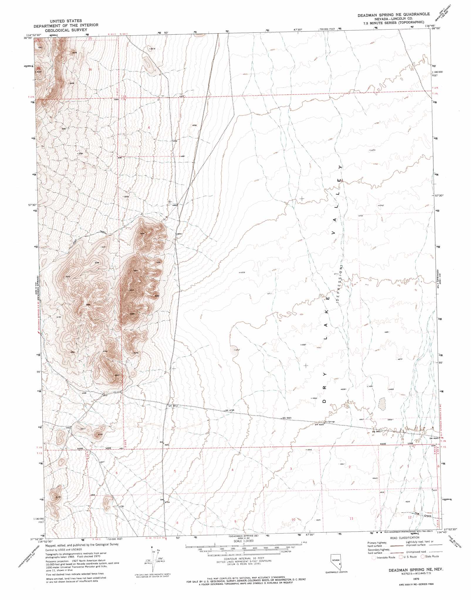
USGS Topo Quad 37114h7 - 1:24,000 scale
| Topo Map Name: | Deadman Spring Ne |
| USGS Topo Quad ID: | 37114h7 |
| Print Size: | ca. 21 1/4" wide x 27" high |
| Southeast Coordinates: | 37.875° N latitude / 114.75° W longitude |
| Map Center Coordinates: | 37.9375° N latitude / 114.8125° W longitude |
| U.S. State: | NV |
| Filename: | o37114h7.jpg |
| Download Map JPG Image: | Deadman Spring Ne topo map 1:24,000 scale |
| Map Type: | Topographic |
| Topo Series: | 7.5´ |
| Map Scale: | 1:24,000 |
| Source of Map Images: | United States Geological Survey (USGS) |
| Alternate Map Versions: |
Deadman Spring NE NV 1970, updated 1973 Download PDF Buy paper map Deadman Spring NE NV 2012 Download PDF Buy paper map Deadman Spring NE NV 2014 Download PDF Buy paper map |
1:24,000 Topo Quads surrounding Deadman Spring Ne
Timber Mountain Pass Ne |
Silver King Mountain |
Bailey Wash |
Fairview Peak |
Bristol Range Ne |
Timber Mountain Pass East |
Silver King Mountain Sw |
Coyote Spring |
Bristol Well |
Bristol Range Se |
Weepah Spring |
Deadman Spring |
Deadman Spring Ne |
Ely Springs |
Highland Peak |
White River Narrows |
Wheatgrass Spring |
Deadman Spring Se |
The Bluffs |
Bennett Pass |
Hiko Ne |
Pahroc Spring |
Pahroc Spring Ne |
Caliente Nw |
Chief Mountain |
> Back to 37114e1 at 1:100,000 scale
> Back to 37114a1 at 1:250,000 scale
> Back to U.S. Topo Maps home
Deadman Spring Ne topo map: Gazetteer
Deadman Spring Ne: Reservoirs
Swiss Bob Reservoir elevation 1525m 5003′Deadman Spring Ne: Springs
Two and One Half Spring elevation 1466m 4809′Deadman Spring Ne: Valleys
The Crack elevation 1412m 4632′Deadman Spring Ne digital topo map on disk
Buy this Deadman Spring Ne topo map showing relief, roads, GPS coordinates and other geographical features, as a high-resolution digital map file on DVD: