Desert Hills Se Topo Map Nevada
To zoom in, hover over the map of Desert Hills Se
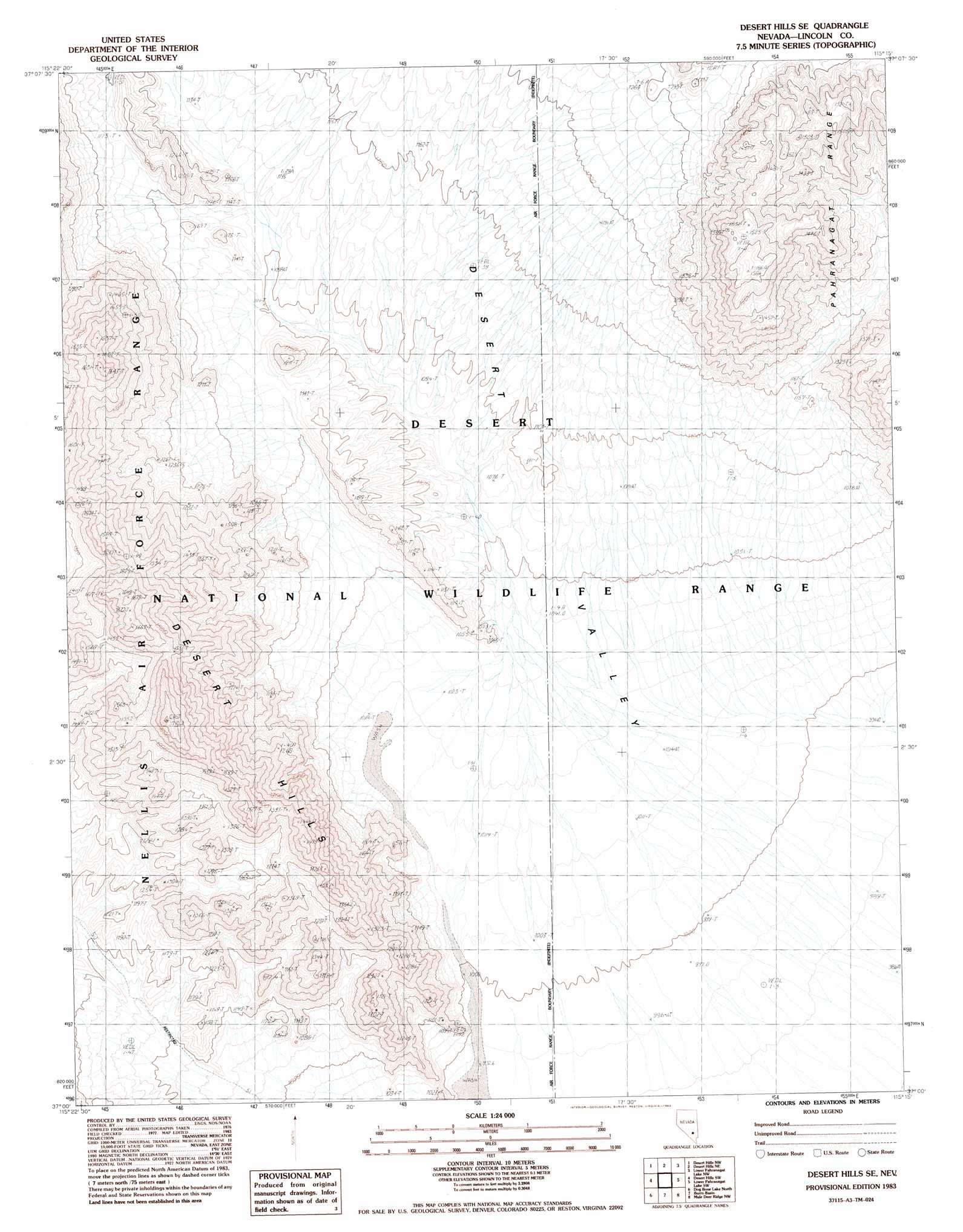
USGS Topo Quad 37115a3 - 1:24,000 scale
| Topo Map Name: | Desert Hills Se |
| USGS Topo Quad ID: | 37115a3 |
| Print Size: | ca. 21 1/4" wide x 27" high |
| Southeast Coordinates: | 37° N latitude / 115.25° W longitude |
| Map Center Coordinates: | 37.0625° N latitude / 115.3125° W longitude |
| U.S. State: | NV |
| Filename: | o37115a3.jpg |
| Download Map JPG Image: | Desert Hills Se topo map 1:24,000 scale |
| Map Type: | Topographic |
| Topo Series: | 7.5´ |
| Map Scale: | 1:24,000 |
| Source of Map Images: | United States Geological Survey (USGS) |
| Alternate Map Versions: |
Desert Hills SE NV 1983, updated 1983 Download PDF Buy paper map |
1:24,000 Topo Quads surrounding Desert Hills Se
Groom Range Se |
Cutler Reservoir |
Badger Spring |
Alamo |
Alamo Se |
Fallout Hills Ne |
Desert Hills Nw |
Desert Hills Ne |
Lower Pahranagat Lake Nw |
Lower Pahranagat Lake |
Southeastern Mine |
Desert Hills Sw |
Desert Hills Se |
Lower Pahranagat Lake Sw |
Lower Pahranagat Lake Se |
Quartz Peak |
Dog Bone Lake North |
Burro Basin |
Mule Deer Ridge Nw |
Mule Deer Ridge Ne |
Tim Spring |
Dog Bone Lake South |
Dead Horse Ridge |
Mule Deer Ridge |
Mule Deer Ridge Se |
> Back to 37115a1 at 1:100,000 scale
> Back to 37114a1 at 1:250,000 scale
> Back to U.S. Topo Maps home
Desert Hills Se digital topo map on disk
Buy this Desert Hills Se topo map showing relief, roads, GPS coordinates and other geographical features, as a high-resolution digital map file on DVD: